
Articles | Volume 17, issue 10
https://doi.org/10.5194/nhess-17-1823-2017
© Author(s) 2017. This work is distributed under
the Creative Commons Attribution 3.0 License.
the Creative Commons Attribution 3.0 License.
https://doi.org/10.5194/nhess-17-1823-2017
© Author(s) 2017. This work is distributed under
the Creative Commons Attribution 3.0 License.
the Creative Commons Attribution 3.0 License.
Research article
| 
23 Oct 2017
Research article |
| 23 Oct 2017
Regional snow-avalanche detection using object-based image analysis of near-infrared aerial imagery
Karolina Korzeniowska
CORRESPONDING AUTHOR
3D Mapping, BSF Swissphoto GmbH, Schönefeld, 12529, Germany
Geohazards Research Group, University of Potsdam, Potsdam, 14476,
Germany
Yves Bühler
WSL Institute for Snow and Avalanche Research SLF, Davos, 7260,
Switzerland
Mauro Marty
Swiss Federal Institute for Forest, Snow and Landscape Research WSL,
Birmensdorf, 8903, Switzerland
Oliver Korup
Geohazards Research Group, University of Potsdam, Potsdam, 14476,
Germany
Related authors
No articles found.
Feiko Bernard van Zadelhoff, Yves Bühler, and Michael Bründl
EGUsphere, https://doi.org/10.5194/egusphere-2026-4604, https://doi.org/10.5194/egusphere-2026-4604, 2026
This preprint is open for discussion and under review for Natural Hazards and Earth System Sciences (NHESS).
Short summary
Short summary
Debris flows are a major hazard in mountainous areas, causing millions of francs in damage in Switzerland every year. Therefore, the Swiss national railway company aims to identify dangerous areas along their infrastructure. We perform this analysis by identifying critical areas using machine learning and detailed simulation modelling of debris flow events caused by extreme rainfall. The results are a valuable baseline to plan mitigation measures and be better prepared for the future.
Jan Kleinn, Dörte Aller, Yves Bühler, Julia Glaus, Adrian Peter, and Nils Hählen
EGUsphere, https://doi.org/10.5194/egusphere-2026-3799, https://doi.org/10.5194/egusphere-2026-3799, 2026
This preprint is open for discussion and under review for Natural Hazards and Earth System Sciences (NHESS).
Short summary
Short summary
We have demonstrated that it is possible to apply an approach to hazard and risk modelling of avalanches, which is commonly used for seismic risks and other hazards. This approach provides more differentiated results and additional information compared to the current approach used in Switzerland for hazard assessment. The applicability of the approach has been demonstrated with an avalanche model commonly used in Switzerland and can be applied to other avalanche models.
Pia Ruttner, Nora Helbig, Annelies Voordendag, Andreas Wieser, and Yves Bühler
The Cryosphere, 20, 4185–4208, https://doi.org/10.5194/tc-20-4185-2026, https://doi.org/10.5194/tc-20-4185-2026, 2026
Short summary
Short summary
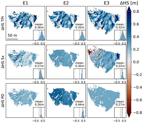
The spatial variability of snow depth distribution in avalanche release areas is key for avalanche forecasting but is strongly influenced by the interaction of wind with the terrain. We generate maps of high resolution snow depth changes during three snowfall events by using low-cost terrestrial laser scanner measurements and compare them to the results of selected snow depth distribution models. We show that basic terrain derivations have the highest correlations to our measurement results.
Aaron Cremona, Matthias Huss, Johannes Marian Landmann, Mauro Marty, Marijn van der Meer, Christian Ginzler, and Daniel Farinotti
The Cryosphere, 20, 3111–3130, https://doi.org/10.5194/tc-20-3111-2026, https://doi.org/10.5194/tc-20-3111-2026, 2026
Short summary
Short summary
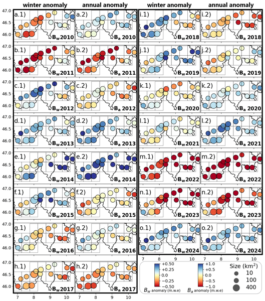
Our study provides daily mass balance estimates for every Swiss glacier from 2010–2024 using modelling, remote sensing observations, and machine learning. Over the period, Swiss glaciers lost nearly a quarter of their ice volume. The approach enables investigating the spatio-temporal variability of glacier mass balance in relation to the driving climatic factors.
Edier Aristizábal, Luigi Lombardo, and Oliver Korup
EGUsphere, https://doi.org/10.5194/egusphere-2026-1749, https://doi.org/10.5194/egusphere-2026-1749, 2026
Short summary
Short summary
Traditional models for landslide susceptibility often ignore spatially-dependent unobserved factors. This study improves accuracy in the Colombian Andes by incorporating spatial dependence and landscape variety, which are natural in environmental data. By accounting for these hidden physical connections, we found that landslide occurrences are more clustered than once thought.
Amalie Skålevåg, Lena Katharina Schmidt, Nele Eggers, Jana Tjeda Brettin, Oliver Korup, and Axel Bronstert
Hydrol. Earth Syst. Sci., 30, 2717–2739, https://doi.org/10.5194/hess-30-2717-2026, https://doi.org/10.5194/hess-30-2717-2026, 2026
Short summary
Short summary
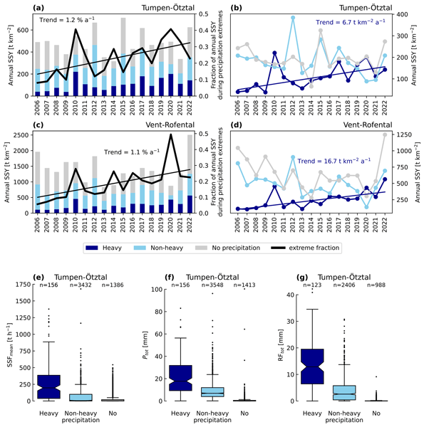
As glaciers retreat in mountain regions, heavy rainstorms increasingly control how much soil and sediment rivers carry downstream. We analysed rainfall and sediment data over 21 years in the Austrian Alps and found heavy precipitation events becoming more important for sediment movement, although total annual suspended sediment transport is declining as glaciers shrink. This shift may increase flood hazards, affecting ecosystems and water quality downstream.
Charis Moana Gretler, Daniel Kükenbrink, Mauro Marty, Christian Ginzler, and Felix Morsdorf
EGUsphere, https://doi.org/10.5194/egusphere-2026-1689, https://doi.org/10.5194/egusphere-2026-1689, 2026
Short summary
Short summary
Repeated airborne laser surveys were used to study how forest structure can be tracked over time in Switzerland. By comparing different years and methods, canopy height estimates were found to be consistent, while vegetation density results varied depending on how the data were collected. This highlights the need for consistent methods and data collection for reliable long-term analysis.
Elizabeth Fischer, Gabriel J. Wolken, Yves Bühler, Marc Christen, and Rick Lader
EGUsphere, https://doi.org/10.5194/egusphere-2026-1345, https://doi.org/10.5194/egusphere-2026-1345, 2026
This preprint is open for discussion and under review for Natural Hazards and Earth System Sciences (NHESS).
Short summary
Short summary
Snow avalanches are a major hazard in Southeast Alaska, where limited data and climate change complicate risk planning. We created the first regional hazard maps using past and projected climate conditions. Results show hazard decreasing at lower elevations as rain replaces snow but increasing at high elevations due to more snow and longer avalanche runouts. These maps provide an important tool for informed land-use and infrastructure planning as Alaska’s landscapes adapt to a changing climate.
Julia Glaus, Jan Kleinn, Lukas Stoffel, Pia Ruttner, Katreen Wikstrom Jones, Johan Gaume, and Yves Bühler
EGUsphere, https://doi.org/10.5194/egusphere-2026-999, https://doi.org/10.5194/egusphere-2026-999, 2026
Short summary
Short summary
Snow avalanches threaten roads, ski areas, and communities in mountain regions. We present a practical method to create daily maps showing where avalanches are likely to travel and how strong they may be. By combining weather data, snow measurements, and computer simulations, our approach supports safer decisions on road closures and avalanche control and helps protect people and infrastructure.

Jaeyoung Lim, Elisabeth Hafner-Aeschbacher, Florian Achermann, Rik Girod, David Rohr, Nicholas Lawrance, Yves Bühler, and Roland Siegwart
Nat. Hazards Earth Syst. Sci., 26, 411–431, https://doi.org/10.5194/nhess-26-411-2026, https://doi.org/10.5194/nhess-26-411-2026, 2026
Short summary
Short summary
As avalanches occur in remote and potentially dangerous locations, data relevant to avalanche monitoring is difficult to obtain. Uncrewed fixed-wing aerial vehicles are promising platforms for gathering aerial imagery to map avalanche activity over a large area. In this work, we present an unmanned aerial system (UAS) capable of autonomously navigating and mapping avalanches in steep mountainous terrain. We expect our work to enable efficient large-scale autonomous avalanche monitoring.
Mauro Marty, Livia Piermattei, Lars T. Waser, and Christian Ginzler
Earth Syst. Sci. Data, 17, 5811–5832, https://doi.org/10.5194/essd-17-5811-2025, https://doi.org/10.5194/essd-17-5811-2025, 2025
Short summary
Short summary
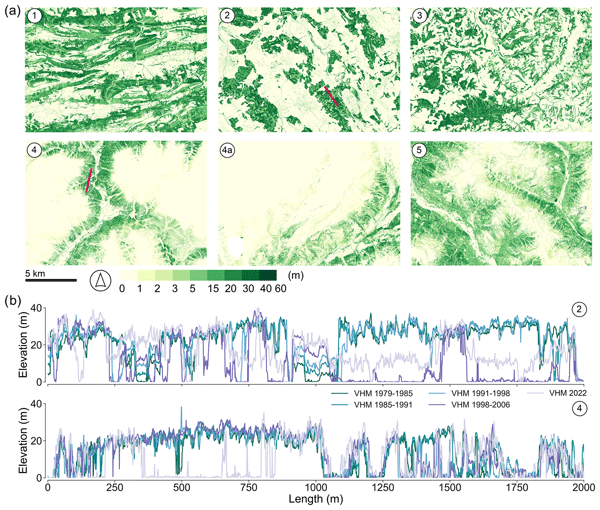
Millions of aerial photographs represent an enormous resource for geoscientists. In this study, we used freely available historical stereo images covering Switzerland (1979–2006) to derive four countrywide digital elevation models (DSMs) at a 1 m spatial resolution. Our DSMs achieved sub-metric accuracy compared to reference data and high image matching completeness, demonstrating the feasibility of capturing surface change at a high spatial resolution over different land cover classes.
Maria Isabel Arango-Carmona, Paul Voit, Marcel Hürlimann, Edier Aristizábal, and Oliver Korup
Nat. Hazards Earth Syst. Sci., 25, 3641–3663, https://doi.org/10.5194/nhess-25-3641-2025, https://doi.org/10.5194/nhess-25-3641-2025, 2025
Short summary
Short summary
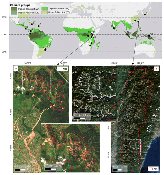
We studied 22 cascading landslide and torrential events in tropical mountains to understand how rainfall, slopes, and soil types interact to trigger them. We found that extreme rainfall alone is not always the cause and long wet periods and sediment type also play a role. Our findings can help improve warning systems and reduce disaster risks in vulnerable regions.

Julia Glaus, Katreen Wikstrom Jones, Perry Bartelt, Marc Christen, Lukas Stoffel, Johan Gaume, and Yves Bühler
Nat. Hazards Earth Syst. Sci., 25, 2399–2419, https://doi.org/10.5194/nhess-25-2399-2025, https://doi.org/10.5194/nhess-25-2399-2025, 2025
Short summary
Short summary
This study assesses RAMMS::EXTENDED's predictive power in estimating avalanche runout distances critical for mountain road safety. Leveraging meteorological data and sensitivity analyses, it offers meaningful predictions, aiding near real-time hazard assessments and future model refinement for improved decision-making.
Pia Ruttner, Annelies Voordendag, Thierry Hartmann, Julia Glaus, Andreas Wieser, and Yves Bühler
Nat. Hazards Earth Syst. Sci., 25, 1315–1330, https://doi.org/10.5194/nhess-25-1315-2025, https://doi.org/10.5194/nhess-25-1315-2025, 2025
Short summary
Short summary
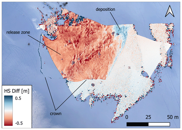
Snow depth variations caused by wind are an important factor in avalanche danger, but detailed and up-to-date information is rarely available. We propose a monitoring system, using lidar and optical sensors, to measure the snow depth distribution at high spatial and temporal resolution. First results show that we can quantify snow depth changes with an accuracy on the low decimeter level, or better, and can identify events such as avalanches or displacement of snow during periods of strong winds.
John Sykes, Pascal Haegeli, Roger Atkins, Patrick Mair, and Yves Bühler
Nat. Hazards Earth Syst. Sci., 25, 1255–1292, https://doi.org/10.5194/nhess-25-1255-2025, https://doi.org/10.5194/nhess-25-1255-2025, 2025
Short summary
Short summary
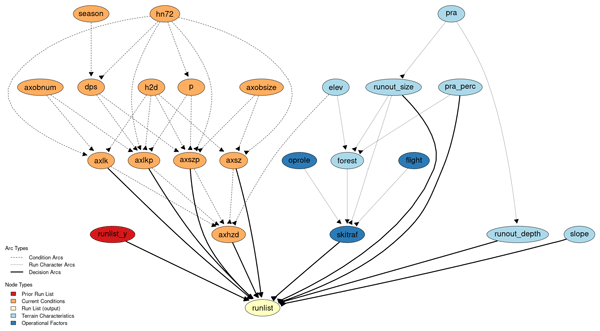
We model the decision-making of professional ski guides and develop decision support tools to assist with determining appropriate terrain based on current conditions. Our approach compares a manually constructed Bayesian network with machine learning classification models. The models accurately capture the real-world decision-making outcomes in 85–93 % of cases. Our conclusions focus on strengths and weaknesses of each model and discuss ramifications for practical applications in ski guiding.
Natalie Lützow, Bretwood Higman, Martin Truffer, Bodo Bookhagen, Friedrich Knuth, Oliver Korup, Katie E. Hughes, Marten Geertsema, John J. Clague, and Georg Veh
The Cryosphere, 19, 1085–1102, https://doi.org/10.5194/tc-19-1085-2025, https://doi.org/10.5194/tc-19-1085-2025, 2025
Short summary
Short summary
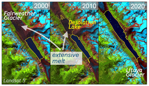
As the atmosphere warms, thinning glacier dams impound smaller lakes at their margins. Yet, some lakes deviate from this trend and have instead grown over time, increasing the risk of glacier floods to downstream populations and infrastructure. In this article, we examine the mechanisms behind the growth of an ice-dammed lake in Alaska. We find that the growth in size and outburst volumes is more controlled by glacier front downwaste than by overall mass loss over the entire glacier surface.
Jan Magnusson, Yves Bühler, Louis Quéno, Bertrand Cluzet, Giulia Mazzotti, Clare Webster, Rebecca Mott, and Tobias Jonas
Earth Syst. Sci. Data, 17, 703–717, https://doi.org/10.5194/essd-17-703-2025, https://doi.org/10.5194/essd-17-703-2025, 2025
Short summary
Short summary
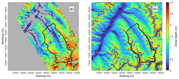
In this study, we present a dataset for the Dischma catchment in eastern Switzerland, which represents a typical high-alpine watershed in the European Alps. Accurate monitoring and reliable forecasting of snow and water resources in such basins are crucial for a wide range of applications. Our dataset is valuable for improving physics-based snow, land surface, and hydrological models, with potential applications in similar high-alpine catchments.
Andrea Manconi, Yves Bühler, Andreas Stoffel, Johan Gaume, Qiaoping Zhang, and Valentyn Tolpekin
Nat. Hazards Earth Syst. Sci., 24, 3833–3839, https://doi.org/10.5194/nhess-24-3833-2024, https://doi.org/10.5194/nhess-24-3833-2024, 2024
Short summary
Short summary
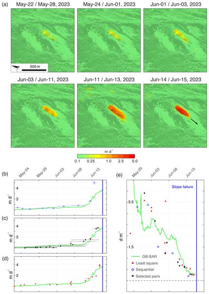
Our research reveals the power of high-resolution satellite synthetic-aperture radar (SAR) imagery for slope deformation monitoring. Using ICEYE data over the Brienz/Brinzauls instability, we measured surface velocity and mapped the landslide event with unprecedented precision. This underscores the potential of satellite SAR for timely hazard assessment in remote regions and aiding disaster mitigation efforts effectively.

Oliver Korup, Lisa V. Luna, and Joaquin V. Ferrer
Nat. Hazards Earth Syst. Sci., 24, 3815–3832, https://doi.org/10.5194/nhess-24-3815-2024, https://doi.org/10.5194/nhess-24-3815-2024, 2024
Short summary
Short summary
Catalogues of mapped landslides are useful for learning and forecasting how frequently they occur in relation to their size. Yet, rare and large landslides remain mostly uncertain in statistical summaries of these catalogues. We propose a single, consistent method of comparing across different data sources and find that landslide statistics disclose more about subjective mapping choices than trigger types or environmental settings.

Amalie Skålevåg, Oliver Korup, and Axel Bronstert
Hydrol. Earth Syst. Sci., 28, 4771–4796, https://doi.org/10.5194/hess-28-4771-2024, https://doi.org/10.5194/hess-28-4771-2024, 2024
Short summary
Short summary
We present a cluster-based approach for inferring sediment discharge event types from suspended sediment concentration and streamflow. Applying it to a glacierised catchment, we find event magnitude and shape complexity to be the key characteristics separating event types, while hysteresis is less important. The four event types are attributed to compound rainfall–melt extremes, high snowmelt and glacier melt, freeze–thaw-modulated snow-melt and precipitation, and late-season glacier melt.
Elisabeth D. Hafner, Theodora Kontogianni, Rodrigo Caye Daudt, Lucien Oberson, Jan Dirk Wegner, Konrad Schindler, and Yves Bühler
The Cryosphere, 18, 3807–3823, https://doi.org/10.5194/tc-18-3807-2024, https://doi.org/10.5194/tc-18-3807-2024, 2024
Short summary
Short summary
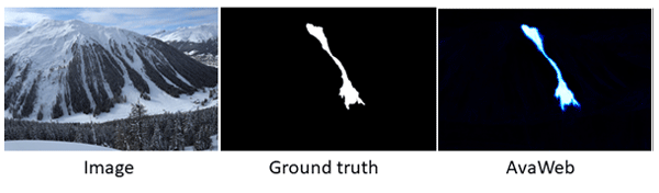
For many safety-related applications such as road management, well-documented avalanches are important. To enlarge the information, webcams may be used. We propose supporting the mapping of avalanches from webcams with a machine learning model that interactively works together with the human. Relying on that model, there is a 90% saving of time compared to the "traditional" mapping. This gives a better base for safety-critical decisions and planning in avalanche-prone mountain regions.
Annette I. Patton, Lisa V. Luna, Joshua J. Roering, Aaron Jacobs, Oliver Korup, and Benjamin B. Mirus
Nat. Hazards Earth Syst. Sci., 23, 3261–3284, https://doi.org/10.5194/nhess-23-3261-2023, https://doi.org/10.5194/nhess-23-3261-2023, 2023
Short summary
Short summary
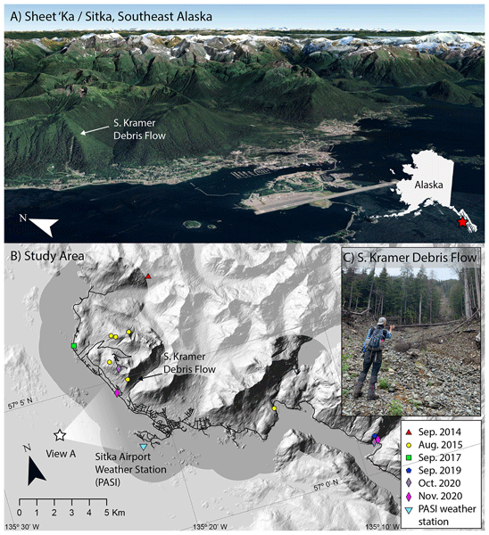
Landslide warning systems often use statistical models to predict landslides based on rainfall. They are typically trained on large datasets with many landslide occurrences, but in rural areas large datasets may not exist. In this study, we evaluate which statistical model types are best suited to predicting landslides and demonstrate that even a small landslide inventory (five storms) can be used to train useful models for landslide early warning when non-landslide events are also included.
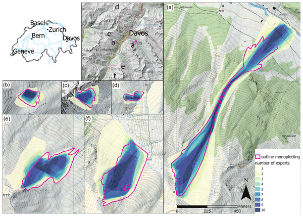
Elisabeth D. Hafner, Frank Techel, Rodrigo Caye Daudt, Jan Dirk Wegner, Konrad Schindler, and Yves Bühler
Nat. Hazards Earth Syst. Sci., 23, 2895–2914, https://doi.org/10.5194/nhess-23-2895-2023, https://doi.org/10.5194/nhess-23-2895-2023, 2023
Short summary
Short summary
Oftentimes when objective measurements are not possible, human estimates are used instead. In our study, we investigate the reproducibility of human judgement for size estimates, the mappings of avalanches from oblique photographs and remotely sensed imagery. The variability that we found in those estimates is worth considering as it may influence results and should be kept in mind for several applications.
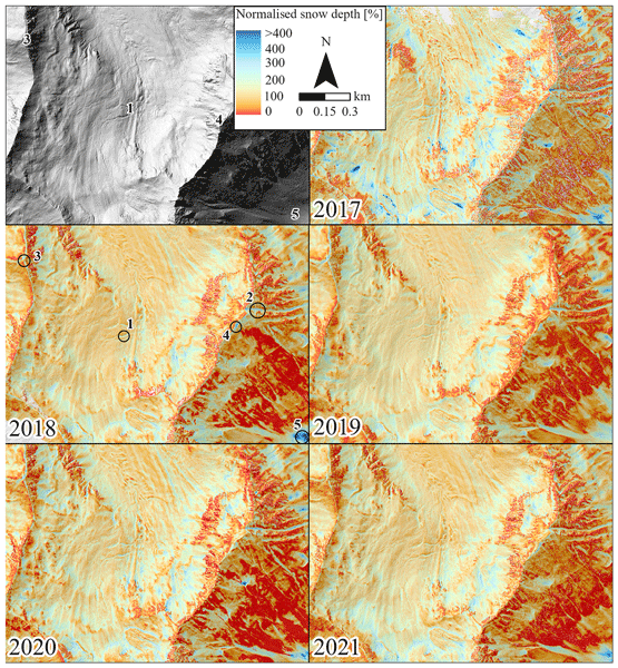
Leon J. Bührle, Mauro Marty, Lucie A. Eberhard, Andreas Stoffel, Elisabeth D. Hafner, and Yves Bühler
The Cryosphere, 17, 3383–3408, https://doi.org/10.5194/tc-17-3383-2023, https://doi.org/10.5194/tc-17-3383-2023, 2023
Short summary
Short summary
Information on the snow depth distribution is crucial for numerous applications in high-mountain regions. However, only specific measurements can accurately map the present variability of snow depths within complex terrain. In this study, we show the reliable processing of images from aeroplane to large (> 100 km2) detailed and accurate snow depth maps around Davos (CH). We use these maps to describe the existing snow depth distribution, other special features and potential applications.
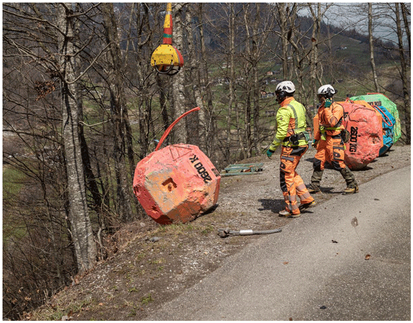
Adrian Ringenbach, Peter Bebi, Perry Bartelt, Andreas Rigling, Marc Christen, Yves Bühler, Andreas Stoffel, and Andrin Caviezel
Earth Surf. Dynam., 11, 779–801, https://doi.org/10.5194/esurf-11-779-2023, https://doi.org/10.5194/esurf-11-779-2023, 2023
Short summary
Short summary
Swiss researchers carried out repeated rockfall experiments with rocks up to human sizes in a steep mountain forest. This study focuses mainly on the effects of the rock shape and lying deadwood. In forested areas, cubic-shaped rocks showed a longer mean runout distance than platy-shaped rocks. Deadwood especially reduced the runouts of these cubic rocks. The findings enrich standard practices in modern rockfall hazard zoning assessments and strongly urge the incorporation of rock shape effects.
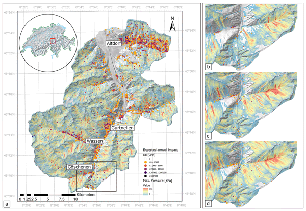
Gregor Ortner, Michael Bründl, Chahan M. Kropf, Thomas Röösli, Yves Bühler, and David N. Bresch
Nat. Hazards Earth Syst. Sci., 23, 2089–2110, https://doi.org/10.5194/nhess-23-2089-2023, https://doi.org/10.5194/nhess-23-2089-2023, 2023
Short summary
Short summary
This paper presents a new approach to assess avalanche risk on a large scale in mountainous regions. It combines a large-scale avalanche modeling method with a state-of-the-art probabilistic risk tool. Over 40 000 individual avalanches were simulated, and a building dataset with over 13 000 single buildings was investigated. With this new method, risk hotspots can be identified and surveyed. This enables current and future risk analysis to assist decision makers in risk reduction and adaptation.
Z. Xiong, D. Stober, M. Krstić, O. Korup, M. I. Arango, H. Li, and M. Werner
ISPRS Ann. Photogramm. Remote Sens. Spatial Inf. Sci., X-5-W1-2023, 75–81, https://doi.org/10.5194/isprs-annals-X-5-W1-2023-75-2023, https://doi.org/10.5194/isprs-annals-X-5-W1-2023-75-2023, 2023

Adrian Ringenbach, Peter Bebi, Perry Bartelt, Andreas Rigling, Marc Christen, Yves Bühler, Andreas Stoffel, and Andrin Caviezel
Earth Surf. Dynam., 10, 1303–1319, https://doi.org/10.5194/esurf-10-1303-2022, https://doi.org/10.5194/esurf-10-1303-2022, 2022
Short summary
Short summary
The presented automatic deadwood generator (ADG) allows us to consider deadwood in rockfall simulations in unprecedented detail. Besides three-dimensional fresh deadwood cones, we include old woody debris in rockfall simulations based on a higher compaction rate and lower energy absorption thresholds. Simulations including different deadwood states indicate that a 10-year-old deadwood pile has a higher protective capacity than a pre-storm forest stand.
John Sykes, Pascal Haegeli, and Yves Bühler
Nat. Hazards Earth Syst. Sci., 22, 3247–3270, https://doi.org/10.5194/nhess-22-3247-2022, https://doi.org/10.5194/nhess-22-3247-2022, 2022
Short summary
Short summary
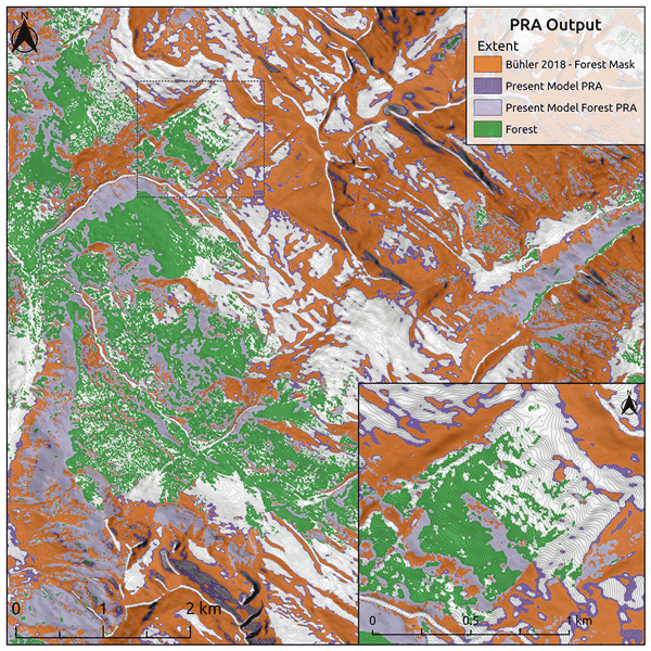
Automated snow avalanche terrain mapping provides an efficient method for large-scale assessment of avalanche hazards, which informs risk management decisions for transportation and recreation. This research reduces the cost of developing avalanche terrain maps by using satellite imagery and open-source software as well as improving performance in forested terrain. The research relies on local expertise to evaluate accuracy, so the methods are broadly applicable in mountainous regions worldwide.
Melanie Fischer, Jana Brettin, Sigrid Roessner, Ariane Walz, Monique Fort, and Oliver Korup
Nat. Hazards Earth Syst. Sci., 22, 3105–3123, https://doi.org/10.5194/nhess-22-3105-2022, https://doi.org/10.5194/nhess-22-3105-2022, 2022
Short summary
Short summary
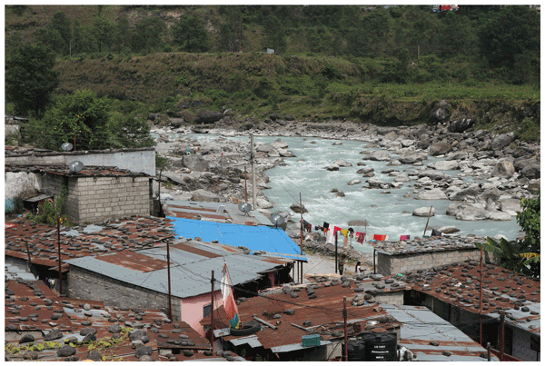
Nepal’s second-largest city has been rapidly growing since the 1970s, although its valley has been affected by rare, catastrophic floods in recent and historic times. We analyse potential impacts of such floods on urban areas and infrastructure by modelling 10 physically plausible flood scenarios along Pokhara’s main river. We find that hydraulic effects would largely affect a number of squatter settlements, which have expanded rapidly towards the river by a factor of up to 20 since 2008.
Adam Emmer, Simon K. Allen, Mark Carey, Holger Frey, Christian Huggel, Oliver Korup, Martin Mergili, Ashim Sattar, Georg Veh, Thomas Y. Chen, Simon J. Cook, Mariana Correas-Gonzalez, Soumik Das, Alejandro Diaz Moreno, Fabian Drenkhan, Melanie Fischer, Walter W. Immerzeel, Eñaut Izagirre, Ramesh Chandra Joshi, Ioannis Kougkoulos, Riamsara Kuyakanon Knapp, Dongfeng Li, Ulfat Majeed, Stephanie Matti, Holly Moulton, Faezeh Nick, Valentine Piroton, Irfan Rashid, Masoom Reza, Anderson Ribeiro de Figueiredo, Christian Riveros, Finu Shrestha, Milan Shrestha, Jakob Steiner, Noah Walker-Crawford, Joanne L. Wood, and Jacob C. Yde
Nat. Hazards Earth Syst. Sci., 22, 3041–3061, https://doi.org/10.5194/nhess-22-3041-2022, https://doi.org/10.5194/nhess-22-3041-2022, 2022
Short summary
Short summary
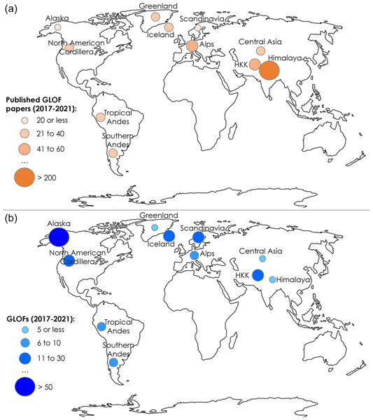
Glacial lake outburst floods (GLOFs) have attracted increased research attention recently. In this work, we review GLOF research papers published between 2017 and 2021 and complement the analysis with research community insights gained from the 2021 GLOF conference we organized. The transdisciplinary character of the conference together with broad geographical coverage allowed us to identify progress, trends and challenges in GLOF research and outline future research needs and directions.
Elisabeth D. Hafner, Patrick Barton, Rodrigo Caye Daudt, Jan Dirk Wegner, Konrad Schindler, and Yves Bühler
The Cryosphere, 16, 3517–3530, https://doi.org/10.5194/tc-16-3517-2022, https://doi.org/10.5194/tc-16-3517-2022, 2022
Short summary
Short summary
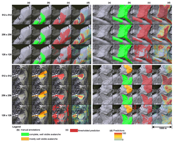
Knowing where avalanches occur is very important information for several disciplines, for example avalanche warning, hazard zonation and risk management. Satellite imagery can provide such data systematically over large regions. In our work we propose a machine learning model to automate the time-consuming manual mapping. Additionally, we investigate expert agreement for manual avalanche mapping, showing that our network is equally as good as the experts in identifying avalanches.
Aubrey Miller, Pascal Sirguey, Simon Morris, Perry Bartelt, Nicolas Cullen, Todd Redpath, Kevin Thompson, and Yves Bühler
Nat. Hazards Earth Syst. Sci., 22, 2673–2701, https://doi.org/10.5194/nhess-22-2673-2022, https://doi.org/10.5194/nhess-22-2673-2022, 2022
Short summary
Short summary
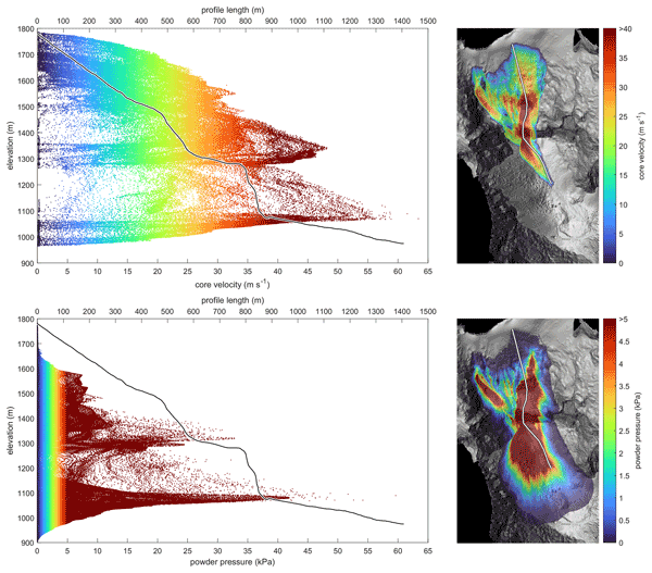
Natural hazard modelers simulate mass movements to better anticipate the risk to people and infrastructure. These simulations require accurate digital elevation models. We test the sensitivity of a well-established snow avalanche model (RAMMS) to the source and spatial resolution of the elevation model. We find key differences in the digital representation of terrain greatly affect the simulated avalanche results, with implications for hazard planning.
Adrian Ringenbach, Elia Stihl, Yves Bühler, Peter Bebi, Perry Bartelt, Andreas Rigling, Marc Christen, Guang Lu, Andreas Stoffel, Martin Kistler, Sandro Degonda, Kevin Simmler, Daniel Mader, and Andrin Caviezel
Nat. Hazards Earth Syst. Sci., 22, 2433–2443, https://doi.org/10.5194/nhess-22-2433-2022, https://doi.org/10.5194/nhess-22-2433-2022, 2022
Short summary
Short summary
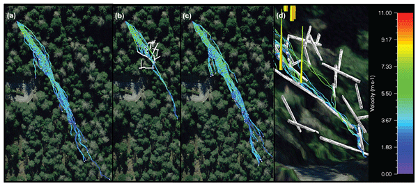
Forests have a recognized braking effect on rockfalls. The impact of lying deadwood, however, is mainly neglected. We conducted 1 : 1-scale rockfall experiments in three different states of a spruce forest to fill this knowledge gap: the original forest, the forest including lying deadwood and the cleared area. The deposition points clearly show that deadwood has a protective effect. We reproduced those experimental results numerically, considering three-dimensional cones to be deadwood.
Yves Bühler, Peter Bebi, Marc Christen, Stefan Margreth, Lukas Stoffel, Andreas Stoffel, Christoph Marty, Gregor Schmucki, Andrin Caviezel, Roderick Kühne, Stephan Wohlwend, and Perry Bartelt
Nat. Hazards Earth Syst. Sci., 22, 1825–1843, https://doi.org/10.5194/nhess-22-1825-2022, https://doi.org/10.5194/nhess-22-1825-2022, 2022
Short summary
Short summary
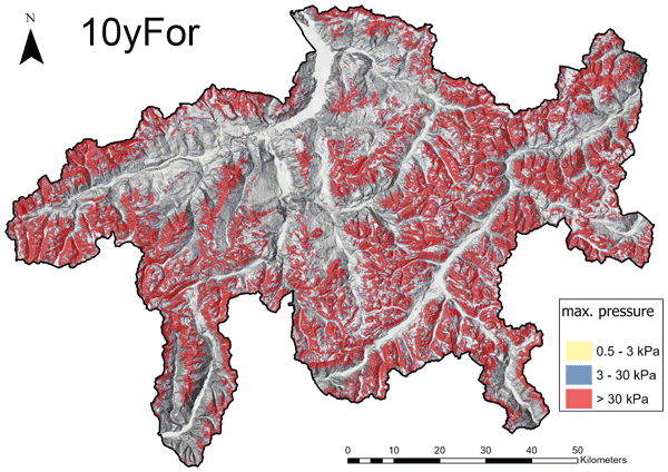
To calculate and visualize the potential avalanche hazard, we develop a method that automatically and efficiently pinpoints avalanche starting zones and simulate their runout for the entire canton of Grisons. The maps produced in this way highlight areas that could be endangered by avalanches and are extremely useful in multiple applications for the cantonal authorities, including the planning of new infrastructure, making alpine regions more safe.
Animesh K. Gain, Yves Bühler, Pascal Haegeli, Daniela Molinari, Mario Parise, David J. Peres, Joaquim G. Pinto, Kai Schröter, Ricardo M. Trigo, María Carmen Llasat, and Heidi Kreibich
Nat. Hazards Earth Syst. Sci., 22, 985–993, https://doi.org/10.5194/nhess-22-985-2022, https://doi.org/10.5194/nhess-22-985-2022, 2022
Short summary
Short summary
To mark the 20th anniversary of Natural Hazards and Earth System Sciences (NHESS), an interdisciplinary and international journal dedicated to the public discussion and open-access publication of high-quality studies and original research on natural hazards and their consequences, we highlight 11 key publications covering major subject areas of NHESS that stood out within the past 20 years.
Natalie Brožová, Tommaso Baggio, Vincenzo D'Agostino, Yves Bühler, and Peter Bebi
Nat. Hazards Earth Syst. Sci., 21, 3539–3562, https://doi.org/10.5194/nhess-21-3539-2021, https://doi.org/10.5194/nhess-21-3539-2021, 2021
Short summary
Short summary
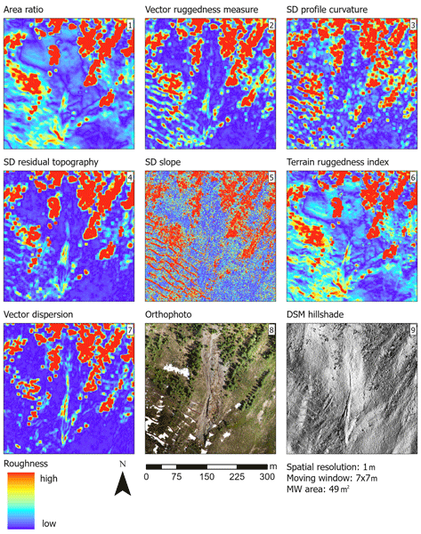
Surface roughness plays a great role in natural hazard processes but is not always well implemented in natural hazard modelling. The results of our study show how surface roughness can be useful in representing vegetation and ground structures, which are currently underrated. By including surface roughness in natural hazard modelling, we could better illustrate the processes and thus improve hazard mapping, which is crucial for infrastructure and settlement planning in mountainous areas.
Nora Helbig, Michael Schirmer, Jan Magnusson, Flavia Mäder, Alec van Herwijnen, Louis Quéno, Yves Bühler, Jeff S. Deems, and Simon Gascoin
The Cryosphere, 15, 4607–4624, https://doi.org/10.5194/tc-15-4607-2021, https://doi.org/10.5194/tc-15-4607-2021, 2021
Short summary
Short summary
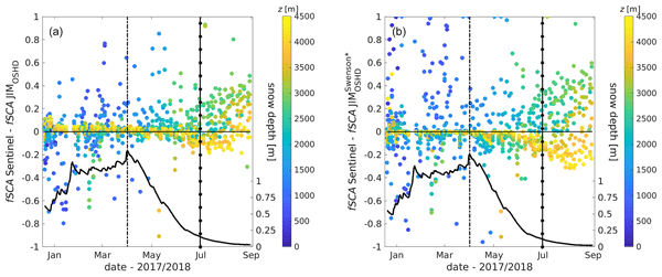
The snow cover spatial variability in mountains changes considerably over the course of a snow season. In applications such as weather, climate and hydrological predictions the fractional snow-covered area is therefore an essential parameter characterizing how much of the ground surface in a grid cell is currently covered by snow. We present a seasonal algorithm and a spatiotemporal evaluation suggesting that the algorithm can be applied in other geographic regions by any snow model application.
Cited articles
Badoux, A., Andres, N., Techel, F., and Hegg, C.: Natural hazard fatalities in Switzerland from 1946 to 2015, Nat. Hazards Earth Syst. Sci., 16, 2747–2768, https://doi.org/10.5194/nhess-16-2747-2016, 2016.
Bagli, S. and Schweizer, J.: Characteristics of wet-snow avalanche activity: 20 years of observations from a high alpine valley (Dischma, Switzerland), Nat. Hazards, 50, 97–108, https://doi.org/10.1007/s11069-008-9322-7, 2009.
Bründl, M., Etter, H.-J., Steiniger, M., Klingler, Ch., Rhyner, J., and Ammann, W. J.: IFKIS – a basis for managing avalanche risk in settlements and on roads in Switzerland, Nat. Hazards Earth Syst. Sci., 4, 257–262, https://doi.org/10.5194/nhess-4-257-2004, 2004.
Bühler, Y., Hüni, A., Christen, M., Meister, R., and Kellerberger, T.: Automated detection and mapping of avalanche deposits using airborne optical remote sensing data, Cold Reg. Sci. Technol., 57, 99–106, https://doi.org/10.1016/j.coldregions.2009.02.007, 2009.
Bühler, Y., Meier, L., and Ginzler, C.: Potential of operational high spatial resolution near-infrared remote sensing instruments for snow surface type mapping, IEEE Geosci. Remote Sens. Lett., 12, 821–825, https://doi.org/10.1109/LGRS.2014.2363237, 2015.
Bühler, Y., Adams, M. S., Bösch, R., and Stoffel, A.: Mapping snow depth in alpine terrain with unmanned aerial systems (UASs): Potential and limitations, Cryosphere, 10, 1075–1088, https://doi.org/10.5194/tc-10-1075-2016, 2016.
Bühler, Y., Adams, M. S., Stoffel, A., and Boesch, R.: Photogrammetric reconstruction of homogenous snow surfaces in alpine terrain applying near-infrared UAS imagery, Int. J. Remote Sens., 0, 1–24, https://doi.org/10.1080/01431161.2016.1275060, 2017.
Castebrunet, H., Eckert, N., and Giraud, G.: Snow and weather climatic control on snow avalanche occurrence fluctuations over 50 yr in the French Alps, Clim. Past, 8, 855–875, https://doi.org/10.5194/cp-8-855-2012, 2012.
Christen, M., Kowalski, J., and Bartelt, P.: RAMMS: Numerical simulation of dense snow avalanches in three-dimensional terrain, Cold Reg. Sci. Technol., 63, 1–14, https://doi.org/10.1016/j.coldregions.2010.04.005, 2010.
Cohen, J.: A coefficient of agreement for nominal scales, Educ. Psychol. Meas., 20, 37–46, 1960.
Congalton, R. G.: A review of assessing the accuracy of classifications of remotely sensed data, Remote Sens. Environ., 37, 35–46, https://doi.org/10.1016/0034-4257(91)90048-B, 1991.
Eckerstorfer, M. and Malnes, E.: Manual detection of snow avalanche debris using high-resolution Radarsat-2 SAR images Radarsat-2 SAR images, Cold Reg. Sci. Technol., 120, 205–218, https://doi.org/10.1016/j.coldregions.2015.08.016, 2015.
Eckerstorfer, M., Bühler, Y., Frauenfelder, R., and Malnes, E.: Remote sensing of snow avalanches: Recent advances, potential, and limitations, Cold Reg. Sci. Technol., 121, 126–140, https://doi.org/10.1016/j.coldregions.2015.11.001, 2016.
Ji, L., Zhang, L., and Wylie, B.: Analysis of dynamic thresholds for the normalized difference water index, Photogramm. Eng. Remote Sens., 75, 1307–1317, https://doi.org/10.14358/PERS.75.11.1307, 2009.
Larsen, S. Ø., Salberg, A., and Solberg, R.: Automatic avalanche mapping using texture classification of optical satellite imagery, edited by: Lasaponara, R., Masini, N., and Biscione, M., EARSeL, 2013, Towards Horizon 2020, 399–410, 2013.
Lato, M. J., Frauenfelder, R., and Bühler, Y.: Automated detection of snow avalanche deposits: segmentation and classification of optical remote sensing imagery, Nat. Hazards Earth Syst. Sci., 12, 2893–2906, https://doi.org/10.5194/nhess-12-2893-2012, 2012.
McClung, D. and Schaerer, P.: The Avalanche Handbook, The Mountaineers Book, Seattle, 2006.
McClung, D. M.: Avalanche character and fatalities in the high mountains of Asia, Ann. Glaciol., 57, 114–118, https://doi.org/10.3189/2016AoG71A075, 2016.
McFeeters, S. K.: The use of the normalized difference water index (NDWI) in the delineation of open water features, Int. J. Remote Sens., 17, 1425–1432, https://doi.org/10.1080/01431169608948714, 1996.
Schweizer, J. and Jamieson, J. B.: Snow cover properties for skier triggering of avalanches, Cold Reg. Sci. Technol., 33, 207–221, https://doi.org/10.1016/S0165-232X(01)00039-8, 2001.
Schweizer, J., Jamieson, J. B., and Schneebeli, M.: Snow avalanche formation, Rev. Geophys., 41, 1–25, https://doi.org/10.1029/2002RG000123, 2003.
Sithole, G. and Vosselman, G.: Experimental comparison of filter algorithms for bare-Earth extraction from airborne laser scanning point clouds, ISPRS J. Photogramm., 59, 85–101, https://doi.org/10.1016/j.isprsjprs.2004.05.004, 2004.
Techel, F., Zweifel, B., and Winkler, K.: Analysis of avalanche risk factors in backcountry terrain based on usage frequency and accident data in Switzerland, Nat. Hazards Earth Syst. Sci., 15, 1985–1997, https://doi.org/10.5194/nhess-15-1985-2015, 2015.
Techel, F., Jarry, F., Kronthaler, G., Mitterer, S., Nairz, P., Pavsek, M., Valt, M., and Darms, G.: Avalanche fatalities in the European Alps: Long-term trends and statistics, Geogr. Helv., 71, 147–159, https://doi.org/10.5194/gh-71-147-2016, 2016.
Townshend, J. R. G. and Justice, C. O.: Analysis of the dynamics of African vegetation using the normalized difference vegetation index, Int. J. Remote Sens., 7, 1435–1445, https://doi.org/10.1080/01431168608948946, 1986.
Varma, M. and Zisserman, A.: A statistical approach to texture classification from single images, Int. J. Comput. Vision, 62, 61–81, https://doi.org/10.1007/s11263-005-4635-4, 2004.
Vickers, H., Eckerstorfer, M., Malnes, E., Larsen, Y., and Hindberg, H.: A method for automated snow avalanche debris detection through use of Synthetic Aperture Radar (SAR) imaging, Earth Space Sci., 3, 446–462, https://doi.org/10.1002/2016EA000168, 2016.
Wilhelm, C., Wiesinger, T., Bründl, M., and Ammann, W.: The avalanche winter 1999 in Switzerland – An overview, Proc. of the 2000 International Snow Science Workshop, Montana, USA, 487–494, 1999.
Short summary
In this study, we have focused on automatically detecting avalanches and classifying them into release zones, tracks, and run-out zones based on aerial imagery using an object-based image analysis (OBIA) approach. We compared the results with manually mapped avalanche polygons, and obtained a user’s accuracy of > 0.9 and a Cohen’s kappa of 0.79–0.85. Testing the method for a larger area of 226.3 km2, we estimated producer’s and user’s accuracies of 0.61 and 0.78, respectively.
In this study, we have focused on automatically detecting avalanches and classifying them into...


Altmetrics
Final-revised paper
Preprint