
Articles | Volume 26, issue 10
https://doi.org/10.5194/nhess-26-4785-2026
© Author(s) 2026. This work is distributed under
the Creative Commons Attribution 4.0 License.
the Creative Commons Attribution 4.0 License.
https://doi.org/10.5194/nhess-26-4785-2026
© Author(s) 2026. This work is distributed under
the Creative Commons Attribution 4.0 License.
the Creative Commons Attribution 4.0 License.
Research article
| 
05 Oct 2026
Research article |
| 05 Oct 2026
| 05 Oct 2026
Building-level exposure asset value modelling for Germany: an Ahrweiler case study
Aaron Buhrmann
GFZ Helmholtz Centre for Geosciences, Hydrology Section, Telegrafenberg, 14473 Potsdam, Germany
Institute of Environmental Science and Geography, University of Potsdam, Potsdam, Brandenburg, Germany
Nivedita Sairam
GFZ Helmholtz Centre for Geosciences, Hydrology Section, Telegrafenberg, 14473 Potsdam, Germany
Cecilia I. Nievas
GFZ Helmholtz Centre for Geosciences, Seismic Hazard and Risk Dynamics Section, Telegrafenberg, 14473 Potsdam, Germany
James E. Daniell
World Bank Group, 1818 H St NW, Washington, DC 20433, USA
Geophysical Institute and Center for Disaster Management and Risk Reduction Technology, Karlsruhe Institute of Technology (KIT), Karlsruhe, Germany
Heidi Kreibich
GFZ Helmholtz Centre for Geosciences, Hydrology Section, Telegrafenberg, 14473 Potsdam, Germany

GFZ Helmholtz Centre for Geosciences, Hydrology Section, Telegrafenberg, 14473 Potsdam, Germany
Institute of Environmental Science and Geography, University of Potsdam, Potsdam, Brandenburg, Germany
Related authors
No articles found.
Henrique M. D. Goulart, Lily-belle Sweet, Axel Deijns, Seth Bryant, and Benjamin Poschlod
EGUsphere, https://doi.org/10.5194/egusphere-2026-5735, https://doi.org/10.5194/egusphere-2026-5735, 2026
This preprint is open for discussion and under review for Hydrology and Earth System Sciences (HESS).
Short summary
Short summary
Floods are changing as the climate warms, but different types of floods may respond differently. We used a data-driven method to identify flood types and study how they change in four Bavarian catchments. Rainfall-driven floods become more frequent and severe, while floods linked to snowmelt decline. These changes shift flood risk from spring towards rainfall-driven flooding throughout the year, with implications for preparedness and infrastructure.
Kyunghun Kim, Nivedita Sairam, and Bruno Merz
EGUsphere, https://doi.org/10.5194/egusphere-2026-5526, https://doi.org/10.5194/egusphere-2026-5526, 2026
This preprint is open for discussion and under review for Natural Hazards and Earth System Sciences (NHESS).
Short summary
Short summary
While drought is known to worsen wildfires, how severely it expands fire size remains unclear. Analyzing nearly 12 000 South Korean fire records from 2000 to 2024, we quantified drought impacts across different fire scales. We found that drought expands fire spread, driving up to a 13.7-fold increase in burned area for large scale events. These findings show that dry conditions exponentially worsen wildfires, aiding climate policy.
Pragya Badika, Nithila Devi Nallasamy, Nadja Veigel, Laurens J. N. Oostwegel, Heidi Kreibich, and Ankit Agarwal
EGUsphere, https://doi.org/10.5194/egusphere-2026-4699, https://doi.org/10.5194/egusphere-2026-4699, 2026
This preprint is open for discussion and under review for Natural Hazards and Earth System Sciences (NHESS).
Short summary
Short summary
Our study explores how varying resolutions in hazard and exposure assessment affect flood hazard classification and impact estimates in the Upper Narmada Basin, India. Coarser resolutions may overestimate flood extent and exposed estimates, potentially skewing emergency planning. Study emphasizes that spatial resolution is a critical uncertainty factor that should align with research questions and decision-making scales.
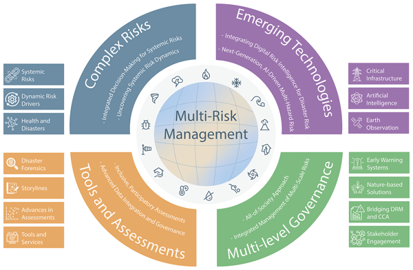
Timothy Tiggeloven, Colin Raymond, Marleen C. de Ruiter, Jana Sillmann, Annegret H. Thieken, Sophie L. Buijs, Roxana Ciurean, Emma Cordier, Julia M. Crummy, Lydia Cumiskey, Kelley De Polt, Melanie Duncan, Davide M. Ferrario, Wiebke S. Jäger, Elco E. Koks, Nicole van Maanen, Heather J. Murdock, Jaroslav Mysiak, Sadhana Nirandjan, Benjamin Poschlod, Peter Priesmeier, Nivedita Sairam, Pia-Johanna Schweizer, Tristian R. Stolte, Marie-Luise Zenker, James E. Daniell, Alexander Fekete, Christian M. Geiß, Marc J. C. van den Homberg, Sirkku K. Juhola, Christian Kuhlicke, Karen Lebek, Robert Šakić Trogrlić, Stefan Schneiderbauer, Silvia Torresan, Cees J. van Westen, Judith N. Claassen, Bijan Khazai, Virginia Murray, Julius Schlumberger, and Philip J. Ward
Geosci. Commun., 9, 185–221, https://doi.org/10.5194/gc-9-185-2026, https://doi.org/10.5194/gc-9-185-2026, 2026
Short summary
Short summary
Natural hazards like floods, earthquakes, and landslides are often interconnected which may create bigger problems than when they occur alone. We studied expert discussions from an international conference to understand how scientists and policymakers can better prepare for these multi-hazards and use new technologies to protect its communities while contributing to dialogues about future international agreements beyond the Sendai Framework and supporting global sustainability goals.
Fuqiang Tian, Murugesu Sivapalan, Sondoss El Sawah, Melissa Haeffner, Anthony Jakeman, Heidi Kreibich, Leyang Liu, Haoyang Lyu, Ana Mijic, Jiale Wang, Jing Wei, and Günter Blöschl
EGUsphere, https://doi.org/10.5194/egusphere-2026-1727, https://doi.org/10.5194/egusphere-2026-1727, 2026
Short summary
Short summary
This opinion paper shows how sociohydrology can better support water management by moving from understanding systems to guiding action. Drawing on ten years of work in the Panta Rhei initiative, it offers a simple way to compare cases, trace how actions lead to intended and unintended outcomes, and improve monitoring, learning, fairness, and legitimacy in decision-making.
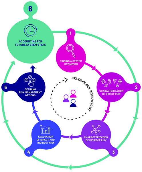
Philip J. Ward, Sophie L. Buijs, Roxana Ciurean, Judith N. Claassen, James Daniell, Kelley De Polt, Melanie Duncan, Stefania Gottardo, Stefan Hochrainer-Stigler, Robert Šakić Trogrlić, Julius Schlumberger, Timothy Tiggeloven, Silvia Torresan, Nicole van Maanen, Andrew Warren, Carmen D. Álvarez-Albelo, Vanessa Banks, Benjamin Blanz, Veronica Casartelli, Jordan Correa, Julia Crummy, Anne Sophie Daloz, Marleen C. de Ruiter, Juan José Díaz-Hernández, Jaime Díaz-Pacheco, Pedro Dorta Antequera, Davide Ferrario, David Geurts, Sara García-González, Joel C. Gill, Raúl Hernández-Martín, Wiebke S. Jäger, Abel López-Díez, Lin Ma, Jaroslav Mysiak, Diep Ngoc Nguyen, Noemi Padrón Fumero, Eva-Cristina Petrescu, Karina Reiter, Jana Sillmann, Lara Smale, and Tristian Stolte
Nat. Hazards Earth Syst. Sci., 26, 1325–1345, https://doi.org/10.5194/nhess-26-1325-2026, https://doi.org/10.5194/nhess-26-1325-2026, 2026
Short summary
Short summary
Disasters often result from interactions between different hazards, like floods triggering landslides, or earthquakes followed by tropical cyclones, so-called multi-hazards. People and societies are increasingly exposed and vulnerable to these multi-hazards. Assessing these aspects is referred to as multi-risk assessment and management. In this paper we synthesise key learnings from the MYRIAD-EU (Multi-hazard and sYstemic framework for enhancing Risk-Informed mAnagement and Decision-making in the E.U.) project, reflecting on progress and challenges faced in addressing multi-hazards and multi-risk.
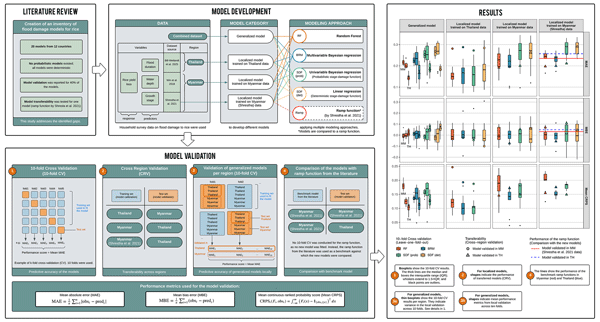
Alina Bill-Weilandt, Nivedita Sairam, Dennis Wagenaar, Kasra Rafiezadeh Shahi, Heidi Kreibich, Perrine Hamel, and David Lallemant
Nat. Hazards Earth Syst. Sci., 26, 925–942, https://doi.org/10.5194/nhess-26-925-2026, https://doi.org/10.5194/nhess-26-925-2026, 2026
Short summary
Short summary
Flooding is a major cause of agricultural loss globally. This study evaluates and compares flood damage models for rice crops. We present an inventory with 20 models from 12 countries, representing the most comprehensive review of such models for rice to date. The study offers practical guidance on model selection and expected errors when transferring models across regions. We provide models and lookup tables that can be used in flood risk assessments in rice-producing regions.
Yamile Villafani, Heiko Apel, Laurens J. N. Oostwegel, Thi Thao Nguyen Huynh, Hong Quan Nguyen, Nigel K. Downes, Andrea Cominola, and Nivedita Sairam
EGUsphere, https://doi.org/10.5194/egusphere-2026-850, https://doi.org/10.5194/egusphere-2026-850, 2026
Short summary
Short summary
Flooding is an increasing threat in fast-growing cities, disrupting daily life, damaging homes, and raising disease risks from contaminated water. In Can Tho City, Vietnam, this study estimates household financial damage and the spread of harmful pathogens in floodwaters, then combines these impacts to identify neighborhoods at greatest risk. The results help planners target protection and support where it is most needed.
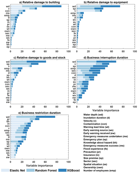
Ravikumar Guntu, Guilherme Samprogna Mohor, Annegret H. Thieken, Meike Müller, and Heidi Kreibich
Nat. Hazards Earth Syst. Sci., 26, 163–186, https://doi.org/10.5194/nhess-26-163-2026, https://doi.org/10.5194/nhess-26-163-2026, 2026
Short summary
Short summary
The 2021 flood in Germany caused severe damage to companies, with over half reporting losses above € 100 000. Using probabilistic models, we identify key factors driving direct damage and business interruption. Water depth, flow velocity and company exposure were key factors, but preparedness played a crucial role. Companies that took good precaution recovered faster. Our findings stress the value of early warnings and risk communication to reduce damage from unprecedented flood events.
Nivedita Sairam and Marleen C. de Ruiter
Nat. Hazards Earth Syst. Sci., 26, 119–130, https://doi.org/10.5194/nhess-26-119-2026, https://doi.org/10.5194/nhess-26-119-2026, 2026
Short summary
Short summary
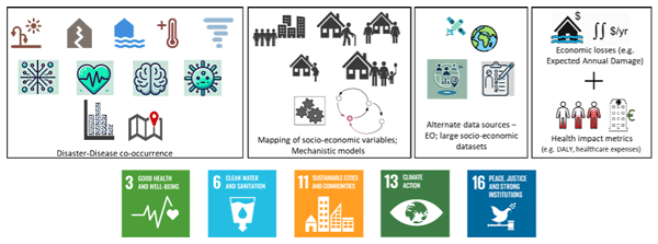
This paper highlights gaps in disaster risk assessments, particularly regarding disease outbreaks after natural hazards. It calls for: (1) learning from compound risk models to understand disaster and disease probabilities, (2) including health metrics in risk frameworks, and (3) improving data and modeling for health impacts. The authors propose a research agenda to enhance disaster risk management.
Apoorva Singh, Ravikumar Guntu, Nivedita Sairam, Kasra Rafiezadeh Shahi, Anna Buch, Melanie Fischer, Chandrika Thulaseedharan Dhanya, and Heidi Kreibich
Nat. Hazards Earth Syst. Sci., 26, 103–118, https://doi.org/10.5194/nhess-26-103-2026, https://doi.org/10.5194/nhess-26-103-2026, 2026
Short summary
Short summary
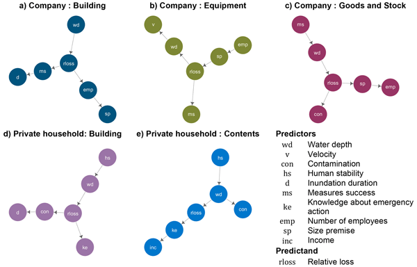
We develop novel probabilistic models to estimate flash flood losses of companies and households in Germany. Using multiple flash flood events, we identify key drivers of flash floods loss. FLEMO flash model reveals that for companies, the effectiveness of emergency measures is crucial in mitigating losses. In contrast, household benefit more from knowledge about emergency action, suggesting adaptation strategies can effectively reduce flash flood losses.
Kasra Rafiezadeh Shahi, Nivedita Sairam, Lukas Schoppa, Le Thanh Sang, Do Ly Hoai Tan, and Heidi Kreibich
Nat. Hazards Earth Syst. Sci., 25, 2845–2861, https://doi.org/10.5194/nhess-25-2845-2025, https://doi.org/10.5194/nhess-25-2845-2025, 2025
Short summary
Short summary
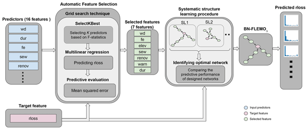
Ho Chi Minh City (HCMC) faces severe flood risks from climatic and socio-economic changes, requiring effective adaptation solutions. Flood loss estimation is crucial, but advanced probabilistic models accounting for key drivers and uncertainty are lacking. This study presents a probabilistic flood loss model with a feature selection paradigm for HCMC’s residential sector. Experiments using new survey data from flood-affected households demonstrate the model's superior performance.
Anna Buch, Dominik Paprotny, Kasra Rafiezadeh Shahi, Heidi Kreibich, and Nivedita Sairam
Nat. Hazards Earth Syst. Sci., 25, 2437–2453, https://doi.org/10.5194/nhess-25-2437-2025, https://doi.org/10.5194/nhess-25-2437-2025, 2025
Short summary
Short summary
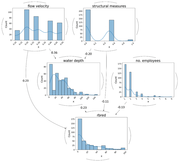
Many households in Vietnam depend on revenue from micro-businesses (shop houses). However, losses caused by regular flooding are not modelled. Business turnover, building age, and water depth were found to be the main drivers of flood losses of micro-businesses. We built and validated probabilistic models (non-parametric Bayesian networks) that estimate flood losses of micro-businesses. The results help with flood risk management and adaption decision making for micro-businesses.
Danhua Xin, James Edward Daniell, Zhenguo Zhang, Friedemann Wenzel, Shaun Shuxun Wang, and Xiaofei Chen
Nat. Hazards Earth Syst. Sci., 25, 1597–1620, https://doi.org/10.5194/nhess-25-1597-2025, https://doi.org/10.5194/nhess-25-1597-2025, 2025
Short summary
Short summary
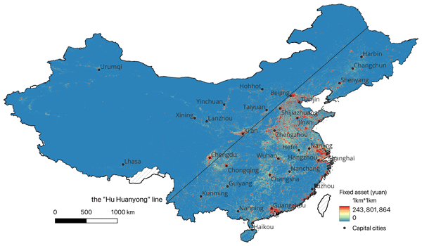
A high-resolution fixed-asset model can help improve the accuracy of earthquake loss assessment. We develop a grid-level fixed-asset model for China from 1951 to 2020. We first compile the provincial-level fixed asset from yearbook-related statistics. Then, this dataset is disaggregated into 1 km × 1 km grids by using multiple remote sensing data as the weight indicator. We find that the fixed-asset value increased rapidly after the 1980s and reached CNY 589.31 trillion in 2020.
André Felipe Rocha Silva, Julian Cardoso Eleutério, Heiko Apel, and Heidi Kreibich
Nat. Hazards Earth Syst. Sci., 25, 1501–1520, https://doi.org/10.5194/nhess-25-1501-2025, https://doi.org/10.5194/nhess-25-1501-2025, 2025
Short summary
Short summary
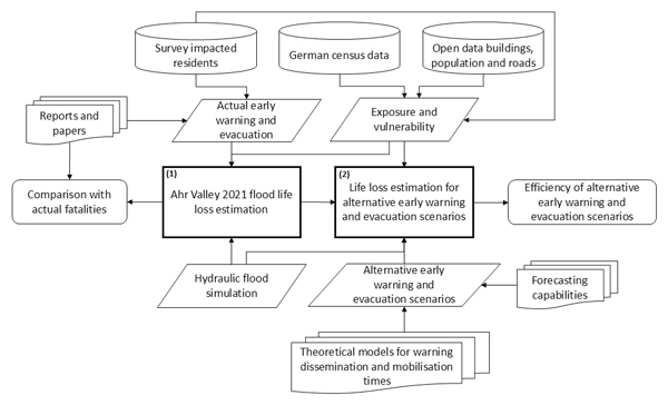
This work uses agent-based modelling to evaluate the impact of flood warning and evacuation systems on human losses during the 2021 Ahr Valley flood in Germany. While the first flood warning with evacuation instructions is identified as timely, its lack of detail and effectiveness resulted in low public risk awareness. Better dissemination of warnings and improved risk perception and preparedness among the population could reduce casualties by up to 80 %.
Maurice W. M. L. Kalthof, Jens de Bruijn, Hans de Moel, Heidi Kreibich, and Jeroen C. J. H. Aerts
Nat. Hazards Earth Syst. Sci., 25, 1013–1035, https://doi.org/10.5194/nhess-25-1013-2025, https://doi.org/10.5194/nhess-25-1013-2025, 2025
Short summary
Short summary
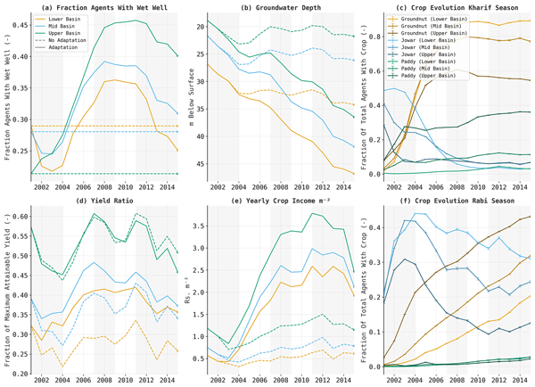
Our study explores how farmers in India's Bhima basin respond to consecutive droughts. We simulated farmers' individual choices – like changing crops or digging wells – and their effects on profits, yields, and water resources. Results show these adaptations, while improving incomes, ultimately increase drought vulnerability and damage. Such insights emphasize the need for alternative adaptations and highlight the value of socio-hydrological models in shaping policies to lessen drought impacts.
Nadja Veigel, Heidi Kreibich, Jens A. de Bruijn, Jeroen C. J. H. Aerts, and Andrea Cominola
Nat. Hazards Earth Syst. Sci., 25, 879–891, https://doi.org/10.5194/nhess-25-879-2025, https://doi.org/10.5194/nhess-25-879-2025, 2025
Short summary
Short summary
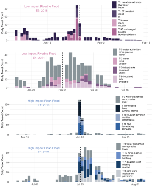
This study explores how social media, specifically Twitter (X), can help us understand public reactions to floods in Germany from 2014 to 2021. Using large language models, we extract topics and patterns of behavior from flood-related tweets. The findings offer insights to improve communication and disaster management. Topics related to low-impact flooding contain descriptive hazard-related content, while the focus shifts to catastrophic impacts and responsibilities during high-impact events.
Belinda Rhein and Heidi Kreibich
Nat. Hazards Earth Syst. Sci., 25, 581–589, https://doi.org/10.5194/nhess-25-581-2025, https://doi.org/10.5194/nhess-25-581-2025, 2025
Short summary
Short summary
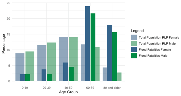
In July 2021, flooding killed 190 people in Germany, 134 of them in the Ahr valley, making it the deadliest flood in recent German history. The flash flood was extreme in terms of water levels, flow velocities and flood extent, and early warning and evacuation were inadequate. Many died on the ground floor or in the street, with older and impaired individuals especially vulnerable. Clear warnings should urge people to seek safety rather than save belongings, and timely evacuations are essential.
Bruno Merz, Günter Blöschl, Robert Jüpner, Heidi Kreibich, Kai Schröter, and Sergiy Vorogushyn
Nat. Hazards Earth Syst. Sci., 24, 4015–4030, https://doi.org/10.5194/nhess-24-4015-2024, https://doi.org/10.5194/nhess-24-4015-2024, 2024
Short summary
Short summary
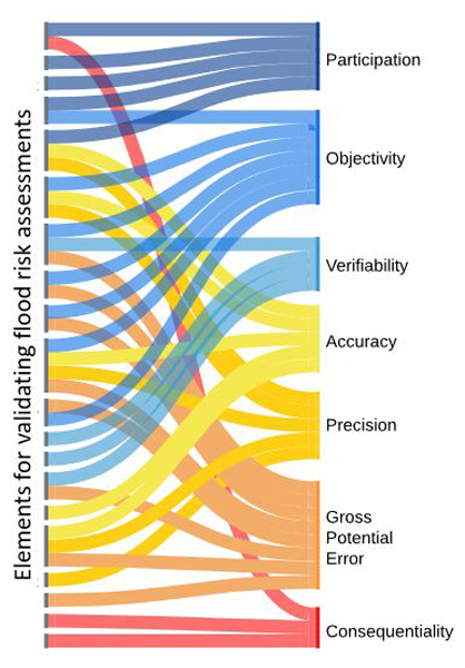
Flood risk assessments help us decide how to reduce the risk of flooding. Since these assessments are based on probabilities, it is hard to check their accuracy by comparing them to past data. We suggest a new way to validate these assessments, making sure they are practical for real-life decisions. This approach looks at both the technical details and the real-world situations where decisions are made. We demonstrate its practicality by applying it to flood emergency planning.
Dominik Paprotny, Belinda Rhein, Michalis I. Vousdoukas, Paweł Terefenko, Francesco Dottori, Simon Treu, Jakub Śledziowski, Luc Feyen, and Heidi Kreibich
Hydrol. Earth Syst. Sci., 28, 3983–4010, https://doi.org/10.5194/hess-28-3983-2024, https://doi.org/10.5194/hess-28-3983-2024, 2024
Short summary
Short summary
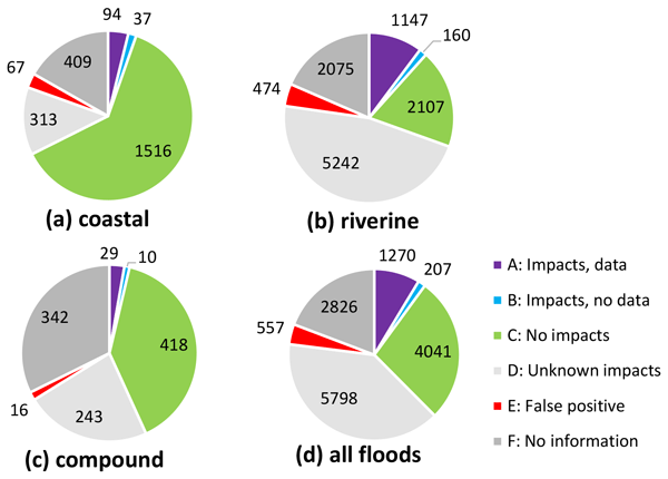
Long-term trends in flood losses are regulated by multiple factors, including climate variation, population and economic growth, land-use transitions, reservoir construction, and flood risk reduction measures. Here, we reconstruct the factual circumstances in which almost 15 000 potential riverine, coastal and compound floods in Europe occurred between 1950 and 2020. About 10 % of those events are reported to have caused significant socioeconomic impacts.
Viet Dung Nguyen, Jeroen Aerts, Max Tesselaar, Wouter Botzen, Heidi Kreibich, Lorenzo Alfieri, and Bruno Merz
Nat. Hazards Earth Syst. Sci., 24, 2923–2937, https://doi.org/10.5194/nhess-24-2923-2024, https://doi.org/10.5194/nhess-24-2923-2024, 2024
Short summary
Short summary
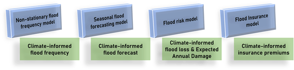
Our study explored how seasonal flood forecasts could enhance insurance premium accuracy. Insurers traditionally rely on historical data, yet climate fluctuations influence flood risk. We employed a method that predicts seasonal floods to adjust premiums accordingly. Our findings showed significant year-to-year variations in flood risk and premiums, underscoring the importance of adaptability. Despite limitations, this research aids insurers in preparing for evolving risks.
Seth Bryant, Heidi Kreibich, and Bruno Merz
Proc. IAHS, 386, 181–187, https://doi.org/10.5194/piahs-386-181-2024, https://doi.org/10.5194/piahs-386-181-2024, 2024
Short summary
Short summary
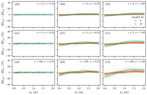
Our study found that simplifying data in flood risk models can introduce errors. We tested 344 damage functions and found errors up to 40 % of the total asset value. This means large-scale flood risk assessments may have significant errors due to the modelling approach. Our research highlights the need for more attention to data aggregation in flood risk models.
Seth Bryant, Guy Schumann, Heiko Apel, Heidi Kreibich, and Bruno Merz
Hydrol. Earth Syst. Sci., 28, 575–588, https://doi.org/10.5194/hess-28-575-2024, https://doi.org/10.5194/hess-28-575-2024, 2024
Short summary
Short summary
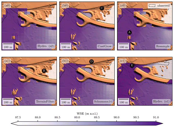
A new algorithm has been developed to quickly produce high-resolution flood maps. It is faster and more accurate than current methods and is available as open-source scripts. This can help communities better prepare for and mitigate flood damages without expensive modelling.
Benedikt Mester, Thomas Vogt, Seth Bryant, Christian Otto, Katja Frieler, and Jacob Schewe
Nat. Hazards Earth Syst. Sci., 23, 3467–3485, https://doi.org/10.5194/nhess-23-3467-2023, https://doi.org/10.5194/nhess-23-3467-2023, 2023
Short summary
Short summary
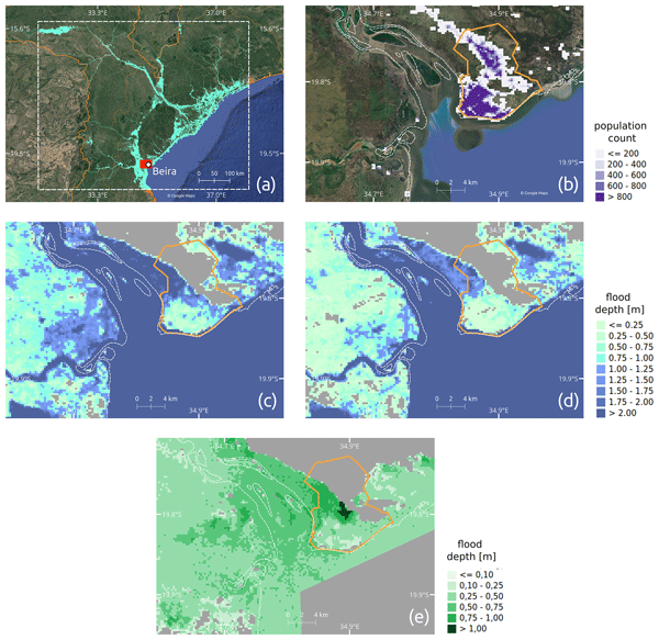
In 2019, Cyclone Idai displaced more than 478 000 people in Mozambique. In our study, we use coastal flood modeling and satellite imagery to construct a counterfactual cyclone event without the effects of climate change. We show that 12 600–14 900 displacements can be attributed to sea level rise and the intensification of storm wind speeds due to global warming. Our impact attribution study is the first one on human displacement and one of very few for a low-income country.
Heidi Kreibich, Kai Schröter, Giuliano Di Baldassarre, Anne F. Van Loon, Maurizio Mazzoleni, Guta Wakbulcho Abeshu, Svetlana Agafonova, Amir AghaKouchak, Hafzullah Aksoy, Camila Alvarez-Garreton, Blanca Aznar, Laila Balkhi, Marlies H. Barendrecht, Sylvain Biancamaria, Liduin Bos-Burgering, Chris Bradley, Yus Budiyono, Wouter Buytaert, Lucinda Capewell, Hayley Carlson, Yonca Cavus, Anaïs Couasnon, Gemma Coxon, Ioannis Daliakopoulos, Marleen C. de Ruiter, Claire Delus, Mathilde Erfurt, Giuseppe Esposito, Didier François, Frédéric Frappart, Jim Freer, Natalia Frolova, Animesh K. Gain, Manolis Grillakis, Jordi Oriol Grima, Diego A. Guzmán, Laurie S. Huning, Monica Ionita, Maxim Kharlamov, Dao Nguyen Khoi, Natalie Kieboom, Maria Kireeva, Aristeidis Koutroulis, Waldo Lavado-Casimiro, Hong-Yi Li, Maria Carmen LLasat, David Macdonald, Johanna Mård, Hannah Mathew-Richards, Andrew McKenzie, Alfonso Mejia, Eduardo Mario Mendiondo, Marjolein Mens, Shifteh Mobini, Guilherme Samprogna Mohor, Viorica Nagavciuc, Thanh Ngo-Duc, Huynh Thi Thao Nguyen, Pham Thi Thao Nhi, Olga Petrucci, Nguyen Hong Quan, Pere Quintana-Seguí, Saman Razavi, Elena Ridolfi, Jannik Riegel, Md Shibly Sadik, Nivedita Sairam, Elisa Savelli, Alexey Sazonov, Sanjib Sharma, Johanna Sörensen, Felipe Augusto Arguello Souza, Kerstin Stahl, Max Steinhausen, Michael Stoelzle, Wiwiana Szalińska, Qiuhong Tang, Fuqiang Tian, Tamara Tokarczyk, Carolina Tovar, Thi Van Thu Tran, Marjolein H. J. van Huijgevoort, Michelle T. H. van Vliet, Sergiy Vorogushyn, Thorsten Wagener, Yueling Wang, Doris E. Wendt, Elliot Wickham, Long Yang, Mauricio Zambrano-Bigiarini, and Philip J. Ward
Earth Syst. Sci. Data, 15, 2009–2023, https://doi.org/10.5194/essd-15-2009-2023, https://doi.org/10.5194/essd-15-2009-2023, 2023
Short summary
Short summary
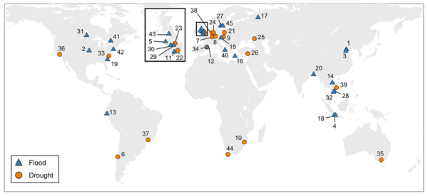
As the adverse impacts of hydrological extremes increase in many regions of the world, a better understanding of the drivers of changes in risk and impacts is essential for effective flood and drought risk management. We present a dataset containing data of paired events, i.e. two floods or two droughts that occurred in the same area. The dataset enables comparative analyses and allows detailed context-specific assessments. Additionally, it supports the testing of socio-hydrological models.

Patrick Ludwig, Florian Ehmele, Mário J. Franca, Susanna Mohr, Alberto Caldas-Alvarez, James E. Daniell, Uwe Ehret, Hendrik Feldmann, Marie Hundhausen, Peter Knippertz, Katharina Küpfer, Michael Kunz, Bernhard Mühr, Joaquim G. Pinto, Julian Quinting, Andreas M. Schäfer, Frank Seidel, and Christina Wisotzky
Nat. Hazards Earth Syst. Sci., 23, 1287–1311, https://doi.org/10.5194/nhess-23-1287-2023, https://doi.org/10.5194/nhess-23-1287-2023, 2023
Short summary
Short summary
Heavy precipitation in July 2021 led to widespread floods in western Germany and neighboring countries. The event was among the five heaviest precipitation events of the past 70 years in Germany, and the river discharges exceeded by far the statistical 100-year return values. Simulations of the event under future climate conditions revealed a strong and non-linear effect on flood peaks: for +2 K global warming, an 18 % increase in rainfall led to a 39 % increase of the flood peak in the Ahr river.
Thulasi Vishwanath Harish, Nivedita Sairam, Liang Emlyn Yang, Matthias Garschagen, and Heidi Kreibich
Nat. Hazards Earth Syst. Sci., 23, 1125–1138, https://doi.org/10.5194/nhess-23-1125-2023, https://doi.org/10.5194/nhess-23-1125-2023, 2023
Short summary
Short summary
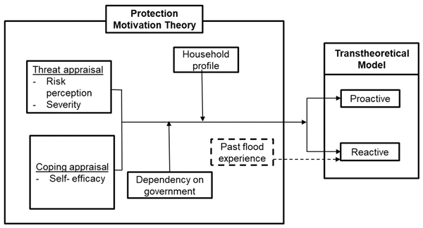
Coastal Asian cities are becoming more vulnerable to flooding. In this study we analyse the data collected from flood-prone houses in Ho Chi Minh City to identify what motivates the households to adopt flood precautionary measures. The results revealed that educating the households about the available flood precautionary measures and communicating the flood protection measures taken by the government encourage the households to adopt measures without having to experience multiple flood events.
Susanna Mohr, Uwe Ehret, Michael Kunz, Patrick Ludwig, Alberto Caldas-Alvarez, James E. Daniell, Florian Ehmele, Hendrik Feldmann, Mário J. Franca, Christian Gattke, Marie Hundhausen, Peter Knippertz, Katharina Küpfer, Bernhard Mühr, Joaquim G. Pinto, Julian Quinting, Andreas M. Schäfer, Marc Scheibel, Frank Seidel, and Christina Wisotzky
Nat. Hazards Earth Syst. Sci., 23, 525–551, https://doi.org/10.5194/nhess-23-525-2023, https://doi.org/10.5194/nhess-23-525-2023, 2023
Short summary
Short summary
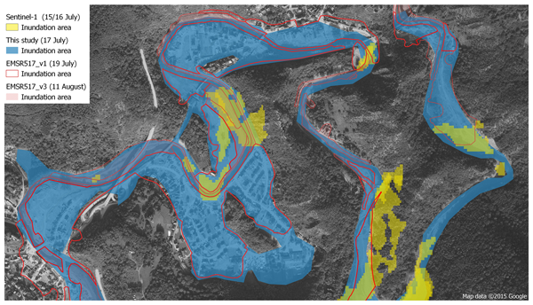
The flood event in July 2021 was one of the most severe disasters in Europe in the last half century. The objective of this two-part study is a multi-disciplinary assessment that examines the complex process interactions in different compartments, from meteorology to hydrological conditions to hydro-morphological processes to impacts on assets and environment. In addition, we address the question of what measures are possible to generate added value to early response management.
Alberto Caldas-Alvarez, Markus Augenstein, Georgy Ayzel, Klemens Barfus, Ribu Cherian, Lisa Dillenardt, Felix Fauer, Hendrik Feldmann, Maik Heistermann, Alexia Karwat, Frank Kaspar, Heidi Kreibich, Etor Emanuel Lucio-Eceiza, Edmund P. Meredith, Susanna Mohr, Deborah Niermann, Stephan Pfahl, Florian Ruff, Henning W. Rust, Lukas Schoppa, Thomas Schwitalla, Stella Steidl, Annegret H. Thieken, Jordis S. Tradowsky, Volker Wulfmeyer, and Johannes Quaas
Nat. Hazards Earth Syst. Sci., 22, 3701–3724, https://doi.org/10.5194/nhess-22-3701-2022, https://doi.org/10.5194/nhess-22-3701-2022, 2022
Short summary
Short summary
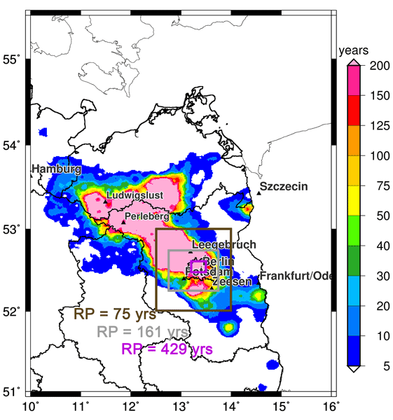
In a warming climate, extreme precipitation events are becoming more frequent. To advance our knowledge on such phenomena, we present a multidisciplinary analysis of a selected case study that took place on 29 June 2017 in the Berlin metropolitan area. Our analysis provides evidence of the extremeness of the case from the atmospheric and the impacts perspectives as well as new insights on the physical mechanisms of the event at the meteorological and climate scales.
Brunella Bonaccorso, Carmelo Cammalleri, Athanasios Loukas, and Heidi Kreibich
Nat. Hazards Earth Syst. Sci., 22, 1857–1862, https://doi.org/10.5194/nhess-22-1857-2022, https://doi.org/10.5194/nhess-22-1857-2022, 2022
Philip J. Ward, James Daniell, Melanie Duncan, Anna Dunne, Cédric Hananel, Stefan Hochrainer-Stigler, Annegien Tijssen, Silvia Torresan, Roxana Ciurean, Joel C. Gill, Jana Sillmann, Anaïs Couasnon, Elco Koks, Noemi Padrón-Fumero, Sharon Tatman, Marianne Tronstad Lund, Adewole Adesiyun, Jeroen C. J. H. Aerts, Alexander Alabaster, Bernard Bulder, Carlos Campillo Torres, Andrea Critto, Raúl Hernández-Martín, Marta Machado, Jaroslav Mysiak, Rene Orth, Irene Palomino Antolín, Eva-Cristina Petrescu, Markus Reichstein, Timothy Tiggeloven, Anne F. Van Loon, Hung Vuong Pham, and Marleen C. de Ruiter
Nat. Hazards Earth Syst. Sci., 22, 1487–1497, https://doi.org/10.5194/nhess-22-1487-2022, https://doi.org/10.5194/nhess-22-1487-2022, 2022
Short summary
Short summary
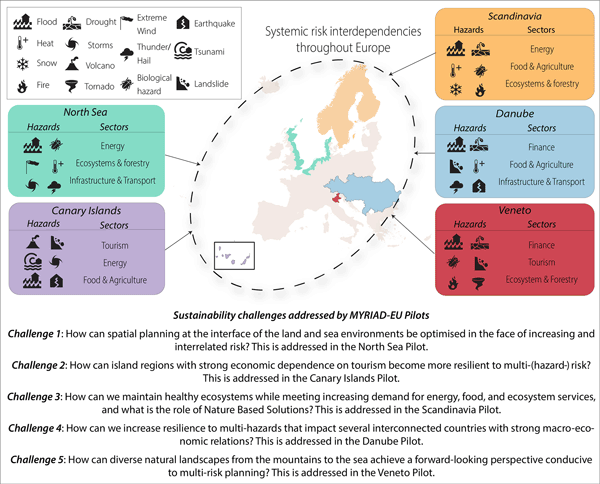
The majority of natural-hazard risk research focuses on single hazards (a flood, a drought, a volcanic eruption, an earthquake, etc.). In the international research and policy community it is recognised that risk management could benefit from a more systemic approach. In this perspective paper, we argue for an approach that addresses multi-hazard, multi-risk management through the lens of sustainability challenges that cut across sectors, regions, and hazards.
Seth Bryant, Heather McGrath, and Mathieu Boudreault
Nat. Hazards Earth Syst. Sci., 22, 1437–1450, https://doi.org/10.5194/nhess-22-1437-2022, https://doi.org/10.5194/nhess-22-1437-2022, 2022
Short summary
Short summary
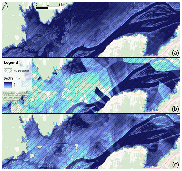
The advent of new satellite technologies improves our ability to study floods. While the depth of water at flooded buildings is generally the most important variable for flood researchers, extracting this accurately from satellite data is challenging. The software tool presented here accomplishes this, and tests show the tool is more accurate than competing tools. This achievement unlocks more detailed studies of past floods and improves our ability to plan for and mitigate disasters.
Animesh K. Gain, Yves Bühler, Pascal Haegeli, Daniela Molinari, Mario Parise, David J. Peres, Joaquim G. Pinto, Kai Schröter, Ricardo M. Trigo, María Carmen Llasat, and Heidi Kreibich
Nat. Hazards Earth Syst. Sci., 22, 985–993, https://doi.org/10.5194/nhess-22-985-2022, https://doi.org/10.5194/nhess-22-985-2022, 2022
Short summary
Short summary
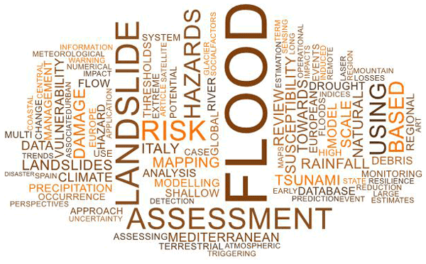
To mark the 20th anniversary of Natural Hazards and Earth System Sciences (NHESS), an interdisciplinary and international journal dedicated to the public discussion and open-access publication of high-quality studies and original research on natural hazards and their consequences, we highlight 11 key publications covering major subject areas of NHESS that stood out within the past 20 years.
Annegret H. Thieken, Guilherme Samprogna Mohor, Heidi Kreibich, and Meike Müller
Nat. Hazards Earth Syst. Sci., 22, 165–185, https://doi.org/10.5194/nhess-22-165-2022, https://doi.org/10.5194/nhess-22-165-2022, 2022
Short summary
Short summary
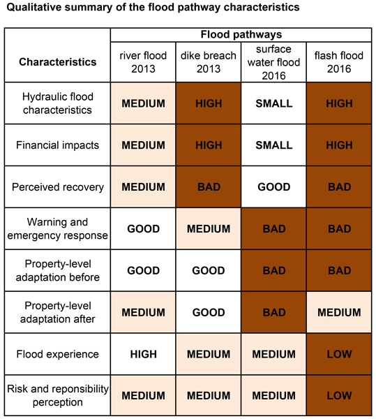
Various floods hit Germany recently. While there was a river flood with some dike breaches in 2013, flooding in 2016 resulted directly from heavy rainfall, causing overflowing drainage systems in urban areas and destructive flash floods in steep catchments. Based on survey data, we analysed how residents coped with these different floods. We observed significantly different flood impacts, warnings, behaviour and recovery, offering entry points for tailored risk communication and support.
Valeria Cigala, Giulia Roder, and Heidi Kreibich
Nat. Hazards Earth Syst. Sci., 22, 85–96, https://doi.org/10.5194/nhess-22-85-2022, https://doi.org/10.5194/nhess-22-85-2022, 2022
Short summary
Short summary
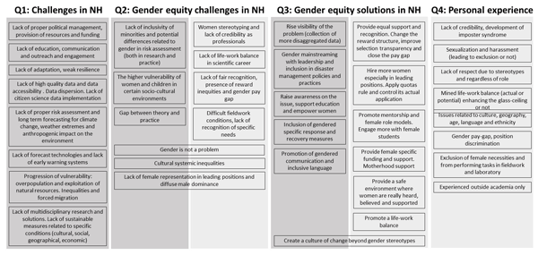
Non-male scientists constitute a minority in the geoscience professional environment, and they are underrepresented in disaster risk reduction planning. So far the international agenda has failed to effectively promote gender inclusion in disaster policy, preventing non-male scientists from career development and recognition. Here we share the thoughts, experiences, and priorities of women and non-binary scientists as a starting point to expand the discourse and promote intersectional research.
Cited articles
AdV: ALKIS: Amtliches Liegenschaftskatasterinformationssystem, adV stands for: Arbeitsgemeinschaft der Vermessungsverwaltungen der Länder der Bundesrepublik Deutschland, Managed by the German cadastral authorities, Data was not accessed directly for this study, https://www.adv-online.de (last access: 31 August 2026), 2023. a
Apel, H., Vorogushyn, S., and Merz, B.: Brief communication: Impact forecasting could substantially improve the emergency management of deadly floods: case study July 2021 floods in Germany, Nat. Hazards Earth Syst. Sci., 22, 3005–3014, https://doi.org/10.5194/nhess-22-3005-2022, 2022. a
Arbeitskreis Volkswirtschaftliche Gesamtrechnungen der Länder: Methodenbeschreibung ESVG 2010/Revision 2019: Volkswirtschaftliche Gesamtrechnungen Der Länder [Method Description ESA 2010/Revision 2019: National Accounts of the Länder], Tech. rep., Statistisches Landesamt Baden-Württemberg, Stuttgart, https://www.statistikportal.de/de/vgrdl/methoden-und-informationen (last access: 31 August 2026), 2021. a
Arbeitskreis Volkswirtschaftliche Gesamtrechnungen der Länder: Anlagevermögen in Den Ländern Der Bundesrepublik Deutschland 1991 Bis 2020, https://www.statistikportal.de/de/vgrdl/ergebnisse-laenderebene/investitionen-anlagevermoegen#alle-ergebnisse (last access: 31 May 2024), 2023. a
Bundesamt für Kartographie und Geodäsie (BKG): NUTS-Gebiete 1:5 000 000, Stand 31.12. (NUTS5000 31.12.), https://gdz.bkg.bund.de/index.php/default/digitale-geodaten/verwaltungsgebiete/nuts-gebiete-1-5-000-000-stand-31-12-nuts5000-31-12.html (last access: 22 January 2024), 2024. a
Brühl, G.: Ahrtal: Siebzig Hochwasser in fünfhundert Jahren, GRAF BRÜHL Onlinemagazin, https://grafbruehl.com/magazin/ahrtal-hochwasser-chroniken/ (last access: 16 January 2025), 2025. a
Bryant, S., Kreibich, H., and Merz, B.: Bias in Flood Hazard Grid Aggregation, Water Resour. Res., 59, e2023WR035100, https://doi.org/10.1029/2023WR035100, 2023. a, b
Bryant, S., Reimer, J., Kreibich, H., and Merz, B.: Aggregating Flood Damage Functions: The Peril of Jensen's Gap, J. Flood Risk Manag., 18, e13053, https://doi.org/10.1111/jfr3.13053, 2025. a, b
Buhrmann, A.: Geometry data for “Building-level exposed asset values for Germany”, Zenodo [data set], https://doi.org/10.5281/zenodo.17249978, 2025a. a, b
Buhrmann, A.: Sanitized data for “Building-level exposed asset values for Germany”, Zenodo [data set], https://doi.org/10.5281/zenodo.20598311, 2025b. a, b, c
Buhrmann, A.: Software for Exposure modelling for Ahrweiler, Zenodo [code], https://doi.org/10.5281/zenodo.17350703, 2025c. a
Buhrmann, A.: EGUSPHERE-2025-5172: Supplementary Data Table 1, Zenodo [data set], https://doi.org/10.5281/zenodo.20633867, 2026. a
Corbane, C., Florczyk, A., Pesaresi, M., Politis, P., and Syrris, V.: GHS Built-up Grid, Derived from Landsat, multitemporal (1975–1990–2000–2014), European Commission, Joint Research Centre (JRC), R2018A, https://doi.org/10.2905/JRC-GHSL-10007, 2018. a
Crichton, D.: The Risk Triangle, Natural disaster management, 102, 102–103, 1999. a
Crowley, H., Despotaki, V., Rodrigues, D., Silva, V., Toma-Danila, D., Riga, E., Karatzetzou, A., Fotopoulou, S., Zugic, Z., Sousa, L., Ozcebe, S., and Gamba, P.: Exposure Model for European Seismic Risk Assessment, Earthq. Spectra, 36, 252–273, https://doi.org/10.1177/8755293020919429, 2020. a, b
Crowley, H., Dabbeek, J., Despotaki, V., Rodrigues, D., Martins, L., Silva, V., Romão, X., Pereira, N., Weatherill, G., and Danciu, L.: European Seismic Risk Model (ESRM20), Eucentre, IT, https://doi.org/10.7414/EUC-EFEHR-TR002-ESRM20, 2021. a, b
Custer, R. and Nishijima, K.: Probabilistic Disaggregation of a Spatial Portfolio of Exposure for Natural Hazard Risk Assessment, Georisk: Assessment and Management of Risk for Engineered Systems and Geohazards, 12, 1–13, https://doi.org/10.1080/17499518.2017.1371761, 2018. a
Dabbeek, J., Crowley, H., Silva, V., Weatherill, G., Paul, N., and Nievas, C. I.: Impact of Exposure Spatial Resolution on Seismic Loss Estimates in Regional Portfolios, B. Earthq. Eng., 19, 5819–5841, https://doi.org/10.1007/s10518-021-01194-x, 2021. a, b
Daniell, J.: Development of socio-economic fragility functions for use in worldwide rapid earthquake loss estimation procedures, PhD thesis, Karlsruher Institut für Technologie, https://publikationen.bibliothek.kit.edu/1000045149 (last access: 31 August 2026), 2014. a
European Commission: NACE Rev. 2: Statistical Classification of Economic Activities in the European Community, Publications Office of the European Union, Luxembourg, ISBN 978-92-79-04741-1, 2008. a
European Commission, Statistical Office of the European Union: Manual on Regional Accounts Methods, Publications Office of the European Union, Luxembourg, ISBN 978-92-79-32356-0, https://doi.org/10.2785/33649, 2013. a
European Union: Regulation (EU) 2016/679 of the European Parliament and of the Council of 27 April 2016 on the protection of natural persons with regard to the processing of personal data and on the free movement of such data, and repealing Directive 95/46/EC (General Data Protection Regulation), Official Journal of the European Union, L 119, 1–88, https://eur-lex.europa.eu/eli/reg/2016/679/oj (last access: 31 August 2026), 2016. a
Eurostat: European System of Accounts:ESA 2010, Publications Office, LU, https://data.europa.eu/doi/10.2785/16644 (last access: 4 August 2025), 2013. a
Figueiredo, R. and Martina, M.: Using open building data in the development of exposure data sets for catastrophe risk modelling, Nat. Hazards Earth Syst. Sci., 16, 417–429, https://doi.org/10.5194/nhess-16-417-2016, 2016. a, b, c
Gerl, T., Kreibich, H., Franco, G., Marechal, D., and Schröter, K.: A Review of Flood Loss Models as Basis for Harmonization and Benchmarking, PLOS ONE, 11, e0159791, https://doi.org/10.1371/journal.pone.0159791, 2016. a, b, c, d
GFZ Helmholtz Centre for Geosciences: OpenBuildingMap, https://www.openbuildingmap.org/ (last access: 24 May 2024), 2024. a
Gomez-Zapata, J. C., Brinckmann, N., Harig, S., Zafrir, R., Pittore, M., Cotton, F., and Babeyko, A.: Variable-resolution building exposure modelling for earthquake and tsunami scenario-based risk assessment: an application case in Lima, Peru, Nat. Hazards Earth Syst. Sci., 21, 3599–3628, https://doi.org/10.5194/nhess-21-3599-2021, 2021. a
Gómez Zapata, J. C., Pittore, M., Cotton, F., Lilienkamp, H., Shinde, S., Aguirre, P., and Santa María, H.: Epistemic Uncertainty of Probabilistic Building Exposure Compositions in Scenario-Based Earthquake Loss Models, B. Earthq. Eng., 20, 2401–2438, https://doi.org/10.1007/s10518-021-01312-9, 2022. a
Google: Google Search Engine, https://www.google.com (last access: 17 January 2025), 2025a. a
Google: Google Scholar, https://scholar.google.com (last access: 17 January 2025), 2025b. a
Google, LLC.: Google Earth, https://www.google.com/intl/de_in/earth/ (last access: 28 May 2024), 2024a. a
Google, LLC.: Google Streetview, https://www.google.com/maps/ (last access: 28 May 2024), 2024b. a
Gouveia, F., Silva, V., Lopes, J., Moreira, R. S., Torres, J. M., and Simas Guerreiro, M.: Automated Identification of Building Features with Deep Learning for Risk Analysis, Discover Applied Sciences, 6, https://doi.org/10.1007/s42452-024-06070-2, 2024. a
Hall, J. W., Sayers, P. B., and Dawson, R. J.: National-Scale Assessment of Current and Future Flood Risk in England and Wales, Nat. Hazards, 36, 147–164, https://doi.org/10.1007/s11069-004-4546-7, 2005. a
IABG mbH and geomer GmbH: Germany BEAM Update – Final Report, Tech. rep., Copernicus, https://mapping.emergency.copernicus.eu/download/EMSN076/EMSN076_Final-Report_v1_20082025.pdf (last access: 31 August 2026), 2020. a
IABG mbH and geomer GmbH: Country-Wide Economic Asset Mapping for Germany, 2025 Update Technical Report, Tech. rep., Copernicus Emergency Management Service, https://riskandrecovery.emergency.copernicus.eu/EMSN223/?embed=true (last access: 21 April 2026), 2025. a
Immobilien Scout GmbH: ImmoScout24, https://www.immobilienscout24.de/ (last access: 28 May 2024), 2024. a
Kleist, L., Thieken, A. H., Köhler, P., Müller, M., Seifert, I., Borst, D., and Werner, U.: Estimation of the regional stock of residential buildings as a basis for a comparative risk assessment in Germany, Nat. Hazards Earth Syst. Sci., 6, 541–552, https://doi.org/10.5194/nhess-6-541-2006, 2006. a
Lehmkuhl, F., Schüttrumpf, H., Schwarzbauer, J., Brüll, C., Dietze, M., Letmathe, P., Völker, C., and Hollert, H.: Assessment of the 2021 Summer Flood in Central Europe, Environmental Sciences Europe, 34, 107, s12302–022–00685–1, https://doi.org/10.1186/s12302-022-00685-1, 2022. a
McLennan, S., Celi, L. A., and Buyx, A.: COVID-19: Putting the General Data Protection Regulation to the Test, JMIR Public Health and Surveillance, 6, e19279, https://doi.org/10.2196/19279, 2020. a
Merz, B. and Thieken, A. H.: Flood Risk Analysis: Concepts and Challenges, Österreichische Wasser-und Abfallwirtschaft, 56, 27–34, 2004. a
Merz, B., Kreibich, H., Schwarze, R., and Thieken, A.: Review article “Assessment of economic flood damage”, Nat. Hazards Earth Syst. Sci., 10, 1697–1724, https://doi.org/10.5194/nhess-10-1697-2010, 2010. a, b
Messner, F., Penning-Rowsell, E., Green, C., Meyer, V., Tunstall, S., van der Veen, A., Tapsell, S., Krywkow, J., Logtmeijer, C., Fernández-Bilbao, A., Geurts, P., Haase, D., and Parker, D.: Evaluating Flood Damages: Guidance and Recommendations on Principles and Methods, Project Deliverable T09-06-01, FLOODsite Project, http://resolver.tudelft.nl/uuid:5602db10-274c-40da-953f-34475ded1755 (last access: 1 January 2026), 2007. a
Meta Platforms Ireland Limited: Mapillary, https://www.mapillary.com/ (last access: 28 May 2024), 2024. a
Molinari, D. and Scorzini, A. R.: On the Influence of Input Data Quality to Flood Damage Estimation: The Performance of the INSYDE Model, Water, 9, 688, https://doi.org/10.3390/w9090688, 2017. a, b
Molinari, D., Scorzini, A. R., Arrighi, C., Carisi, F., Castelli, F., Domeneghetti, A., Gallazzi, A., Galliani, M., Grelot, F., Kellermann, P., Kreibich, H., Mohor, G. S., Mosimann, M., Natho, S., Richert, C., Schroeter, K., Thieken, A. H., Zischg, A. P., and Ballio, F.: Are flood damage models converging to “reality”? Lessons learnt from a blind test, Nat. Hazards Earth Syst. Sci., 20, 2997–3017, https://doi.org/10.5194/nhess-20-2997-2020, 2020. a, b
Nievas, C.: EHRE data extract for Ahrweiler, Zenodo [data set], https://doi.org/10.5281/zenodo.17317039, 2025. a, b
Oostwegel, L. J. N., Schorlemmer, D., and Guéguen, P.: From Footprints to Functions: A Comprehensive Global and Semantic Building Footprint Dataset, Scientific Data, 12, 1699, https://doi.org/10.1038/s41597-025-06132-z, 2025. a
Paprotny, D.: Residential exposure to natural hazards in Europe, 2000–2020, Zenodo, https://doi.org/10.5281/zenodo.6573503, 2022. a, b, c, d
Paprotny, D.: Replacement Costs: Germany – Bryant.Seth@gmail.Com – Gmail [personal correspondence], 2025. a
Paprotny, D. and Mengel, M.: Population, Land Use and Economic Exposure Estimates for Europe at 100 m Resolution from 1870 to 2020, Scientific Data, 10, 372, https://doi.org/10.1038/s41597-023-02282-0, 2023. a
Paprotny, D., Kreibich, H., Morales-Nápoles, O., Castellarin, A., Carisi, F., and Schröter, K.: Exposure and Vulnerability Estimation for Modelling Flood Losses to Commercial Assets in Europe, Sci. Total Environ., 737, 140011, https://doi.org/10.1016/j.scitotenv.2020.140011, 2020a. a, b, c, d, e, f, g
Paprotny, D., Kreibich, H., Morales-Nápoles, O., Wagenaar, D., Castellarin, A., Carisi, F., Bertin, X., Merz, B., and Schröter, K.: A Probabilistic Approach to Estimating Residential Losses from Different Flood Types, Nat. Hazards, 105, 2569–2601, https://doi.org/10.1007/s11069-020-04413-x, 2021. a
Rözer, V., Kreibich, H., Schröter, K., Müller, M., Sairam, N., Doss-Gollin, J., Lall, U., and Merz, B.: Probabilistic Models Significantly Reduce Uncertainty in Hurricane Harvey Pluvial Flood Loss Estimates, Earth's Future, 7, 384–394, https://doi.org/10.1029/2018EF001074, 2019. a
Sairam, N., Brill, F., Sieg, T., Farrag, M., Kellermann, P., Nguyen, V. D., Lüdtke, S., Merz, B., Schröter, K., Vorogushyn, S., and Kreibich, H.: Process-Based Flood Risk Assessment for Germany, Earth's Future, 9, e2021EF002259, https://doi.org/10.1029/2021EF002259, 2021. a
Schmalwasser, D. O. and Schidlowski, M.: Measuring Capital Stock in Germany, Wirtschaft und Statistik, https://www.destatis.de/EN/Methods/WISTAScientificJournal/Downloads/capital-stock-germany-112006.html (last access: 1 January 2026), 2006. a
Schorlemmer, D., Beutin, T., Cotton, F., Garcia Ospina, N., Hirata, N., Ma, K.-F., Nievas, C., Prehn, K., and Wyss, M.: Global Dynamic Exposure and the OpenBuildingMap - A Big-Data and Crowd-Sourcing Approach to Exposure Modeling, EGU General Assembly 2020, Online, 4–8 May 2020, EGU2020-18920, https://doi.org/10.5194/egusphere-egu2020-18920, 2020. a
Schröter, K., Lüdtke, S., Redweik, R., Meier, J., Bochow, M., Ross, L., Nagel, C., and Kreibich, H.: Flood Loss Estimation Using 3D City Models and Remote Sensing Data, Environ. Modell. Softw., 105, 118–131, https://doi.org/10.1016/j.envsoft.2018.03.032, 2018. a
Seel, K. A.: Die Ahr Und Ihre Hochwässer in Alten Quellen, https://kreis-ahrweiler.de/kvar/VT/hjb1983/hjb1983.25.htm (last access: 16 January 2025), 2025. a
Sieg, T. and Thieken, A. H.: Improving Flood Impact Estimations, Environ. Res. Lett., 17, 064007, https://doi.org/10.1088/1748-9326/ac6d6c, 2022. a, b, c
Sieg, T., Kienzler, S., Rözer, V., Vogel, K., Rust, H., Bronstert, A., Kreibich, H., Merz, B., and Thieken, A. H.: Toward an Adequate Level of Detail in Flood Risk Assessments, J. Flood Risk Manag., 16, e12889, https://doi.org/10.1111/jfr3.12889, 2023. a
Silva, V., Brzev, S., Scawthorn, C., Yepes, C., Dabbeek, J., and Crowley, H.: A Building Classification System for Multi-hazard Risk Assessment, Int. J. Disast. Risk Sc., 13, 161–177, https://doi.org/10.1007/s13753-022-00400-x, 2022. a
Silva, V., Sousa, R., Ribeiro Gouveia, F., Lopes, J., and Guerreiro, M. J.: A Building Imagery Database for the Calibration of Machine Learning Algorithms, Earthq. Spectra, 40, 1577–1590, https://doi.org/10.1177/87552930241229103, 2024. a
Thieken, A. H., Müller, M., Kleist, L., Seifert, I., Borst, D., and Werner, U.: Regionalisation of asset values for risk analyses, Nat. Hazards Earth Syst. Sci., 6, 167–178, https://doi.org/10.5194/nhess-6-167-2006, 2006. a, b, c
Thieken, A. H., Olschewski, A., Kreibich, H., Kobsch, S., and Merz, B.: Development and Evaluation of FLEMOps – a New Flood Loss Estimation MOdel for the Private Sector, in: Flood Recovery, Innovation and Response I, WIT Press, London, England, vol. I, 315–324, ISBN 978-1-84564-132-0, 2008. a
Wagenaar, D., Lüdtke, S., Schröter, K., Bouwer, L. M., and Kreibich, H.: Regional and Temporal Transferability of Multi-Variable Flood Damage Models, Water Resour. Res., https://doi.org/10.1029/2017WR022233, 2018. a
Waldhof, J.: AdV Online – Kontaktformular [#483], E-mail message, mailto:zshh@ldbv.bayern.de, e-mail sent to B. Buhrmann (buhrmann@gfz.de); cc: Florian Siegert, Margret Bellenberg, and Gerfried Westenberg, 2025. a
Wieland, M., Pittore, M., Parolai, S., Begaliev, U., Yasunov, P., Tyagunov, S., Moldobekov, B., Saidiy, S., Ilyasov, I., and Abakanov, T.: A Multiscale Exposure Model for Seismic Risk Assessment in Central Asia, Seismol. Res. Lett., 86, 210–222, https://doi.org/10.1785/0220140130, 2015. a
Wu, J., Li, Y., Li, N., and Shi, P.: Development of an Asset Value Map for Disaster Risk Assessment in China by Spatial Disaggregation Using Ancillary Remote Sensing Data, Risk Anal., 38, 17–30, https://doi.org/10.1111/risa.12806, 2018. a, b
Wu, J., Ye, M., Wang, X., and Koks, E.: Building Asset Value Mapping in Support of Flood Risk Assessments: A Case Study of Shanghai, China, Sustainability, 11, 971, https://doi.org/10.3390/su11040971, 2019. a
Wünsch, A., Herrmann, U., Kreibich, H., and Thieken, A. H.: The Role of Disaggregation of Asset Values in Flood Loss Estimation: A Comparison of Different Modeling Approaches at the Mulde River, Germany, Environ. Manage., 44, 524–541, https://doi.org/10.1007/s00267-009-9335-3, 2009. a, b, c
Zionts, S.: A Multiple Criteria Method for Choosing among Discrete Alternatives, Eur. J. Oper. Res., 7, 143–147, https://doi.org/10.1016/0377-2217(81)90275-7, 1981. a
Short summary
Our research lays the groundwork for the next generation of disaster risk modelling by improving how building-level value and use are estimated across Germany. By testing multiple data sources and methods, we identify a transparent, adaptable approach that enhances forecasts of damage and recovery – helping to protect lives, property, and communities.
Our research lays the groundwork for the next generation of disaster risk modelling by improving...


Altmetrics
Final-revised paper
Preprint