
Articles | Volume 26, issue 3
https://doi.org/10.5194/nhess-26-1573-2026
© Author(s) 2026. This work is distributed under
the Creative Commons Attribution 4.0 License.
the Creative Commons Attribution 4.0 License.
https://doi.org/10.5194/nhess-26-1573-2026
© Author(s) 2026. This work is distributed under
the Creative Commons Attribution 4.0 License.
the Creative Commons Attribution 4.0 License.
Research article
| 
31 Mar 2026
Research article |
| 31 Mar 2026
| 31 Mar 2026
Development and validation of an Early Warning System for coastal flooding operating on a Mediterranean urban beach
Antonis Chatzipavlis
CORRESPONDING AUTHOR

Department of Physics and Earth Sciences, University of Ferrara, Via Saragat 1, Ferrara, 44122, Italy
Daniele Trogu
Department of Chemical and Geological Sciences, University of Cagliari, Monserrato, 09042, Italy
Andrea Ruju
Department of Meteorology and Climatology, Regional Agency for Environmental Protection, Sassari, 07100, Italy
Juan Montes
Earth Sciences Department, University of Cadiz INMAR, Avda. República Saharaui s/n, Puerto Real, 11510, Spain
Antonio Usai
Department of Chemical and Geological Sciences, University of Cagliari, Monserrato, 09042, Italy
Marco Porta
Department of Chemical and Geological Sciences, University of Cagliari, Monserrato, 09042, Italy
Giovanni Coco
Institut de Ciències del Mar, CSIC, Barcelona, 08003, Spain
Sandro De Muro
Department of Chemical and Geological Sciences, University of Cagliari, Monserrato, 09042, Italy
Paolo Ciavola
Department of Physics and Earth Sciences, University of Ferrara, Via Saragat 1, Ferrara, 44122, Italy
CNR-IAS Oristano, Institute for Study of Anthropogenic Impacts and Sustainability in Marine Environment, Torregrande, 09072, Italy
Related authors
No articles found.
Marco Luppichini, Francesco Comiti, Andrea Andreoli, Barbara Aldighieri, Paolo Billi, Irene Maria Bollati, Andrea Brenna, Diletta Chirici, Paolo Ciavola, Silvia Cilli, Marco Donnini, Simona Francalanci, Lorenzo Innocenti, Laura Longoni, Luca Mao, Ivan Marchesini, Ilenia Murgia, Giacomo Pellegrini, Daniele Penna, Lorenzo Picco, Riccardo Rainato, Leonardo Schippa, Luca Solari, Gianluca Tronti, Bruno Testa, Matteo Verdone, and Monica Bini
Earth Syst. Sci. Data, 18, 7021–7041, https://doi.org/10.5194/essd-18-7021-2026, https://doi.org/10.5194/essd-18-7021-2026, 2026
Short summary
Short summary
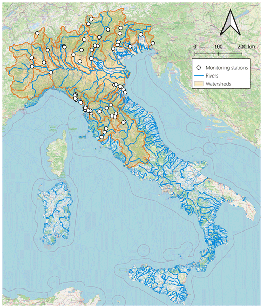
Rivers carry sediment that shapes landscapes and coasts, but in Italy these data are scattered and often incomplete. We created a national database and online platform to gather and organize past and present sediment measurements in one place. By linking data with clear information about where, when, and how they were collected, we made them easier to explore and compare over time.
Paola Emilia Souto-Ceccon, Juan Montes, Enrico Duo, Paolo Ciavola, Tomás Fernández-Montblanc, and Clara Armaroli
Earth Syst. Sci. Data, 17, 1041–1054, https://doi.org/10.5194/essd-17-1041-2025, https://doi.org/10.5194/essd-17-1041-2025, 2025
Short summary
Short summary
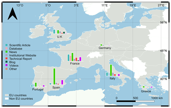
This dataset supports the growing need for information on coastal storm impacts. It covers different European countries and is an open-access tool that can be exploited, updated, or complemented by different users and for different purposes. Via labelling with unique identifiers, the database allows for a quick and consistent retrieval of all of the resources associated with a storm event. The adopted approach can be easily exported to all European countries and beyond.
Enrico Duo, Juan Montes, Marine Le Gal, Tomás Fernández-Montblanc, Paolo Ciavola, and Clara Armaroli
Nat. Hazards Earth Syst. Sci., 25, 13–39, https://doi.org/10.5194/nhess-25-13-2025, https://doi.org/10.5194/nhess-25-13-2025, 2025
Short summary
Short summary
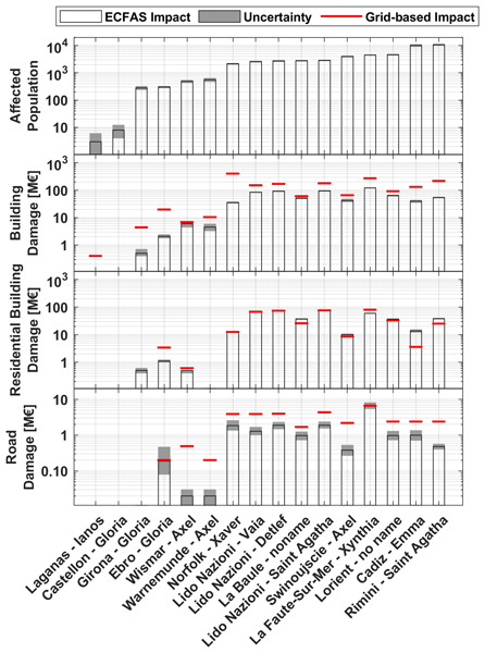
The present work, developed within the EU H2020 European Coastal Flood Awareness System (ECFAS) project, presents an approach used to estimate direct impacts of coastal flood on population, buildings, and roads along European coasts. The findings demonstrate that the ECFAS impact approach offers valuable estimates for affected populations, reliable damage assessments for buildings and roads, and improved accuracy compared to traditional grid-based approaches.
Marine Le Gal, Tomás Fernández-Montblanc, Enrico Duo, Juan Montes Perez, Paulo Cabrita, Paola Souto Ceccon, Véra Gastal, Paolo Ciavola, and Clara Armaroli
Nat. Hazards Earth Syst. Sci., 23, 3585–3602, https://doi.org/10.5194/nhess-23-3585-2023, https://doi.org/10.5194/nhess-23-3585-2023, 2023
Short summary
Short summary
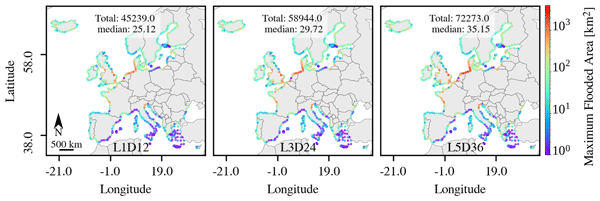
Assessing coastal hazards is crucial to mitigate flooding disasters. In this regard, coastal flood databases are valuable tools. This paper describes a new coastal flood map catalogue covering the entire European coastline, as well as the methodology to build it and its accuracy. The catalogue focuses on frequent extreme events and relies on synthetic scenarios estimated from local storm conditions. Flood-prone areas and regions sensitive to storm duration and water level peak were identified.
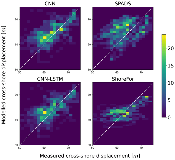
Eduardo Gomez-de la Peña, Giovanni Coco, Colin Whittaker, and Jennifer Montaño
Earth Surf. Dynam., 11, 1145–1160, https://doi.org/10.5194/esurf-11-1145-2023, https://doi.org/10.5194/esurf-11-1145-2023, 2023
Short summary
Short summary
Predicting how shorelines change over time is a major challenge in coastal research. We here have turned to deep learning (DL), a data-driven modelling approach, to predict the movement of shorelines using observations from a camera system in New Zealand. The DL models here implemented succeeded in capturing the variability and distribution of the observed shoreline data. Overall, these findings indicate that DL has the potential to enhance the accuracy of current shoreline change predictions.
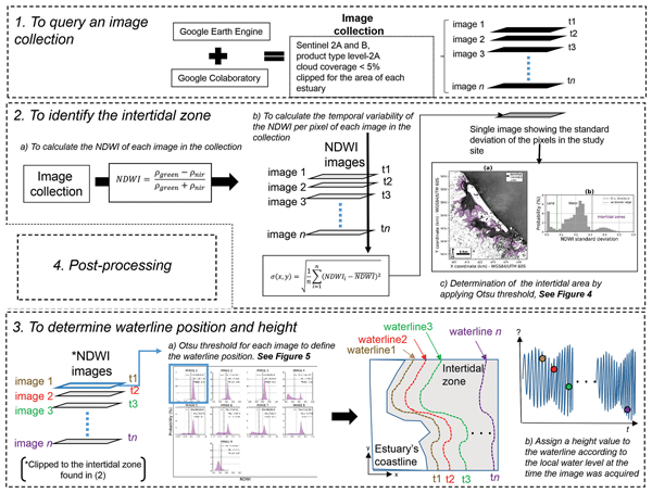
Wagner L. L. Costa, Karin R. Bryan, and Giovanni Coco
Nat. Hazards Earth Syst. Sci., 23, 3125–3146, https://doi.org/10.5194/nhess-23-3125-2023, https://doi.org/10.5194/nhess-23-3125-2023, 2023
Short summary
Short summary
For predicting flooding events at the coast, topo-bathymetric data are essential. However, elevation data can be unavailable. To tackle this issue, recent efforts have centred on the use of satellite-derived topography (SDT) and bathymetry (SDB). This work is aimed at evaluating their accuracy and use for flooding prediction in enclosed estuaries. Results show that the use of SDT and SDB in numerical modelling can produce similar predictions when compared to the surveyed elevation data.
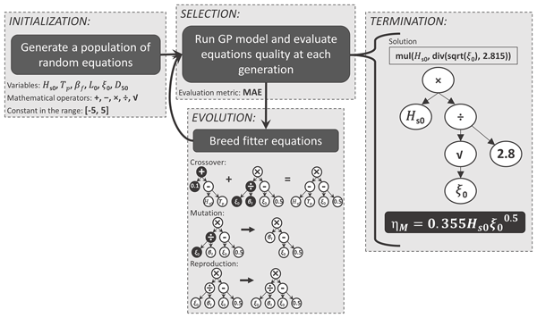
Charline Dalinghaus, Giovanni Coco, and Pablo Higuera
Nat. Hazards Earth Syst. Sci., 23, 2157–2169, https://doi.org/10.5194/nhess-23-2157-2023, https://doi.org/10.5194/nhess-23-2157-2023, 2023
Short summary
Short summary
Wave setup is a critical component of coastal flooding. Consequently, understanding and being able to predict wave setup is vital to protect coastal resources and the population living near the shore. Here, we applied machine learning to improve the accuracy of present predictors of wave setup. The results show that the new predictors outperform existing formulas demonstrating the capability of machine learning models to provide a physically sound description of wave setup.
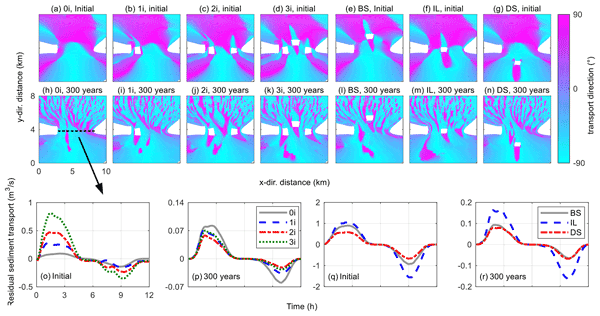
Yizhang Wei, Yining Chen, Jufei Qiu, Zeng Zhou, Peng Yao, Qin Jiang, Zheng Gong, Giovanni Coco, Ian Townend, and Changkuan Zhang
Earth Surf. Dynam., 10, 65–80, https://doi.org/10.5194/esurf-10-65-2022, https://doi.org/10.5194/esurf-10-65-2022, 2022
Short summary
Short summary
The barrier tidal basin is increasingly altered by human activity and sea-level rise. These environmental changes probably lead to the emergence or disappearance of islands, yet the effect of rocky islands on the evolution of tidal basins remains poorly investigated. Using numerical experiments, we explore the evolution of tidal basins under varying numbers and locations of islands. This work provides insights for predicting the response of barrier tidal basins in a changing environment.
Cited articles
Almar, R., Ranasinghe, R., Bergsma, E. W. J., Diaz, H., Melet, A., Papa, F., Vousdoukas, M., Athanasiou, P., Dada, O., Almeida, L. P., and Kestenare, E.: A global analysis of extreme coastal water levels with implications for potential coastal overtopping, Nat. Commun., 12, 1–9, https://doi.org/10.1038/s41467-021-24008-9, 2021.
Alday, M., Ardhuin, F., Dodet, G., and Accensi, M.: Accuracy of numerical wave model results: application to the Atlantic coasts of Europe, Ocean Sci., 18, 1665–1689, https://doi.org/10.5194/os-18-1665-2022, 2022.
Aniskiewicz, P., Benedyczak, R., Furmanczyk, K., and Andrzejewski, P.: Validation of Empirical Wave Run-up Formulas to the Polish Baltic Sea Coast, J. Coastal Res., 75, 10075, 243–247, https://doi.org/10.2112/SI75-049.1, 2016.
Ardhuin, F., Rogers, E., Babanin, A. V., Filipot, J. F., Magne, R., Roland, A., Van der Westhuysen, A., Queffeulou, P., Lefevre, J. M., Aouf, L., and Collard, F.: Semiempirical dissipation source functions for wind-wave models: Part I, definition, calibration, and validation, J. Phys. Oceanogr., 51, 2131–2150, https://doi.org/10.1175/2010JPO4324.1, 2009.
Armaroli, C., Ciavola, P., Perini, L., Calabrese, L., Lorito, S., Valentini, A., and Masina, M.: Critical storm thresholds for significant morphological changes and damage along the Emilia-Romagna coastline, Italy, Geomorphology, 143–144, 34–51, https://doi.org/10.1016/j.geomorph.2011.09.006, 2012.
Asariotis, R., Monioudi, I. N., Mohos Naray, V., Velegrakis, A. F., Vousdoukas, M. I., Mentaschi, L., and Feyen, L.: Climate change and seaports: hazards, impacts and policies and legislation for adaptation, Anthropocene Coasts, 7, 14, https://doi.org/10.1007/s44218-024-00047-9, 2024.
Athanassiou, P., van Dongeren, A. P., Giardino, A., Vousdoukas, M., Antolinez, J. A. A., and Ranasinghe, R.: A Clustering Approach for Predicting Dune Morphodynamic Response to Storms Using Typological Coastal Profiles: A Case Study at the Dutch Coast, Front. Mar. Sci., 8, 747754, https://doi.org/10.3389/fmars.2021.747754, 2021.
Atkinson, A. L., Power, H. E., Moura, T., Hammond, T., Callaghan, D. P., and Baldock, T. E.: Assessment of runup predictions by empirical models on non-truncated beaches on the south-east Australian coast, Coast. Eng., 119, 15–31, https://doi.org/10.1016/j.coastaleng.2016.10.001, 2017.
Bajo, M. and Umgiesser, G.: Storm surge forecast through a combination of dynamic and neural network models, Ocean Model., 33, 1–9, https://doi.org/10.1016/j.ocemod.2009.12.007, 2010.
Bakkensen, L. A. and Barrage, L.: Flood risk belief heterogeneity and coastal home price dynamics: Going under water?, National Bureau of Economic Research (NBER), Working Paper 23854, 30 pp., https://doi.org/10.3386/w23854, 2021.
Biolchi, L. G., Unguendoli, S., Bressan, L., Giambastiani, B. M. S., and Valentini, A.: Ensemble technique application to an XBeach-based coastal Early Warning System for the Northwest Adriatic Sea (Emilia-Romagna region, Italy), Coast. Eng., 173, 104081, https://doi.org/10.1016/j.coastaleng.2022.104081, 2022.
Biondo, M., Buosi, C., Trogu, D., Mansfield, H., Vacchi, M., Ibba, A., Porta, M., Ruju, A., and De Muro, S.: Natural vs. Anthropic Influence on the Multidecadal Shoreline Changes of Mediterranean Urban Beaches: Lessons from the Gulf of Cagliari (Sardinia), Water, 12, 3578, https://doi.org/10.3390/w12123578, 2020.
Bujak, D., Ilic, S., Miličević, H., and Carević, D.: Wave Runup Prediction and Alongshore Variability on a Pocket Gravel Beach under Fetch-Limited Wave Conditions, J. Mar. Sci. Eng., 11, 614, https://doi.org/10.3390/jmse11030614, 2023.
Cabrita, P., Montes, J., Duo, E., Brunetta, R., and Ciavola, P.: The Role of Different Total Water Level Definitions in Coastal Flood Modelling on a Low-Elevation Dune System, J. Mar. Sci. Eng., 12, 1003, https://doi.org/10.3390/jmse12061003, 2024.
Caruso, M. F. and Marani, M.: Extreme-coastal-water-level estimation and projection: a comparison of statistical methods, Nat. Hazards Earth Syst. Sci., 22, 1109–1128, https://doi.org/10.5194/nhess-22-1109-2022, 2022.
Cavaleri, L., Balsamo, G., Beljaars, A., Bertotti, L., Davison, S., Edwards, J., Kanehama, T., and Wedi, N.: ECMWF and UK Met Office Offshore Blowing Winds: Impact of Horizontal Resolution and Coastal Orography, J. Geophys. Res.-Atmos., 129, 14 pp., https://doi.org/10.1029/2023JD039673, 2024.
Chao, W. T., Young, C. C., Hsu, T. W., Liu, W. C., and Liu, C. Y.: Long-lead-time prediction of storm surge using artificial neural networks and effective typhoon parameters: revisit and deeper insight, Water, 12, 2394, https://doi.org/10.3390/w12092394, 2020.
Ciavola, P., Ferreira, O., Haerens, P., Van Koningsveld, M., and Armaroli, C.: Storm impacts along European coastlines. Part 2: lessons learned from the MICORE project, Environ. Sci. Policy, 14, 924–933, https://doi.org/10.1016/j.envsci.2011.05.009, 2011.
Clementi, E., Aydogdu, A., Goglio, A.C., Pistoia, J., Escudier, R., Drudi, M., Grandi, A., Mariani, A., Lyubartsev, V., Lecci, R., Cretí, S., Coppini, G., Masina, S., and Pinardi, N.: Mediterranean Sea Physical Analysis and Forecast (CMEMS MED-Currents, EAS6 system), Version 1, Copernicus Monitoring Environment Marine Service (CMEMS) [data set], https://doi.org/10.25423/CMCC/MEDSEA_ANALYSISFOREC
AST_PHY_006_013_EAS8, 2021.
CMS: Quality Information Document for the Mediterranean Sea Physics Analysis and Forecasting Product MEDSEA_ANALYSISFORECAST_PHY_006_013, Copernicus Marine Service, 63 pp., https://documentation.marine.copernicus.eu/QUID/CMEMS-MED-QUID-006-013.pdf (last access: 4 March 2025), 2024.
CMS: New Release of the Copernicus Marine Toolbox, Copernicus Marine Service, version 2.0.0, https://marine.copernicus.eu/news/new-release-copernicus-marine-toolbox, (last access: 5 March 2025), 2025.
CMS: Copernicus Emergency Management Service: EMSR858 – Situational reporting: Reporting, Copernicus, https://mapping.emergency.copernicus.eu/activations/EMSR858/reporting/, (last access: 28 February 2026), 2026.
Coco, G., Senechal, N., Rejas, A., Bryan, K. R., Capo, S., Parisot, J. P., Brown, J. A., and MacMahan, J. H. M.: Beach response to a sequence of extreme storms, Geomorphology, 204, 493–501, https://doi.org/10.1016/j.geomorph.2013.08.028, 2013.
Cohn, N. and Ruggiero, P.: The influence of seasonal to interannual nearshore profile variability on extreme water levels: Modeling wave runup on dissipative beaches, Coast. Eng., 115, 79–92, https://doi.org/10.1016/j.coastaleng.2016.01.006, 2016.
Croteau, R., Pacheco, A., and Ferreira, O.: Flood Vulnerability under Sea Level Rise for a Coastal Community Located in a Back-barrier Environment, Portugal, J. Coast. Conserv., 27, 16 pp., https://doi.org/10.1007/s11852-023-00955-x, 2023.
Dato, J. F., Dinápoli, M. G., D'Onofrio, E. E., and Simionato, C. G.: On water level forecasting using artificial neural networks: the case of the Río de la Plata Estuary, Argentina, Nat. Hazards, 120, 9753–9776, https://doi.org/10.1007/s11069-024-06585-2, 2024.
Del Río, L., Plomaritis, T. A., Benavente, J., Valladares, M., and Ribera, P.: Establishing Storm Thresholds for the Spanish Gulf of Cádiz, Geomorphology, 143–144, 13–23, https://doi.org/10.1016/j.geomorph.2011.04.048, 2012.
De Muro, S., Porta, M., Passarella, M., and Ibba, A.: Geomorphology of four wave-dominated microtidal Mediterranean beach systems with Posidonia oceanica meadow: a case study of the Northern Sardinia coast, J. Maps, 13, 74–85, https://doi.org/10.1080/17445647.2016.1259593, 2017.
Douglass, S. L.: Estimating extreme values of run-up on beaches, J. Waterway Port C. Div., 118, 220–224, https://doi.org/10.1061/(ASCE)0733-950X(1992)118:2(220), 1992.
ECMWF: Atmospheric Model high resolution 15-day forecast (Set I – HRES), European Center for Medium-Range Weather Forecasts, https://www.ecmwf.int/en/forecasts/datasets/set-i, (last access: 12 April 2025), 2025.
Eichentopf, S., Karunarathna, H., and Alsina, J. M.: Morphodynamics of sandy beaches under the influence of storm sequences: current research status and future needs, Water Sci. Eng., 12, 221–234, https://doi.org/10.1016/j.wse.2019.09.007, 2019.
EMODnet Bathymetry Consortium: EMODnet Digital Bathymetry (DTM 2024), https://doi.org/10.12770/cf51df64-56f9-4a99-b1aa-36b8d7b743a1, 2024.
Garzon, J. L., Ferreira, O., Zozimo, A. C., Fortes, C. J. E. M., Ferreira, A. M., Pinheiro, L. V., and Reis, M. T.: Development of a Bayesian networks-based early warning system for wave-induced flooding, Int. J. Disast. Risk Re., 96, 103931, https://doi.org/10.1016/j.ijdrr.2023.103931, 2023.
Gomes da Silva, P., Coco, G., Garnier, R., and Klein, A. H. F.: On the prediction of runup, setup and swash on beaches, Earth-Sci. Rev., 204, 103148, https://doi.org/10.1016/j.earscirev.2020.103148, 2020.
Haiden, T., Janousek, M., Vitart, F., Tanguy, M., Prates, F., and Chevallier, M.: Evaluation of ECMWF forecasts, ECMWF Technical Report, 62 pp., https://doi.org/10.21957/52f2f31351, 2024.
Harley, M. D., Valentini, A., Armaroli, C., Ciavola, P., Perini, L., Calabrese, L., and Marucci, F.: An early warning system for the on-line prediction of coastal storm risk on the Italian coastline, Coast. Eng. Proc., 1, 11 pp., https://doi.org/10.9753/icce.v33.management.77, 2012.
Harley, M. D., Valentini, A., Armaroli, C., Perini, L., Calabrese, L., and Ciavola, P.: Can an early-warning system help minimize the impacts of coastal storms? A case study of the 2012 Halloween storm, northern Italy, Nat. Hazards Earth Syst. Sci., 16, 209–222, https://doi.org/10.5194/nhess-16-209-2016, 2016.
Hashemi, M. R., Spaulding, M. L., Shaw, A., Farhadi, H., and Lewis, M.: An efficient artificial intelligence model for prediction of tropical storm surge, Nat. Hazards, 82, 471–491, https://doi.org/10.1007/s11069-016-2193-4, 2016.
Hasselmann, K., Barnett, T., Bouws, E., Carlson, H., Cartwright, D., Enke, K., Ewing, J. A., Gienapp, H., Hasselmann, D.E., Kruseman, P., Meerburg, A., Müller, P., Olbers, D.J., Richter, K., Sell, W., and Walden, H.: Measurements of wind-wave growth and swell decay during the Joint North Sea Wave Project (JONSWAP), Deut. Hydrograf. Z., Reihe A, 12, 1–95, 1973.
Hauer, M. E., Evans, J. M., and Mishra, D. R.: Millions projected to be at risk from sea-level rise in the continental United States, Nat. Clim. Change, 6, 691–695, https://doi.org/10.1038/nclimate2961, 2016.
Hersbach, H., Bell, B., Berrisford, P., Hirahara, S., Horányi, A., Muñoz-Sabater, J., Nicolas, J., Peubey, C., Radu, R., Schepers, D., Simmons, A., Soci, C., Abdalla, S., Abellan, X., Balsamo, G., Bechtold, P., Biavati, G., Bidlot, J., Bonavita, M., De Chiara, G., Dahlgren, P., Dee, D., Diamantakis, M., Dragani, R., Flemming, J., Forbes, R., Fuentes, M., Geer, A., Haimberger, L., Healy, S., Hogan, R. J., Hólm, E., Janisková, M., Keeley, S., Laloyaux, P., Lopez, P., Lupu, C., Radnoti, G., de Rosnay, P., Rozum, I., Vamborg, F., Villaume, S., and Thépaut, J.-N.: The ERA5 global reanalysis, Q. J. Roy. Meteor. Soc., 146, 1999–2049, https://doi.org/10.1002/qj.3803, 2020.
Holman, R. A.: Extreme value statistics for wave run-up on a natural beach, Coast. Eng., 9, 527–544, https://doi.org/10.1016/0378-3839(86)90002-5, 1986.
Hunt, I. A.: Design of seawalls and breakwaters, J. Waterway Div.-ASCE, 85, 123–152, https://doi.org/10.1061/JWHEAU.0000129, 1959.
IPCC: Climate Change 2023: Synthesis Report, Contribution of Working Groups I, II and III to the Sixth Assessment Report of the Intergovernmental Panel on Climate Change, edited by: Core Writing Team and Lee, H.-O., IPCC, Geneva, Switzerland, 202 pp., https://doi.org/10.59327/IPCC/AR6-9789291691647, 2023.
Irazoqui Apecechea, M., Melet, A., and Armaroli, C.: Towards a Pan-European Coastal Flood Awareness System: Skill of Extreme Sea-Level Forecasts from the Copernicus Marine Service, Front. Mar. Sci., 9, 1091844, https://doi.org/10.3389/fmars.2022.1091844, 2023.
Iribarren, C. R. and Nogales, C.: Protection des ports, Proceedings of the XVIIth International Navigation Congress, Lisbon, Portugal, Section II, Communication, 4, 31–80, 1949.
ISPRA: Tide Gauge Network – Cagliari Monitoring Station, Istituto Superiore per la Protezione e la Ricerca Ambientale, https://www.mareografico.it/?session=0S97946769682PJFG83R68&syslng=ita&sysmen=2&sysind=13&syssub=0&sysfnt=0&code=STAZ&idst=1I (last access: 14 March 2025), 2025.
Jelesnianski, C. P., Chen, J., and Shaffer, W. A.: SLOSH: Sea, Lake, and Overland Surges from Hurricanes, National Oceanic and Atmospheric Administration, Technical Report NWS 48, https://repository.library.noaa.gov/view/noaa/7235/noaa_7235_DS1.pdf (last access: 28 July 2024), 1992.
Jevrejeva, S., Jackson, L. P., Riva, R. E., Grinsted, A., and Moore, J. C.: Coastal sea level rise with warming above 2 °C, P. Natl. Acad. Sci. USA, 113, 13342–13347, https://doi.org/10.1073/pnas.1605312113, 2016.
Jimenez, J., Ciavola, P., Balouin, Y., Armaroli, C., Bosom, E., and Gervais, M.: Geomorphic Coastal Vulnerability to Storms in Microtidal Fetch-Limited Environments: Application to NW Mediterranean and N Adriatic Seas, J. Coastal Res., 56, 1641–1645, 2009.
Klonaris, G. Th., Memos, C. D., and Karambas, Th. V.: A Boussinesq-type model including wave-breaking terms in both continuity and momentum equations, Ocean Eng., 57, 128–140, https://doi.org/10.1016/j.oceaneng.2012.08.007, 2013.
Korres, G., Ravdas, M., Zacharioudaki, A., Denaxa, D., and Sotiropoulou, M.: Mediterranean Sea Waves Reanalysis (CMEMS Med-Waves, MedWAM3 system), Version 1, Copernicus Monitoring Environment Marine Service [data set], https://doi.org/10.10.25423/CMCC/MEDSEA_MULTIYEAR_
WAV_006_012, 2021.
Korres, G., Oikonomou, C., Denaxa, D., and Sotiropoulou, M.: Mediterranean Sea Waves Analysis and Forecast (Copernicus Marine Service MED-Waves, MEDWAM4 system), Version 1, Copernicus Marine Service [data set], https://doi.org/10.10.25423/CMCC/MEDSEA_ANALYSISFOR
ECAST_WAV_006_017_MEDWAM4, 2023.
Le Gal, M., Fernández-Montblanc, T., Duo, E., Montes Perez, J., Cabrita, P., Souto Ceccon, P., Gastal, V., Ciavola, P., and Armaroli, C.: A new European coastal flood database for low–medium intensity events, Nat. Hazards Earth Syst. Sci., 23, 3585–3602, https://doi.org/10.5194/nhess-23-3585-2023, 2023.
Monioudi, I. N., Asariotis, R., Becker, A., Bhat, C., Dowding-Gooden, D., Esteban, M., Feyen, L., Mentaschi, L., Nikolaou, A., Nurse, L., Phillips, W., Smith, D. A. Y., Satoh, M., Trotz, U. O'D., Velegrakis, A. F., Voukouvalas, E., Vousdoukas, M. I., and Witkop, R.: Climate change impacts on critical international transportation assets of Caribbean Small Island Developing States (SIDS): the case of Jamaica and Saint Lucia, Reg. Environ. Change, 18, 2211–2225, https://doi.org/10.1007/s10113-018-1360-4, 2018.
Murfin, J. and Spiegel, M.: Is the risk of sea level rise capitalized in residential real estate?, Rev. Financ. Stud., 33, 1217–1255, https://doi.org/10.1093/rfs/hhz134, 2020.
Naeini, S. S. and Snaiki, R.: A physics-informed machine learning model for time-dependent wave runup prediction, Ocean Eng., 295, 116986, https://doi.org/10.1016/j.oceaneng.2024.116986, 2024.
Neumann, B., Vafeidis, A. T., Zimmermann, J., and Nicholls, R. J.: Future coastal population growth and exposure to sea-level rise and coastal flooding – a global assessment, PLoS ONE, 10, e0118571, https://doi.org/10.1371/journal.pone.0118571, 2015a
Neumann, J. E., Price, J., Chinowsky, P., Wright, L., Ludwig, L., Streeter, R., Jones, R., Smith, J. B., Perkins, W., Jantarasami, L., and Martinich, J.: Climate change risks to US infrastructure: impacts on roads, bridges, coastal development, and urban drainage, Climatic Change, 131, 97–109, https://doi.org/10.1007/s10584-013-1037-4, 2015b.
Nicholls, R. J., Hinkel, J., Lincke, D., and van der Pol, T.: Global investment costs for coastal defense through the 21st century, The World Bank, Policy Research Working Paper No. 8745, 64 pp., https://doi.org/10.1596/1813-9450-8745, 2019.
Nielsen, P. and Hanslow, D. J.: Wave run-up distributions on natural beaches, J. Coastal Res., 7, 1139–1152, 1991.
Oikonomou, C., Denaxa, D., and Korres, G.: Quality Information Document for Mediterranean Production Centre, product: MEDSEA_ANALYSISFORECAST_WAV_006_017, Copernicus Marine Service, 39 pp., https://catalogue.marine.copernicus.eu/documents/QUID/CMEMS-MED-QUID-006-017.pdf (last access: 13 February 2025), 2023.
Oo, Y. H., Vieira da Silva, G., and Zhang, H.: Storm sequence chronology and initial profile morphology controls on beach erosion, Appl. Ocean Res., 130, 103431, https://doi.org/10.1016/j.apor.2022.103431, 2023.
Otto, P., Piter, A., and Gijsman, R.: Statistical Analysis of Beach Profiles – A Spatiotemporal Functional Approach, Coast. Eng., 170, 103999, https://doi.org/10.1016/j.coastaleng.2021.103999, 2021.
Paprotny, D., Andrzejewski, P., Terefenko, P., and Furmanczyk, K.: Application of Empirical Wave Run-Up Formulas to the Polish Baltic Sea Coast, PLoS ONE, 9, e105437, https://doi.org/10.1371/journal.pone.0105437, 2014.
Pérez-Gómez, B., Garcia-Leon, M., Garcia-Valdecasas, J., Clementi, E., Mosso Aranda, C., Perez-Rubio, S., Masina, S., Coppini, G., Molina-Sanchez, R., Munoz-Cubillo, A., Garcia Fletcher, A., Sanchez Gonzalez, J. F., Sanchez-Arcilla, A., and Alvarez Fanjul, E.: Understanding Sea Level Processes During Western Mediterranean Storm Gloria, Front. Mar. Sci., 8, 647437, https://doi.org/10.3389/fmars.2021.647437, 2021.
Poate, T. G., McCall, R., and Masselink, G.: A new parameterisation for runup on gravel beaches, Coast. Eng., 117, 176–190, https://doi.org/10.1016/j.coastaleng.2016.08.003, 2016.
Pugh, D. T.: Tides, Surges, and Mean Sea-Level: A Handbook for Engineers and Scientists, John Wiley and Sons Ltd., Hoboken, New York, USA, 472 pp., ISBN: 047191505X, 1987.
Roelvink, D., Reneirs, A., van Dongeren, A., van Thiel de Vries, J., McCall, R., and Lescinsky, J.: Modeling storm impacts on beaches, dunes and barrier islands, Coast. Eng., 56, 1133–1152, https://doi.org/10.1016/j.coastaleng.2009.08.006, 2009.
Ruggiero, P., Holman, R. A., and Beach, R. A.: Wave run-up on a high-energy dissipative beach, J. Geophys. Res., 109, C06025, https://doi.org/10.1029/2003JC002160, 2004.
Ruju, A., Passarella, M., Trogu, D., Buosi, C., Ibba, A., and De Muro, S.: An operational wave system within the monitoring program of a mediterranean beach, J. Mar. Sci. Eng., 7, 32, https://doi.org/10.3390/jmse7020032, 2019.
Ruju, A., Buosi, C., Coco, G., Porta, M., Trogu, D., Ibba, A., and De Muro, S.: Ecosystem services of reed and seagrass debris on a urban Mediterranean beach (Poetto, Italy), Estuar. Coast. Shelf S., 271, 107862, https://doi.org/10.1016/j.ecss.2022.107862, 2022.
Ruju, A. and Viola, F.:. An assessment of the impact of boundary conditions in dynamical downscaling techniques for fetch-limited waves, Coast. Eng. J., 66, 637–658, https://doi.org/10.1080/21664250.2024.2399393, 2024.
Rulent, J., Calafat, F. M., Banks, C. J., Bricheno, L. M., Gommenginger, C., Green, J. A. M., Haigh, I. D., Lewis, H., and Martin, A. C. H.: Comparing Water Level Estimation in Coastal and Shelf Seas from Satellite Altimetry and Numerical Models, Front. Mar. Sci., 7, 549467, https://doi.org/10.3389/fmars.2020.549467, 2020.
Sanchez-Arcilla, A., Gomez-Aguar, J., Egozcue, J. J., Ortego, M. I., Galiatsatou, P., and Prinos, P.: Extremes from scarce data. The role of Bayesian and scaling techniques in reducing uncertainty, J. Hydraul. Res., 46, 224–234, https://doi.org/10.1080/00221686.2008.9521956, 2008.
Sánchez-Artús, X., Gracia, V., Espino, M., Grifoll, M., Simarro, G., Guillén, J., González, M., and Sanchez-Arcilla, A.: Operational hydrodynamic service as a tool for coastal flood assessment, Ocean Sci., 21, 749–766, https://doi.org/10.5194/os-21-749-2025, 2025.
Sardegna Geoportale: WMS Service – Regione Sardegna, https://webgis.regione.sardegna.it/geoserverraster/ows?service=WMS&request=GetCapabilities (last access: 5 May 2024), 2024.
Senechal, N., Coco, G., Bryan, K. R., and Holman, R. A.: Wave runup during extreme storm conditions, J. Geophys. Res.-Oceans, 116, C07032, https://doi.org/10.1029/2010JC006819, 2011.
Stephens, E. and Cloke, H.: Improving flood forecasts for better flood preparedness in the UK (and beyond), Geogr. J., 180, 310–316, https://doi.org/10.1111/geoj.12103, 2014.
Stockdon, H. F., Holman, R. A., Howd, P. A., and Sallenger, J. A. H.: Empirical parameterization of setup, swash, and runup, Coast. Eng., 53, 573–588, https://doi.org/10.1016/j.coastaleng.2005.12.005, 2006.
Stokes, K., Poate, T. Masselink, G., King, E., Saulter, A., and Ely, N.: Forecasting coastal overtopping at engineered and naturally defended coastlines, Coast. Eng., 164, p.103827, https://doi.org/10.1016/j.coastaleng.2020.103827, 2021.
Strazzera, E., Cherchi, E., and Ferrini, S.: A choice modelling approach for assessment of use and quasi option value in urban planning for areas of environmental interest, Fondazione Eni Enrico Mattei, NDL63.2008, 32 pp., https://doi.org/10.22004/ag.econ.42903, 2008.
Suanez, S., Blaise, E., Cancouet, R., and Floch, F.: Empirical Parameterization of Wave Runup and Dune Erosion during Storm Conditions on a Natural Macrotidal Beach Serge, J. Coastal Res., 75, 932–936, https://doi.org/10.2112/SI75-187.1, 2016.
Trogu, D., Simeone, S., Ruju, A., Porta, M., Ibba, A., and De Muro, S.: A Four-Year Video Monitoring Analysis of the Posidonia oceanica Banquette Dynamic: A Case Study from an Urban Microtidal Mediterranean Beach (Poetto Beach, Southern Sardinia, Italy), J. Mar. Sci. Eng., 11, 2376, https://doi.org/10.3390/jmse11122376, 2023.
Trogu, D., Simeone, S., Usai, A., Porta, M., and De Muro, S.: On the role of wood and seagrass rests in coastal flooding events in Mediterranean microtidal beaches, Journal of Marine Sciences and Engineering (JMSE), 113, 115–119, https://doi.org/10.2112/JCR-SI113-023.1, 2024.
Trogu, D., Porta, M., Usai, A., De Muro, S., Chatzipavlis, A., Ruju, A., Montes, J., Coco, G., and Ciavola, P.: Supplementary dataset (frames) of the submitted to NHESS paper (ID: EGUSPHERE_2025_2292), Version v1, Zenodo [data set], https://doi.org/10.5281/zenodo.18828498, 2026.
UNCTAD: Climate change impacts on coastal transport infrastructure in the Caribbean: enhancing the adaptive capacity of Small Island Developing States (SIDS), Saint Lucia: A case study, United Nations Conference on Trade and Development (UNCTAD), UNDA project 1415O, 136 pp., https://unctad.org/system/files/official-document/dtltlb2018d3_en.pdf, (last access: 27 July 2024), 2018.
USACE: Shore Protection Manual, United States Army Corps of Engineers – Coastal Engineering Research Center, United States Washington, DC, USA, https://doi.org/10.5962/bhl.title.47829, 1984.
Vousdoukas, M. I., Velegrakis, A. F, Dimou, K., Zervakis, V., and Conley, D. C.: Wave run-up observations in microtidal, sediment-starved beaches of the Eastern Mediterranean. J. Marine Syst., 78, 537–547, https://doi.org/10.1016/j.jmarsys.2009.01.004, 2009.
Vousdoukas, M. I., Wziatek, D., and Almeida, L. P.: Coastal vulnerability assessment based on video wave run-up observations at a mesotidal, steep-sloped beach, Ocean Dynam., 62, 123–137, https://doi.org/10.1007/s10236-011-0480-x, 2012.
Vousdoukas, M. I., Voukouvalas, E., Mentaschi, L., Dottori, F., Giardino, A., Bouziotas, D., Bianchi, A., Salamon, P., and Feyen, L.: Developments in large-scale coastal flood hazard mapping, Nat. Hazards Earth Syst. Sci., 16, 1841–1853, https://doi.org/10.5194/nhess-16-1841-2016, 2016.
Vousdoukas, M. I., Mentaschi, L., Voukouvalas, E., Bianchi, A., Dottori, F., and Feyen, L.: Climatic and socioeconomic controls of future coastal flood risk in Europe, Nat. Clim. Change, 8, 776–780, https://doi.org/10.1038/s41558-018-0260-4, 2018a.
Vousdoukas, M. I., Mentaschi, L., Voukouvalas, E., Verlaan, M., Jevrejeva, S., Jackson, L. P., and Feyen, L.: Global Probabilistic Projections of Extreme Sea Levels Show Intensification of Coastal Flood Hazard, Nat. Commun., 9, 2360, https://doi.org/10.1038/s41467-018-04692-w, 2018b.
Vousdoukas, M., Mentaschi, L., Mongelli, I., Ciscar Martinez, J., Hinkel, J., Ward, P., Gosling, S., and Feyen, L.: Adapting to rising coastal flood risk in the EU under climate change, Publications Office of the European Union, Luxembourg, JRC118512, https://doi.org/10.2760/456870, ISBN 978-92-76-12990-5, 2020.
Wang, Q., Chen, J., and Hu, K.: Storm surge prediction for Louisiana coast using artificial neural networks, in: Neural Information Processing, ICONIP 2016, edited by: Hirose, A., Ozawa, S., Doya, K., Ikeda, K., Lee, M., and Liu, D., Lecture Notes in Computer Science, Springer, Cham, Switzerland, 9949, 396–405, https://doi.org/10.1007/978-3-319-46675-0_43, 2016.
Wang, W. and Yuan, H.: A tidal level prediction approach based on BP neural network and cubic B-spline curve with knot insertion algorithm, Math. Probl. Eng., 2018, 9835079, https://doi.org/10.1155/2018/9835079, 2018.
Xiao, C., Zhang, K., and Shen, J.: CEST: A Three-Dimensional Coastal and Estuarine Storm Tide Model, International Hurricane Research Center, Florida International University, Miami, Florida, 20 pp., 2006.
Zampato, L., Bajo, M., Canestrelli, P., and Umgiesser, G.: Storm surge modelling in Venice: two years of operational results, J. Oper. Oceanogr., 9, 46–57, https://doi.org/10.1080/1755876x.2015.1118804, 2016.
Zhao, Y., Li, F., Yao, R., Jiao, W., and Hill, R. L.: An Empirical Orthogonal Function-Based Approach for Spatially- and Temporally-Extensive Soil Moisture Data Combination, Water, 12, 2919, https://doi.org/10.3390/w12102919, 2020.
Zijlema, M. and van der Westhuysen, A. J.: On convergence behaviour and numerical accuracy in stationary SWAN simulations of nearshore wind wave spectra, Coast. Eng., 52,(3) 237–256, https://doi.org/10.1016/j.coastaleng.2004.12.006, 2005.
Zijlema, M., Stelling, G. S., and Smit, P. B.: SWASH: An operational public domain code for simulating wave fields and rapidly varied flows in coastal waters, Coast. Eng., 58, 992–1012, https://doi.org/10.1016/j.coastaleng.2011.05.015, 2011.
Short summary
This study evaluates the performance of an EWS (Early Warning System) for coastal flooding operating at a beach scale. The system captures total water level exceedances based on predefined morphological thresholds and trigger timely warnings, particularly under energetic conditions. Its forecasts are found to align well with selected overtopping events of varying magnitude and duration, leading to flooding of the berm-dune zone, which have been monitored by on-site coastal videocameras.
This study evaluates the performance of an EWS (Early Warning System) for coastal flooding...


Altmetrics
Final-revised paper
Preprint