Articles | Volume 26, issue 10
https://doi.org/10.5194/nhess-26-5057-2026
© Author(s) 2026. This work is distributed under
the Creative Commons Attribution 4.0 License.
https://doi.org/10.5194/nhess-26-5057-2026
© Author(s) 2026. This work is distributed under
the Creative Commons Attribution 4.0 License.
Areal reduction factors from high-resolution rain gauges in Austria

Golbarg Goshtasbpour
Dept. Hydrology and River Basin Management, Leichtweiß-Institute for Hydraulic Engineering and Water Resources, Technische Universität Braunschweig, 38106 Braunschweig, Germany
Jannick Alpers
Dept. Hydrology and River Basin Management, Leichtweiß-Institute for Hydraulic Engineering and Water Resources, Technische Universität Braunschweig, 38106 Braunschweig, Germany
Kai Schröter
Dept. Hydrology and River Basin Management, Leichtweiß-Institute for Hydraulic Engineering and Water Resources, Technische Universität Braunschweig, 38106 Braunschweig, Germany
Hannes Müller-Thomy
CORRESPONDING AUTHOR
Dept. Hydrology and River Basin Management, Leichtweiß-Institute for Hydraulic Engineering and Water Resources, Technische Universität Braunschweig, 38106 Braunschweig, Germany
previously published under the name Hannes Müller
Related authors
No articles found.
Kai Schröter, Pia-Johanna Schweizer, Benedikt Gräler, Lydia Cumiskey, Sukaina Bharwani, Janne Parviainen, Chahan M. Kropf, Viktor Wattin Håkansson, Martin Drews, Tracy Irvine, Clarissa Dondi, Heiko Apel, Jana Löhrlein, Stefan Hochrainer-Stigler, Stefano Bagli, Levente Huszti, Christopher Genillard, Silvia Unguendoli, Fred Hattermann, and Max Steinhausen
Nat. Hazards Earth Syst. Sci., 25, 3055–3073, https://doi.org/10.5194/nhess-25-3055-2025, https://doi.org/10.5194/nhess-25-3055-2025, 2025
Short summary
Short summary
With the increasing negative impacts of extreme weather events globally, it is crucial to align efforts to manage disasters with measures to adapt to climate change. We identify challenges in systems and organizations working together. We suggest that collaboration across various fields is essential and propose an approach to improve collaboration, including a framework for better stakeholder engagement and an open-source data system that helps gather and connect important information.
Shahin Khosh Bin Ghomash, Heiko Apel, Kai Schröter, and Max Steinhausen
Nat. Hazards Earth Syst. Sci., 25, 1737–1749, https://doi.org/10.5194/nhess-25-1737-2025, https://doi.org/10.5194/nhess-25-1737-2025, 2025
Short summary
Short summary
This work introduces RIM2D (Rapid Inundation Model 2D), a hydrodynamic model for precise and rapid flood predictions that is ideal for early warning systems. We demonstrate RIM2D's ability to deliver detailed and localized flood forecasts using the June 2023 flood in Braunschweig, Germany, as a case study. This research highlights the readiness of RIM2D and the required hardware for integration into operational flood warning and impact-based forecasting systems.
Ralf Loritz, Alexander Dolich, Eduardo Acuña Espinoza, Pia Ebeling, Björn Guse, Jonas Götte, Sibylle K. Hassler, Corina Hauffe, Ingo Heidbüchel, Jens Kiesel, Mirko Mälicke, Hannes Müller-Thomy, Michael Stölzle, and Larisa Tarasova
Earth Syst. Sci. Data, 16, 5625–5642, https://doi.org/10.5194/essd-16-5625-2024, https://doi.org/10.5194/essd-16-5625-2024, 2024
Short summary
Short summary
The CAMELS-DE dataset features data from 1582 streamflow gauges across Germany, with records spanning from 1951 to 2020. This comprehensive dataset, which includes time series of up to 70 years (median 46 years), enables advanced research on water flow and environmental trends and supports the development of hydrological models.
Bruno Merz, Günter Blöschl, Robert Jüpner, Heidi Kreibich, Kai Schröter, and Sergiy Vorogushyn
Nat. Hazards Earth Syst. Sci., 24, 4015–4030, https://doi.org/10.5194/nhess-24-4015-2024, https://doi.org/10.5194/nhess-24-4015-2024, 2024
Short summary
Short summary
Flood risk assessments help us decide how to reduce the risk of flooding. Since these assessments are based on probabilities, it is hard to check their accuracy by comparing them to past data. We suggest a new way to validate these assessments, making sure they are practical for real-life decisions. This approach looks at both the technical details and the real-world situations where decisions are made. We demonstrate its practicality by applying it to flood emergency planning.
Niklas Ebers, Kai Schröter, and Hannes Müller-Thomy
Nat. Hazards Earth Syst. Sci., 24, 2025–2043, https://doi.org/10.5194/nhess-24-2025-2024, https://doi.org/10.5194/nhess-24-2025-2024, 2024
Short summary
Short summary
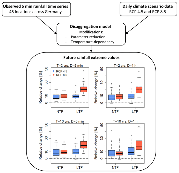
Future changes in sub-daily rainfall extreme values are essential in various hydrological fields, but climate scenarios typically offer only daily resolution. One solution is rainfall generation. With a temperature-dependent rainfall generator climate scenario data were disaggregated to 5 min rainfall time series for 45 locations across Germany. The analysis of the future 5 min rainfall time series showed an increase in the rainfall extremes values for rainfall durations of 5 min and 1 h.
Marcos Julien Alexopoulos, Hannes Müller-Thomy, Patrick Nistahl, Mojca Šraj, and Nejc Bezak
Hydrol. Earth Syst. Sci., 27, 2559–2578, https://doi.org/10.5194/hess-27-2559-2023, https://doi.org/10.5194/hess-27-2559-2023, 2023
Short summary
Short summary
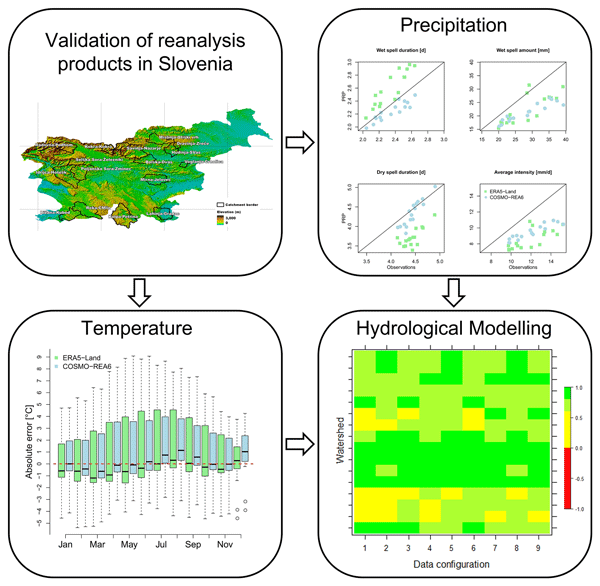
For rainfall-runoff simulation of a certain area, hydrological models are used, which requires precipitation data and temperature data as input. Since these are often not available as observations, we have tested simulation results from atmospheric models. ERA5-Land and COSMO-REA6 were tested for Slovenian catchments. Both lead to good simulations results. Their usage enables the use of rainfall-runoff simulation in unobserved catchments as a requisite for, e.g., flood protection measures.
Heidi Kreibich, Kai Schröter, Giuliano Di Baldassarre, Anne F. Van Loon, Maurizio Mazzoleni, Guta Wakbulcho Abeshu, Svetlana Agafonova, Amir AghaKouchak, Hafzullah Aksoy, Camila Alvarez-Garreton, Blanca Aznar, Laila Balkhi, Marlies H. Barendrecht, Sylvain Biancamaria, Liduin Bos-Burgering, Chris Bradley, Yus Budiyono, Wouter Buytaert, Lucinda Capewell, Hayley Carlson, Yonca Cavus, Anaïs Couasnon, Gemma Coxon, Ioannis Daliakopoulos, Marleen C. de Ruiter, Claire Delus, Mathilde Erfurt, Giuseppe Esposito, Didier François, Frédéric Frappart, Jim Freer, Natalia Frolova, Animesh K. Gain, Manolis Grillakis, Jordi Oriol Grima, Diego A. Guzmán, Laurie S. Huning, Monica Ionita, Maxim Kharlamov, Dao Nguyen Khoi, Natalie Kieboom, Maria Kireeva, Aristeidis Koutroulis, Waldo Lavado-Casimiro, Hong-Yi Li, Maria Carmen LLasat, David Macdonald, Johanna Mård, Hannah Mathew-Richards, Andrew McKenzie, Alfonso Mejia, Eduardo Mario Mendiondo, Marjolein Mens, Shifteh Mobini, Guilherme Samprogna Mohor, Viorica Nagavciuc, Thanh Ngo-Duc, Huynh Thi Thao Nguyen, Pham Thi Thao Nhi, Olga Petrucci, Nguyen Hong Quan, Pere Quintana-Seguí, Saman Razavi, Elena Ridolfi, Jannik Riegel, Md Shibly Sadik, Nivedita Sairam, Elisa Savelli, Alexey Sazonov, Sanjib Sharma, Johanna Sörensen, Felipe Augusto Arguello Souza, Kerstin Stahl, Max Steinhausen, Michael Stoelzle, Wiwiana Szalińska, Qiuhong Tang, Fuqiang Tian, Tamara Tokarczyk, Carolina Tovar, Thi Van Thu Tran, Marjolein H. J. van Huijgevoort, Michelle T. H. van Vliet, Sergiy Vorogushyn, Thorsten Wagener, Yueling Wang, Doris E. Wendt, Elliot Wickham, Long Yang, Mauricio Zambrano-Bigiarini, and Philip J. Ward
Earth Syst. Sci. Data, 15, 2009–2023, https://doi.org/10.5194/essd-15-2009-2023, https://doi.org/10.5194/essd-15-2009-2023, 2023
Short summary
Short summary
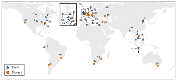
As the adverse impacts of hydrological extremes increase in many regions of the world, a better understanding of the drivers of changes in risk and impacts is essential for effective flood and drought risk management. We present a dataset containing data of paired events, i.e. two floods or two droughts that occurred in the same area. The dataset enables comparative analyses and allows detailed context-specific assessments. Additionally, it supports the testing of socio-hydrological models.
Ross Pidoto, Nejc Bezak, Hannes Müller-Thomy, Bora Shehu, Ana Claudia Callau-Beyer, Katarina Zabret, and Uwe Haberlandt
Earth Surf. Dynam., 10, 851–863, https://doi.org/10.5194/esurf-10-851-2022, https://doi.org/10.5194/esurf-10-851-2022, 2022
Short summary
Short summary
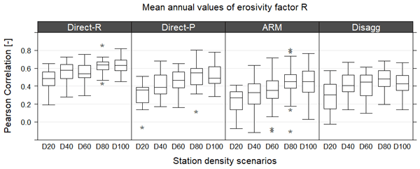
Erosion is a threat for soils with rainfall as the driving force. The annual rainfall erosivity factor quantifies rainfall impact by analysing high-resolution rainfall time series (~ 5 min). Due to a lack of measuring stations, alternatives for its estimation are analysed in this study. The best results are obtained for regionalisation of the erosivity factor itself. However, the identified minimum of 60-year time series length suggests using rainfall generators as in this study as well.
Animesh K. Gain, Yves Bühler, Pascal Haegeli, Daniela Molinari, Mario Parise, David J. Peres, Joaquim G. Pinto, Kai Schröter, Ricardo M. Trigo, María Carmen Llasat, and Heidi Kreibich
Nat. Hazards Earth Syst. Sci., 22, 985–993, https://doi.org/10.5194/nhess-22-985-2022, https://doi.org/10.5194/nhess-22-985-2022, 2022
Short summary
Short summary
To mark the 20th anniversary of Natural Hazards and Earth System Sciences (NHESS), an interdisciplinary and international journal dedicated to the public discussion and open-access publication of high-quality studies and original research on natural hazards and their consequences, we highlight 11 key publications covering major subject areas of NHESS that stood out within the past 20 years.
Cited articles
Alexopoulos, M. J., Müller-Thomy, H., Nistahl, P., Šraj, M., and Bezak, N.: Validation of precipitation reanalysis products for rainfall-runoff modelling in Slovenia, Hydrol. Earth Syst. Sci., 27, 2559–2578, https://doi.org/10.5194/hess-27-2559-2023, 2023. a
Barbero, G., Moisello, U., and Todeschini, S.: Evaluation of the Areal Reduction Factor in an Urban Area through Rainfall Records of Limited Length: A Case Study, J. Hydrol. Eng., 19, 05014016, https://doi.org/10.1061/(ASCE)HE.1943-5584.0001022, 2014. a
Bell, F.: The areal reduction factor in rainfall frequency estimation, Report No. 35, Institute of Hydrology, University of New South Wales, Australia, https://nora.nerc.ac.uk/id/eprint/5751/1/IH_035.pdf (last access: 5 January 2026), 1976. a
Berndt, C. H. U.: Spatial interpolation of climate variables in Northern Germany-Influence of temporal resolution and network density, Journal of Hydrology: Regional Studies, 15, 184–202, 2018. a
Biondi, D., Greco, A., and Luca, D. L.: Fixed-area vs storm-centered areal reduction factors: a Mediterranean case study, J. Hydrol., 595, 125654, https://doi.org/10.1016/j.jhydrol.2020.125654, 2021. a
Breinl, K., Lun, D., Müller-Thomy, H., and Blöschl, G.: Understanding the relationship between rainfall and flood probabilities through combined intensity-duration-frequency analysis, J. Hydrol., 602, 126759, https://doi.org/10.1016/j.jhydrol.2021.126759, 2021. a, b
Cache, T., Bevacqua, E., Zscheischler, J., Müller‐Thomy, H., and Peleg, N.: Simulating Realistic Design Storms: A Joint Return Period Approach, Water Resour. Res., 61, e2024WR039739, https://doi.org/10.1029/2024WR039739, 2025. a
Chang, C., Chen, Y., and Huang, J. J.: Variability of Rainfall Areal Reduction Factors for a Coastal City: A Case Study of Shenzhen, China, J. Hydrol. Eng., 28, https://doi.org/10.1061/JHYEFF.HEENG-5813, 2023. a, b, c, d
Corradini, C., Morbidelli, R., Saltalippi, C., and Flammini, A.: Meteorological systems producing rainfall, in: Rainfall, Elsevier, 27–48, ISBN 978-0-12-822544-8, https://doi.org/10.1016/B978-0-12-822544-8.00011-1, 2022. a
De Michele, C., Kottegoda, N. T., and Rosso, R.: The derivation of areal reduction factor of storm rainfall from its scaling properties, Water Resour. Res., 37, 3247–3252, https://doi.org/10.1029/2001WR000346, 2001. a
Dotzek, N., Groenemeijer, P., Feuerstein, B., and Holzer, A. M.: Overview of ESSL's severe convective storms research using the European Severe Weather Database ESWD, J. Hydrol. X, 93, 575–586, https://doi.org/10.1016/j.atmosres.2008.10.020, 2009. a
Ebers, N., Schröter, K., and Müller-Thomy, H.: Estimation of future rainfall extreme values by temperature-dependent disaggregation of climate model data, Nat. Hazards Earth Syst. Sci., 24, 2025–2043, https://doi.org/10.5194/nhess-24-2025-2024, 2024. a
Flammini, A., Dari, J., Corradini, C., Saltalippi, C., and Morbidelli, R.: Areal reduction factor estimate for extreme rainfall events, in: Rainfall, Elsevier, 285–306, ISBN 978-0-12-822544-8, https://doi.org/10.1016/B978-0-12-822544-8.00014-7, 2022. a
Fuchs, L.: Plotting Positions Used for Parameter Determination of Extreme-Type-I Distribution – Biases investigated by Monte-Carlo Methods, Deutsche Gewässerkundliche Mitteilungen, 27, 21–25, 1983. a
Fuchsberger, J., Kirchengast, G., and Kabas, T.: WegenerNet high-resolution weather and climate data from 2007 to 2020, Earth Syst. Sci. Data, 13, 1307–1334, https://doi.org/10.5194/essd-13-1307-2021, 2021. a, b, c
Fuchsberger, J., Kirchengast, G., and Bichler, C.: WegenerNet climate station network Level 2 data version 8.0 (2007–2024), Wegener Center for Climate and Global Change, University of Graz, Austria [data set], https://doi.org/10.25364/WEGC/WPS8.0-2025.1, 2025. a
Ghaemi, E., Foelsche, U., Kann, A., and Fuchsberger, J.: Evaluation of Integrated Nowcasting through Comprehensive Analysis (INCA) precipitation analysis using a dense rain-gauge network in southeastern Austria, Hydrol. Earth Syst. Sci., 25, 4335–4356, https://doi.org/10.5194/hess-25-4335-2021, 2021. a
Goshtasbpour, G. and Haberlandt, U.: Estimation of radar-based area–depth–duration–frequency curves with special focus on spatial sampling problems, Hydrol. Earth Syst. Sci., 29, 3917–3933, https://doi.org/10.5194/hess-29-3917-2025, 2025. a, b, c
Jarvis, A., Reuter, H., Nelson, A., and Guevara, E.: Hole-filled seamless SRTM data v4, International Centre for Tropical Agriculture (CIAT), https://un-spider.org/links-and-resources/data-sources/digital-elevation-model-srtm-41-cgiar-csi (last access: 5 January 2026), 2008. a
Kabas, T., Foelsche, U., and Kirchengast, G.: Seasonal and Annual Trends of Temperature and Precipitation within 1951/1971-2007 in South-Eastern Styria, Austria, Meteorol. Z., 20, 277–289, https://doi.org/10.1127/0941-2948/2011/0233, 2011. a, b, c, d
Kang, B., Kim, E., Kim, J.-G., and Moon, S.: Comparative Study on Spatiotemporal Characteristics of Fixed-Area and Storm-Centered ARFs, J. Hydrol. Eng., 24, 04019044, https://doi.org/10.1061/(ASCE)HE.1943-5584.0001839, 2019. a
Lengfeld, K., Walawender, E., Winterrath, T., and Becker, A.: CatRaRE: A Catalogue of radar-based heavy rainfall events in Germany derived from 20 years of data, Meteorol. Z., 30, 469–487, https://doi.org/10.1127/metz/2021/1088, 2021. a
Lutz, J., Roksvåg, T., Dyrrdal, A. V., Lussana, C., and Thorarinsdottir, T. L.: Areal reduction factors from gridded data products, J. Hydrol., 635, 131177, https://doi.org/10.1016/j.jhydrol.2024.131177, 2024. a
Marra, F., Armon, M., Borga, M., and Morin, E.: Orographic Effect on Extreme Precipitation Statistics Peaks at Hourly Time Scales, Geophys. Res. Lett., 48, e2020GL091498, https://doi.org/10.1029/2020GL091498, 2021. a
Marra, F., Koukoula, M., Canale, A., and Peleg, N.: Predicting extreme sub-hourly precipitation intensification based on temperature shifts, Hydrol. Earth Syst. Sci., 28, 375–389, https://doi.org/10.5194/hess-28-375-2024, 2024. a, b
Matulla, C., Penlap, E. K., Haas, P., and Formayer, H.: Comparative analysis of spatial and seasonal variability: Austrian precipitation during the 20th century, Int. J. Climatol., 23, 1577–1588, https://doi.org/10.1002/joc.960, 2003. a, b
Mineo, C., Ridolfi, E., Napolitano, F., and Russo, F.: The areal reduction factor: A new analytical expression for the Lazio Region in central Italy, J. Hydrol., 560, 471–479, https://doi.org/10.1016/j.jhydrol.2018.03.033, 2018. a, b
Omolayo, A.: On the transposition of areal reduction factors for rainfall frequency estimation, J. Hydrol., 145, 191–205, https://doi.org/10.1016/0022-1694(93)90227-Z, 1993. a
Pavlovic, S., Perica, S., St Laurent, M., and Mejía, A.: Intercomparison of selected fixed-area areal reduction factor methods, J. Hydrol., 537, 419–430, https://doi.org/10.1016/j.jhydrol.2016.03.027, 2016. a
Peel, M. C., Finlayson, B. L., and McMahon, T. A.: Updated world map of the Köppen-Geiger climate classification, Hydrol. Earth Syst. Sci., 11, 1633–1644, https://doi.org/10.5194/hess-11-1633-2007, 2007. a
Ramos, M. H., Creutin, J.-D., and Leblois, E.: Visualization of storm severity, J. Hydrol., 315, 295–307, https://doi.org/10.1016/j.jhydrol.2005.04.007, 2005. a, b, c
Rodriguez‐Iturbe, I. and Mejía, J. M.: On the transformation of point rainfall to areal rainfall, Water Resour. Res., 10, 729–735, https://doi.org/10.1029/WR010i004p00729, 1974. a, b
Schulz, W., C. K. D. G. D. M.: : Cloud-to-ground lightning in Austria: A 10-year study using data from a lightning location system, J. Geophys. Res., 110, D09101, https://doi.org/10.1029/2004JD005332, 2005. a
Seibert, P. F. A. F. H.: Synoptic and regional patterns of heavy precipitation in Austria, Theor. Appl. Climatol., 87, 139–153, https://doi.org/10.1007/s00704-006-0198-8, 2007. a, b
Sevdari, K. and Marmullaku, D.: Shapefile of European countries, Technical University of Denmark [data set], https://doi.org/10.11583/DTU.23686383, 2023. a
Sivapalan, M. and Blöschl, G.: Transformation of point rainfall to areal rainfall: Intensity-duration-frequency curves, J. Hydrol., 204, 150–167, https://doi.org/10.1016/S0022-1694(97)00117-0, 1998. a, b, c
Skaugen, T.: Classification of rainfall into small- and large-scale events by statistical pattern recognition, J. Hydrol., 200, 40–57, https://doi.org/10.1016/S0022-1694(97)00003-6, 1997. a
Svensson, C. and Jones, D.: Review of methods for deriving areal reduction factors, J. Flood Risk Manag., 3, 232–245, https://doi.org/10.1111/j.1753-318X.2010.01075.x, 2010. a
Thorndahl, S., Nielsen, J., and Rasmussen, M.: Estimation of Storm-Centred Areal Reduction Factors from Radar Rainfall for Design in Urban Hydrology, Water, 11, 1120, https://doi.org/10.3390/w11061120, 2019. a, b
U.S. Weather Bureau: Rainfall Intensity-Frequency Regime Part 1, Washington, DC, https://www.weather.gov/media/owp/oh/hdsc/docs/TP29P1.pdf (last access: 5 January 2026), 1957a. a
U.S. Weather Bureau: Rainfall Intensity-Frequency Regime Part 2, Washington, DC, https://www.weather.gov/media/owp/oh/hdsc/docs/TP29P2.pdf (last access: 5 January 2026), 1957b. a
Vaes, G., Willems, P., and Berlamont, J.: Areal rainfall correction coefficients for small urban catchments, Atmos. Res., 77, 48–59, https://doi.org/10.1016/j.atmosres.2004.10.015, 2005. a, b
Veneziano, D. and Langousis, A.: The areal reduction factor: A multifractal analysis, Water Resour. Res., 41, 2004WR003765, https://doi.org/10.1029/2004WR003765, 2005. a
Wilson, P. S. and Toumi, R.: A fundamental probability distribution for heavy rainfall, Geophys. Res. Lett., 32, https://doi.org/10.1029/2005GL022465, 2005. a
Wright, D. B., Smith, J. A., and Baeck, M. L.: Critical Examination of Area Reduction Factors, J. Hydrol. Eng., 19, 769–776, https://doi.org/10.1061/(ASCE)HE.1943-5584.0000855, 2014. a, b
Short summary
It is important to know how often an extreme precipitation amount can occur. This frequency can be derived via analysis of observed time series. With precipitation traditionally observed at single points (the rain gauges), the derived frequencies are not valid for e.g. catchments. Valid areal extreme values can be achieved by a subsequent reduction in space. This study analyses the impact of seasons, durations, frequencies and topography on reduction factors for extreme values (5 min to 1 day).
It is important to know how often an extreme precipitation amount can occur. This frequency can...
Altmetrics
Final-revised paper
Preprint