
Articles | Volume 26, issue 8
https://doi.org/10.5194/nhess-26-4013-2026
© Author(s) 2026. This work is distributed under
the Creative Commons Attribution 4.0 License.
the Creative Commons Attribution 4.0 License.
https://doi.org/10.5194/nhess-26-4013-2026
© Author(s) 2026. This work is distributed under
the Creative Commons Attribution 4.0 License.
the Creative Commons Attribution 4.0 License.
Research article
| 
26 Aug 2026
Research article |
| 26 Aug 2026
| 26 Aug 2026
Exposure of settlements to wildfires in a transboundary wildland–urban interface region in Central Europe
Evripidis Avouris
CORRESPONDING AUTHOR

Faculty of Environmental Sciences, Environmental Remote Sensing Group, TUD Dresden University of Technology, Dresden, Germany
Christopher Marrs
Faculty of Environmental Sciences, Environmental Remote Sensing Group, TUD Dresden University of Technology, Dresden, Germany
Kristina Beetz
Faculty of Environmental Sciences, Environmental Remote Sensing Group, TUD Dresden University of Technology, Dresden, Germany
now at: ICEYE, Espoo, Finland
Lucie Kudláčková
Global Change Research Institute of the Czech Academy of Sciences, Brno, Czech Republic
Johanna Kranz
Faculty of Environmental Sciences, Environmental Remote Sensing Group, TUD Dresden University of Technology, Dresden, Germany
Markéta Poděbradská
Global Change Research Institute of the Czech Academy of Sciences, Brno, Czech Republic
Miroslav Trnka
Global Change Research Institute of the Czech Academy of Sciences, Brno, Czech Republic
Matthias Forkel
CORRESPONDING AUTHOR
Faculty of Environmental Sciences, Environmental Remote Sensing Group, TUD Dresden University of Technology, Dresden, Germany
Related authors
No articles found.
Siyuan Wang, Hui Yang, Sujan Koirala, Maurizio Santoro, Anna Candotti, Ulrich Weber, Ranit De, Claire Robin, Felix Cremer, Matthias Forkel, Markus Reichstein, and Nuno Carvalhais
Earth Syst. Sci. Data, 18, 5895–5913, https://doi.org/10.5194/essd-18-5895-2026, https://doi.org/10.5194/essd-18-5895-2026, 2026
Short summary
Short summary
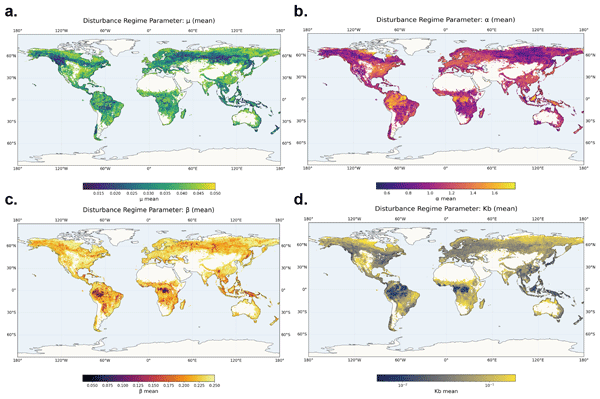
Forest disturbances are difficult to predict in models because they occur randomly. We discovered that the long-term rules of disturbance known as
regimeleave a unique footprint in a forest's spatial biomass patterns. We trained a model on millions of computer simulations to learn this link. By applying this model to detailed satellite biomass, we could read these patterns to infer the disturbance regime globally, helping make climate projections more accurate.
Monika Hlavsová, Lauro Rossi, Kathrin Szillat, Kerstin Stahl, Mirko D'Andrea, Veit Blauhut, Gabriela Ivaňáková, Livia Labudová, and Miroslav Trnka
EGUsphere, https://doi.org/10.5194/egusphere-2026-3041, https://doi.org/10.5194/egusphere-2026-3041, 2026
This preprint is open for discussion and under review for Natural Hazards and Earth System Sciences (NHESS).
Short summary
Short summary
Information about drought impacts is often incomplete because collecting such data requires substantial time and resources. We tested whether online news articles available in all official EU languages could help fill gaps in the European Drought Impact Database. The approach added many new records, especially for recent droughts, but results varied strongly between countries and sectors. Online sources can improve drought monitoring, but expert observations and local reporting remain essential.
Andreia F. S. Ribeiro, Maik Biling, Kirsten Thonicke, Werner von Bloh, Jakob Wessel, Sabine Undorf, Matthias Forkel, and Jakob Zscheischler
EGUsphere, https://doi.org/10.5194/egusphere-2026-2952, https://doi.org/10.5194/egusphere-2026-2952, 2026
Short summary
Short summary
Wildfires are becoming more extreme, yet our state-of-the-art tools fail to capture the full risk. We simulate a large ensemble of wildfire simulations capturing a broader range of physically plausible extreme wildfire events beyond what observations alone can reveal. Extreme fire danger alone does not explain the worst impacts: ignitions, fuel and vegetation-fire feedback need to be incorporated. This modelling framework is transferable to other climate-impact sectors beyond wildfires.
Matěj Orság, Radovan Kopp, Jan Balek, Daniela Semerádová, Adam Vizina, Milan Fischer, Petr Skalák, Petr Štěpánek, Pavel Zahradníček, Jan Mareš, and Miroslav Trnka
EGUsphere, https://doi.org/10.5281/zenodo.19493262, https://doi.org/10.5281/zenodo.19493262, 2026
Short summary
Short summary
Rivers are warming. In the Czech Republic, water temperatures have risen steadily, shrinking the cold-water habitat that brown trout depend on for survival and reproduction. Using climate model projections, we showed that thermally suitable river reaches may decline from nearly the entire network today to just four percent by 2085. The greatest threat is not rare heat extremes but chronic moderate warming that erodes favourable conditions across the warm season and during winter spawning.
Olivia Hau, Matthias Forkel, Wolfgang Buermann, Johanna Kranz, Mirco Migliavacca, Ulrich Weber, and Alexander Josef Winkler
EGUsphere, https://doi.org/10.5194/egusphere-2026-910, https://doi.org/10.5194/egusphere-2026-910, 2026
Short summary
Short summary
Shifts in spring and autumn growth due to climate warming change how plants reflect sunlight and release heat and moisture into the air, modulating surface warming. The strength of these effects and their regional variability remain poorly understood. Using satellite and climate data, we show that earlier spring growth increases moisture release, especially in forests, while autumn changes are smaller and less consistent. Impacts on land-atmosphere interactions vary by ecosystem and data source.
Pere Joan Gelabert, Adrián Jiménez-Ruano, Clara Ochoa, Fermín Alcasena, Johan Sjöström, Christopher Marrs, Luís Mário Ribeiro, Palaiologos Palaiologou, Carmen Bentué Martínez, Emilio Chuvieco, Cristina Vega-García, and Marcos Rodrigues
Nat. Hazards Earth Syst. Sci., 25, 4713–4729, https://doi.org/10.5194/nhess-25-4713-2025, https://doi.org/10.5194/nhess-25-4713-2025, 2025
Short summary
Short summary
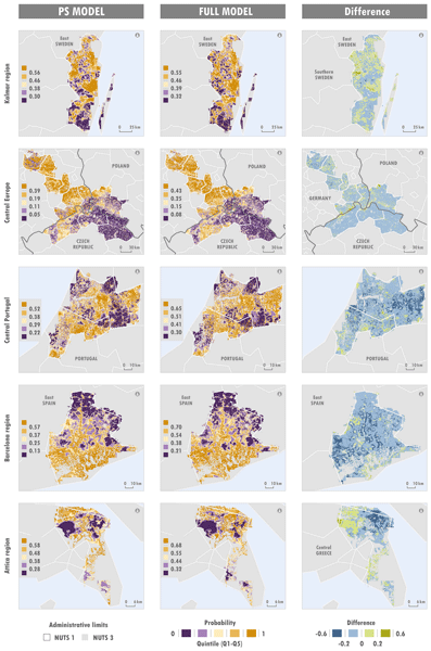
Wildfires threaten ecosystems and communities across Europe. Our study developed models to predict where and why these ignitions occur in different European environments. We found that weather anomalies and human factors, like proximity to urban areas and roads, are key drivers. Using Machine Learning our models achieved strong predictive accuracy. These insights help design better wildfire prevention strategies, ensuring safer landscapes and communities as fire risks grow with climate change.
Jan Řehoř, Rudolf Brázdil, Oldřich Rakovec, Martin Hanel, Milan Fischer, Rohini Kumar, Jan Balek, Markéta Poděbradská, Vojtěch Moravec, Luis Samaniego, Yannis Markonis, and Miroslav Trnka
Hydrol. Earth Syst. Sci., 29, 3341–3358, https://doi.org/10.5194/hess-29-3341-2025, https://doi.org/10.5194/hess-29-3341-2025, 2025
Short summary
Short summary
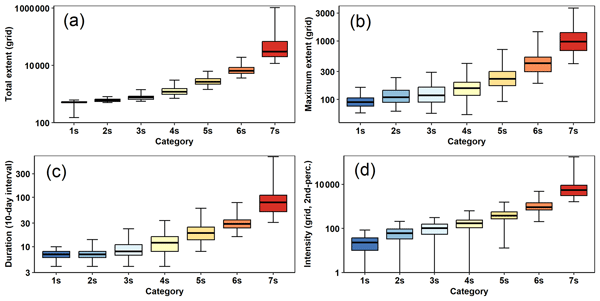
We present a robust method for identification and classification of global land drought events (GLDEs) based on soil moisture. Two models were used to calculate soil moisture and delimit soil drought over global land from 1980–2022, with clusters of 775 and 630 GLDEs. Using four spatiotemporal and three motion-related characteristics, we categorized GLDEs into seven severity and seven dynamic categories. The frequency of GLDEs has generally increased in recent decades.
Adrianus de Laat, Vincent Huijnen, Niels Andela, and Matthias Forkel
EGUsphere, https://doi.org/10.5194/egusphere-2024-732, https://doi.org/10.5194/egusphere-2024-732, 2024
Preprint archived
Short summary
Short summary
This study assesses state-of-the art and more advanced and innovative satellite-observation-based (bottom-up) wildfire emission estimates. They are evaluated by comparison with satellite observation of single fire emission plumes. Results indicate that more advanced fire emission estimates – more information – are more realistic but that especially for a limited number of very large fires certain differences remain – for unknown reasons.
Hoontaek Lee, Martin Jung, Nuno Carvalhais, Tina Trautmann, Basil Kraft, Markus Reichstein, Matthias Forkel, and Sujan Koirala
Hydrol. Earth Syst. Sci., 27, 1531–1563, https://doi.org/10.5194/hess-27-1531-2023, https://doi.org/10.5194/hess-27-1531-2023, 2023
Short summary
Short summary
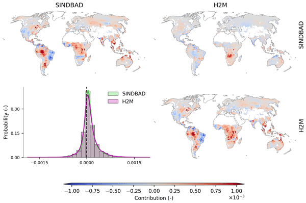
We spatially attribute the variance in global terrestrial water storage (TWS) interannual variability (IAV) and its modeling error with two data-driven hydrological models. We find error hotspot regions that show a disproportionately large significance in the global mismatch and the association of the error regions with a smaller-scale lateral convergence of water. Our findings imply that TWS IAV modeling can be efficiently improved by focusing on model representations for the error hotspots.
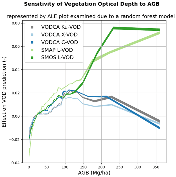
Luisa Schmidt, Matthias Forkel, Ruxandra-Maria Zotta, Samuel Scherrer, Wouter A. Dorigo, Alexander Kuhn-Régnier, Robin van der Schalie, and Marta Yebra
Biogeosciences, 20, 1027–1046, https://doi.org/10.5194/bg-20-1027-2023, https://doi.org/10.5194/bg-20-1027-2023, 2023
Short summary
Short summary
Vegetation attenuates natural microwave emissions from the land surface. The strength of this attenuation is quantified as the vegetation optical depth (VOD) parameter and is influenced by the vegetation mass, structure, water content, and observation wavelength. Here we model the VOD signal as a multi-variate function of several descriptive vegetation variables. The results help in understanding the effects of ecosystem properties on VOD.
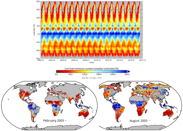
Matthias Forkel, Luisa Schmidt, Ruxandra-Maria Zotta, Wouter Dorigo, and Marta Yebra
Hydrol. Earth Syst. Sci., 27, 39–68, https://doi.org/10.5194/hess-27-39-2023, https://doi.org/10.5194/hess-27-39-2023, 2023
Short summary
Short summary
The live fuel moisture content (LFMC) of vegetation canopies is a driver of wildfires. We investigate the relation between LFMC and passive microwave satellite observations of vegetation optical depth (VOD) and develop a method to estimate LFMC from VOD globally. Our global VOD-based estimates of LFMC can be used to investigate drought effects on vegetation and fire risks.
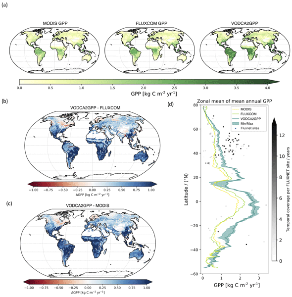
Benjamin Wild, Irene Teubner, Leander Moesinger, Ruxandra-Maria Zotta, Matthias Forkel, Robin van der Schalie, Stephen Sitch, and Wouter Dorigo
Earth Syst. Sci. Data, 14, 1063–1085, https://doi.org/10.5194/essd-14-1063-2022, https://doi.org/10.5194/essd-14-1063-2022, 2022
Short summary
Short summary
Gross primary production (GPP) describes the conversion of CO2 to carbohydrates and can be seen as a filter for our atmosphere of the primary greenhouse gas CO2. We developed VODCA2GPP, a GPP dataset that is based on vegetation optical depth from microwave remote sensing and temperature. Thus, it is mostly independent from existing GPP datasets and also available in regions with frequent cloud coverage. Analysis showed that VODCA2GPP is able to complement existing state-of-the-art GPP datasets.
Cited articles
Abatzoglou, J. T., Kolden, C. A., Cullen, A. C., Sadegh, M., Williams, E. L., Turco, M., and Jones, M. W.: Climate change has increased the odds of extreme regional forest fire years globally, Nat. Commun., 16, 6390, https://doi.org/10.1038/s41467-025-61608-1, 2025.
Abrahams, J., Anacia, A., Beavers, R., Gabriel Andrés, B., Caffrey, M., Omar Darío, C., Ciotti, M., Derrough, T., Douris, J., Espinosa, L., Fraser, G., G. Goldammer, J., Gudnason, T., Gyenes, Z., Hainsworth, A., Krausmann, E., Loughlin, S., Løvholt, F., Mallinis, G., Mitsopoulos, I., Nadim, F., Necci, A., Rudari, R., Severi, E., Sexton, J., Silva, V., Smallwood, C., Suk, J., Tsolova, S., Vigh, J. L., Villegas, C., Wannous, C., Weatherill, G., Yepes-Estrada, C., and Woolf, M.: Words into Action guidelines: National disaster risk assessment, Part Three: Hazard specific Risk Assessment, United Nations Office for Disaster Risk Reduction, https://www.preventionweb.net/files/52828_nationaldisasterriskassessmenthazar%5B1%5D.pdf (last access: 20 August 2026), 2017.
Alaska Fuel Model Guide Task Group (Ed.): Fuel model guide to Alaska vegetation, Alaska Wildland Fire Coordinating Group, Fire Modeling and Analysis Committee, Fairbanks, AK, https://fire.ak.blm.gov/content/admin/awfcg_committees/Fire%20Modeling%20and%20Analysis/AK%20Revised%20Fuel%20Model%20Guide%20May%202018.pdf (last access: 20 August 2026), 2018.
Alcasena, F., Salis, M., Ager, A., Castell, R., and Vega-García, C.: Assessing Wildland Fire Risk Transmission to Communities in Northern Spain, Forests, 8, 30, https://doi.org/10.3390/f8020030, 2017.
Alcasena, F., Ager, A., Le Page, Y., Bessa, P., Loureiro, C., and Oliveira, T.: Assessing Wildfire Exposure to Communities and Protected Areas in Portugal, Fire, 4, 82, https://doi.org/10.3390/fire4040082, 2021.
Alcasena, F. J., Ager, A. A., Salis, M., Day, M. A., and Vega-Garcia, C.: Wildfire spread, hazard and exposure metric raster grids for central Catalonia, Data in Brief, 17, 1–5, https://doi.org/10.1016/j.dib.2017.12.069, 2018.
Almeida, M., Soviev, M., San-Miguel, J., Durrant, T., Oom, D., Branco, A., Ferrari, D., Boca, R., Maianti, P., De, R. D., Suarez-Moreno, M., Roglia, E., Scionti, N., Broglia, M., Alves, D., Matos, C., Ribeiro, L. M., Viegas, D. X., Ribeiro, C., Rodrigues, T., Chuvieco, E., Oliva, P., Garcia, M., Velea, R., Laterza, R., De, L. M., Lorenzoni, P., Arca, B., Salis, M., Bacciu, V., Del, G. L., Pelizzaro, G., Duce, P., Marrs, C., Forkel, M., Beetz, K., Kosczor, E., Podebradska, M., Politi, N., Sfetsos, A., Vlachogiannis, D., Eftychidis, G., Stavrakoudis, D., Varela, V., Gitas, I. Z., Sjostrom, J., Petrila, M., Lorent, A., Drobinkova, N., Vasilev, V., Tsvetkova, N., Yanko, B., Gospodinov, I., Zibtsev, S., Goldammer, J., Myroniuk, V., Sydorenko, S., Soshenskyi, O., Bogomolov, V., and Borsuk, O.: Report on the large wildfires of 2022 in Europe, Joint Research Centre, https://doi.org/10.2760/19760, 2024.
Aragoneses, E., García, M., Salis, M., Ribeiro, L. M., and Chuvieco, E.: Classification and mapping of European fuels using a hierarchical, multipurpose fuel classification system, Earth Syst. Sci. Data, 15, 1287–1315, https://doi.org/10.5194/essd-15-1287-2023, 2023.
Argañaraz, J. P., Radeloff, V. C., Bar-Massada, A., Gavier-Pizarro, G. I., Scavuzzo, C. M., and Bellis, L. M.: Assessing wildfire exposure in the Wildland-Urban Interface area of the mountains of central Argentina, J. Environ. Manage., 196, 499–510, https://doi.org/10.1016/j.jenvman.2017.03.058, 2017.
Avouris, E.: Wildfire Exposure Online Map, Technische Universität Dresden, OPARA [data set], https://doi.org/10.25532/OPARA-954, 2025.
Beetz, K.: Forest fires in the Bohemian-Saxon Switzerland in 2022: Mapping and analysis of fuel types, fire dynamics and severity using remote sensing data, unpublished master's thesis, TU Dresden, 2023.
Beetz, K., Marrs, C., Busse, A., Poděbradská, M., Kinalczyk, D., Kranz, J., and Forkel, M.: Effects of bark beetle disturbance and fuel types on fire radiative power and burn severity in the Bohemian-Saxon Switzerland, Forestry, cpae024, https://doi.org/10.1093/forestry/cpae024, 2024.
Berčák, R., Holuša, J., Kaczmarowski, J., Tyburski, Ł., Szczygieł, R., Held, A., Vacik, H., Slivinský, J., and Chromek, I.: Fire Protection Principles and Recommendations in Disturbed Forest Areas in Central Europe: A Review, Fire, 6, 310, https://doi.org/10.3390/fire6080310, 2023.
Bowman, D. M. J. S., Williamson, G. J., Abatzoglou, J. T., Kolden, C. A., Cochrane, M. A., and Smith, A. M. S.: Human exposure and sensitivity to globally extreme wildfire events, Nat. Ecol. Evol., 1, 0058, https://doi.org/10.1038/s41559-016-0058, 2017.
Brázdil, R., Zahradník, P., Szabó, P., Chromá, K., Dobrovolný, P., Dolák, L., Trnka, M., Řehoř, J., and Suchánková, S.: Meteorological and climatological triggers of notable past and present bark beetle outbreaks in the Czech Republic, Clim. Past, 18, 2155–2180, https://doi.org/10.5194/cp-18-2155-2022, 2022.
Byram, G. M.: Combustion of Forest Fuels, in: Forest Fire: Control and Use, McGraw-Hill, 61–89, ISBN 978-0-07-015484-1, 1959.
Caballero, D. and Beltrán, I.: Concepts and ideas of assessing settlement fire vulnerability in the W-UI zone, International Workshop Forest Fires in the Wildland-Urban Interface and Rural Areas in Europe Athens, Greece, 15–16 May 2003, https://www.fria.gr/WARM/chapters/warmCh07Caballero.pdf (last access: 20 August 2026), 2003.
Copernicus Emergency Management Service: EMSR610: Wildfire in Saxony, Germany, https://mapping.emergency.copernicus.eu/activations/EMSR610/ (last access: 20 August 2026), 2022.
Copernicus Land Monitoring Service: Tree Cover Density 2018 (raster 10 m, 100 m), Europe, yearly, https://doi.org/10.2909/e677441e-fb94-431c-b4f9-304f10e4dfd8, 2024.
Copernicus Land Monitoring Service: Land Cover 2020 (raster 10 m), global, annual – version 1 (01.00), https://doi.org/10.2909/602507B2-96C7-47BB-B79D-7BA25E97D0A9, 2025.
ČÚZK: Geoportál: https://geoportal.cuzk.cz, last access: 17 November 2024.
Deutscher Wetterdienst: Climate Data Center (CDC) (CDC-v2.1.b22.09), https://cdc.dwd.de/portal/ (last access: 29 October 2025), 2025.
European Commission, Joint Research Centre, Almeida, M., Soviev, M., San-Miguel, J., Durrant, T., Oom, D., Branco, A., Ferrari, D., Boca, R., Maianti, P., De Rigo, D., Suarez-Moreno, M., Roglia, E., Scionti, N., Broglia, M., Alves, D., Matos, C., Ribeiro, L. M., Viegas, D. X., Ribeiro, C., Rodrigues, T., Chuvieco, E., Oliva, P., Garcia, M., Velea, R., Laterza, R., De Lucia, M., Lorenzoni, P., Arca, B., Salis, M., Bacciu, V., Del Giudice, L., Pelizzaro, G., Duce, P., Marrs, C., Forkel, M., Beetz, K., Kosczor, E., Podebradska, M., Politi, N., Sfetsos, A., Vlachogiannis, D., Eftychidis, G., Stavrakoudis, D., Varela, V., Gitas, I. Z., Sjostrom, J., Petrila, M., Lorent, A., Drobinkova, N., Vasilev, V., Tsvetkova, N., Yanko, B., Gospodinov, I., Zibtsev, S., Goldammer, J., Myroniuk, V., Sydorenko, S., Soshenskyi, O., Bogomolov, V., and Borsuk, O.: Report on the large wildfires of 2022 in Europe, Publications Office of the European Union, Luxembourg, https://doi.org/10.2760/19760, 2024.
Finney, M. A.: An Overview of FlamMap Fire Modeling Capabilities, in: Andrews, P. L. and Butler, B. W., comps. 2006, Fuels Management-How to Measure Success: Conference Proceedings, 28–30 March 2006, Portland, OR, Proceedings RMRS-P-41, U.S. Department of Agriculture, Forest Service, Rocky Mountain Research Station, Fort Collins, CO, 213–220, https://research.fs.usda.gov/treesearch/25948 (last access: 20 August 2026), 2006.
Finney, M. A., McAllister, S. S., Grumstrup, T. P., and Forthofer, J. M.: Wildland fire behaviour: dynamics, principles and processes, CSIRO Publishing, https://doi.org/10.1071/9781486309092, 2021.
Finney, M. A., Zimmer, S. N., Riley, K. L., and Grenfell, I. C.: A generalized wildfire containment algorithm, Ecol. Model., 505, 111134, https://doi.org/10.1016/j.ecolmodel.2025.111134, 2025.
FlamMap Help: https://owfflammaphelp62.firenet.gov, last access: 7 October 2023.
FlamMap – Missoula Fire Sciences Laboratory: https://research.fs.usda.gov/firelab/products/dataandtools/flammap, last access: 20 April 2026.
Flink, H.-M., Oksanen, J., Pyysalo, U., Rönneberg, M., and Sarjakoski, L. T.: Usability Evaluation of a Map-Based Multi-Publishing Service, in: Advances in Cartography and GIScience. Volume 1: Selection from ICC 2011, Paris, edited by: Ruas, A., Springer, Berlin, Heidelberg, 239–257, https://doi.org/10.1007/978-3-642-19143-5_14, 2011.
Forthofer, J., Shannon, K., and Butler, B.: Simulating diurnally driven slope winds with WindNinja, in: Proceedings of 8th Eighth Symposium on Fire and Forest Meteorology, Kalispell, MT, 13–15 October 2009, American Meteorological Society, Boston, MA, 13 pp., https://ams.confex.com/ams/8Fire/techprogram/paper_156275.htm (last access: 26 October 2025), 2009.
Geofabrik – Europe: http://download.geofabrik.de/europe.html, last access: 23 October 2023.
Geoportal Sachsenatlas: https://geoportal.sachsen.de/, last access: 24 June 2024.
Guo, Y., Wang, J., Ge, Y., and Zhou, C.: Global expansion of wildland-urban interface intensifies human exposure to wildfire risk in the 21st century, Science Advances, 10, eado9587, https://doi.org/10.1126/sciadv.ado9587, 2024.
Haas, J. R., Calkin, D. E., and Thompson, M. P.: A national approach for integrating wildfire simulation modeling into Wildland Urban Interface risk assessments within the United States, Landscape Urban Plan., 119, 44–53, https://doi.org/10.1016/j.landurbplan.2013.06.011, 2013.
Hasičovo: https://www.hasicovo.cz, last access: 31 October 2023.
Hasičský záchranný sbor České republiky: https://www.hzscr.cz, last access: 24 October 2023.
Heisig, J., Olson, E., and Pebesma, E.: Predicting Wildfire Fuels and Hazard in a Central European Temperate Forest Using Active and Passive Remote Sensing, Fire, 5, 29, https://doi.org/10.3390/fire5010029, 2022.
Hlásny, T., Zimová, S., Merganičová, K., Štěpánek, P., Modlinger, R., and Turčáni, M.: Devastating outbreak of bark beetles in the Czech Republic: Drivers, impacts, and management implications, Forest Ecol. Manag., 490, 1–13, https://doi.org/10.1016/j.foreco.2021.119075, 2021.
Johnston, L. M., Wang, X., Erni, S., Taylor, S. W., McFayden, C. B., Oliver, J. A., Stockdale, C., Christianson, A., Boulanger, Y., Gauthier, S., Arseneault, D., Wotton, B. M., Parisien, M.-A., and Flannigan, M. D.: Wildland fire risk research in Canada, Environ. Rev., 28, 164–186, https://doi.org/10.1139/er-2019-0046, 2020.
Jones, M. W., Abatzoglou, J. T., Veraverbeke, S., Andela, N., Lasslop, G., Forkel, M., Smith, A. J. P., Burton, C., Betts, R. A., van der Werf, G. R., Sitch, S., Canadell, J. G., Santín, C., Kolden, C., Doerr, S. H., and Le Quéré, C.: Global and Regional Trends and Drivers of Fire Under Climate Change, Rev. Geophys., 60, e2020RG000726, https://doi.org/10.1029/2020RG000726, 2022.
Jones, M. W., Kelley, D. I., Burton, C. A., Di Giuseppe, F., Barbosa, M. L. F., Brambleby, E., Hartley, A. J., Lombardi, A., Mataveli, G., McNorton, J. R., Spuler, F. R., Wessel, J. B., Abatzoglou, J. T., Anderson, L. O., Andela, N., Archibald, S., Armenteras, D., Burke, E., Carmenta, R., Chuvieco, E., Clarke, H., Doerr, S. H., Fernandes, P. M., Giglio, L., Hamilton, D. S., Hantson, S., Harris, S., Jain, P., Kolden, C. A., Kurvits, T., Lampe, S., Meier, S., New, S., Parrington, M., Perron, M. M. G., Qu, Y., Ribeiro, N. S., Saharjo, B. H., San-Miguel-Ayanz, J., Shuman, J. K., Tanpipat, V., van der Werf, G. R., Veraverbeke, S., and Xanthopoulos, G.: State of Wildfires 2023–2024, Earth Syst. Sci. Data, 16, 3601–3685, https://doi.org/10.5194/essd-16-3601-2024, 2024.
Keane, R. E.: Wildland Fuel Fundamentals and Applications, 1st edn., Springer Cham, https://doi.org/10.1007/978-3-319-09015-3, 2015.
Knutzen, F., Averbeck, P., Barrasso, C., Bouwer, L. M., Gardiner, B., Grünzweig, J. M., Hänel, S., Haustein, K., Johannessen, M. R., Kollet, S., Müller, M. M., Pietikäinen, J.-P., Pietras-Couffignal, K., Pinto, J. G., Rechid, D., Rousi, E., Russo, A., Suarez-Gutierrez, L., Veit, S., Wendler, J., Xoplaki, E., and Gliksman, D.: Impacts on and damage to European forests from the 2018–2022 heat and drought events, Nat. Hazards Earth Syst. Sci., 25, 77–117, https://doi.org/10.5194/nhess-25-77-2025, 2025.
Kranz, J., Bauer, K., Pampanoni, V., Zhao, L., Marrs, C., Mauder, M., Poděbradská, M., van der Maaten-Theunissen, M., Yebra, M., and Forkel, M.: Assessing predictors for fuel moisture content in Central European forests, Agr. Forest Meteorol., 371, 110590, https://doi.org/10.1016/j.agrformet.2025.110590, 2025.
Kreisfeuerwehrverband – Sächsische Schweiz-Osterzgebirge e.V.: https://kfv-soe.de/, last access: 31 October 2023.
Kudláčková, L., Poděbradská, M., Bláhová, M., Cienciala, E., Beranová, J., McHugh, C., Finney, M., Novotný, J., Zahradníček, P., Štěpánek, P., Linda, R., Pikl, M., Vébrová, D., Možný, M., Surový, P., Žalud, Z., and Trnka, M.: Using FlamMap to assess wildfire behavior in Bohemian Switzerland National Park, Nat. Hazards, 120, 3943–3977, https://doi.org/10.1007/s11069-023-06361-8, 2024.
Landesamt für Geobasisinformation Sachsen: https://www.landesvermessung.sachsen.de, last access: 19 October 2023.
Landnutzung – Geobasisinformation: https://www.landesvermessung.sachsen.de//landnutzung-9558.html, last access: 17 November 2024.
Mallinis, G.: Assessing differences in fire hazard over Mediterranean coppice and high forests, STSM Report, University of Sassari, Department of Science for Nature and Environmental Resources, https://www.eurocoppice.uni-freiburg.de/intern/pdf/stsm/stsmreport-giorgos-mallinis-rev.pdf (last access: 20 August 2026), 2014.
Mallinis, G., Mitsopoulos, I., Beltran, E., and Goldammer, J.: Assessing Wildfire Risk in Cultural Heritage Properties Using High Spatial and Temporal Resolution Satellite Imagery and Spatially Explicit Fire Simulations: The Case of Holy Mount Athos, Greece, Forests, 7, 46, https://doi.org/10.3390/f7020046, 2016.
Ministerium des Innern und für Kommunales des Landes Brandenburg: Großwaldbrände im Land Brandenburg – Bericht zur Waldbrandsaison 2022, Landesschule und Technische Einrichtung für Brand- und Katastrophenschutz, Potsdam, https://mik.brandenburg.de/mik/de/service/publikationen/detail/~18-07-2023-waldbrandbericht-2022 (last access: 20 August 2026), 2023.
Mitsopoulos, I., Mallinis, G., Karali, A., Giannakopoulos, C., and Arianoutsou, M.: Mapping fire behaviour under changing climate in a Mediterranean landscape in Greece, Reg. Environ. Change, 16, 1929–1940, https://doi.org/10.1007/s10113-015-0884-0, 2016.
Moghaddas, J. J., Collins, B. M., Menning, K., Moghaddas, E. E. Y., and Stephens, S. L.: Fuel treatment effects on modeled landscape-level fire behavior in the northern Sierra Nevada, Can. J. Forest Res., 40, 1751–1765, https://doi.org/10.1139/X10-118, 2010.
Müller, J., Bußler, H., Goßner, M., Rettelbach, T., and Duelli, P.: The European spruce bark beetle Ips typographus in a national park: from pest to keystone species, Biodivers. Conserv., 17, 2979–3001, https://doi.org/10.1007/s10531-008-9409-1, 2008.
NASA MODIS Science Data Support Team: MODIS/Aqua Terra Thermal Anomalies/Fire locations 1 km FIRMS NRT (Vector data), https://doi.org/10.5067/FIRMS/MODIS/MCD14DL.NRT.0061, 2021.
NASA VIIRS Land Science Team: VIIRS (S-NPP) I Band 375 m Active Fire Product NRT (Vector data), https://doi.org/10.5067/FIRMS/VIIRS/VNP14IMGT_NRT.002, 2020.
Nationalpark Sächsische Schweiz: https://nationalpark-saechsische-schweiz.de, last access: 14 April 2023.
Natur und Biologische Vielfalt: https://www.natur.sachsen.de, last access: 13 November 2024.
Oliveira, S., Gonçalves, A., Benali, A., Sá, A., Zêzere, J. L., and Pereira, J. M.: Assessing Risk and Prioritizing Safety Interventions in Human Settlements Affected by Large Wildfires, Forests, 11, 859, https://doi.org/10.3390/f11080859, 2020.
Oliveira, S., Rocha, J., and Sá, A.: Wildfire risk modeling, Current Opinion in Environmental Science & Health, 23, 100274, https://doi.org/10.1016/j.coesh.2021.100274, 2021.
OpenStreetMap: https://wiki.openstreetmap.org/wiki, last access: 31 October 2023.
Peterson, D. L., Evers, L., Gravenmier, R. A., and Eberhardt, E.: A consumer guide: tools to manage vegetation and fuels, U.S. Department of Agriculture, Forest Service, Pacific Northwest Research Station, Portland, OR, https://doi.org/10.2737/PNW-GTR-690, 2007.
Požár v NP České Švýcarsko: https://www.npcs.cz/pozar-v-np-ceske-svycarsko, last access: 16 November 2024.
Radeloff, V. C., Helmers, D. P., Kramer, H. A., Mockrin, M. H., Alexandre, P. M., Bar-Massada, A., Butsic, V., Hawbaker, T. J., Martinuzzi, S., Syphard, A. D., and Stewart, S. I.: Rapid growth of the US wildland-urban interface raises wildfire risk, P. Natl. Acad. Sci. USA, 115, 3314–3319, https://doi.org/10.1073/pnas.1718850115, 2018.
Rothermel, R. C.: A mathematical model for predicting fire spread in wildland fuels, Res. Pap. INT-115, U.S. Department of Agriculture, Intermountain Forest and Range Experiment Station, Ogden, UT, 40 pp., https://research.fs.usda.gov/treesearch/32533 (last access: 20 August 2026), 1972.
Rothermel, R. C. and Deeming, J. E.: Measuring and Interpreting Fire Behavior for Correlation with Fire Effects, USDA Forest Service, Ogden, Utah, https://www.frames.gov/catalog/6153 (last access: 20 August 2026), 1980.
Sá, A. C. L., Aparicio, B., Benali, A., Bruni, C., Salis, M., Silva, F., Marta-Almeida, M., Pereira, S., Rocha, A., and Pereira, J.: Coupling wildfire spread simulations and connectivity analysis for hazard assessment: a case study in Serra da Cabreira, Portugal, Nat. Hazards Earth Syst. Sci., 22, 3917–3938, https://doi.org/10.5194/nhess-22-3917-2022, 2022.
Safaie, S., Stepanyan, M., Houdijk, R., and Onur, T.: Words into Action guidelines: National disaster risk assessment, Part One: Main Body, United Nations Office for Disaster Risk Reduction, https://www.preventionweb.net/files/52828_nationaldisasterriskassessmentpart1.pdf (last access: 20 August 2026), 2017.
Salis, M., Arca, B., Bacciu, V., Duce, P., and Spano, D.: Assessment of Fire Severity in a Mediterranean Area using FlamMap Simulator, Eighth Symposium on Fire and Forest Meteorology, Kalispell, Montana, USA, 12–15 October 2009, https://ams.confex.com/ams/pdfpapers/156339.pdf (last access: 20 August 2026), 2009.
Salis, M., Ager, A. A., Arca, B., Finney, M. A., Bacciu, V., Duce, P., and Spano, D.: Assessing exposure of human and ecological values to wildfire in Sardinia, Italy, Int. J. Wildland Fire, https://doi.org/10.1071/WF11060, 2012.
Scott, J. H.: Glossary of wildfire hazard and risk, Pyrologix, https://pyrologix.com/downloads/wildfirehazardandriskglossary_20190523/ (last access: 20 August 2026), 2019.
Scott, J. H. and Burgan, R. E.: Standard fire behavior fuel models: a comprehensive set for use with Rothermel's surface fire spread model, U.S. Department of Agriculture, Forest Service, Rocky Mountain Research Station, Ft. Collins, CO, https://doi.org/10.2737/RMRS-GTR-153, 2005.
Scott, J. H., Thompson, M. P., and Calkin, D. E.: A wildfire risk assessment framework for land and resource management, Gen. Tech. Rep. RMRS-GTR-315, U.S. Department of Agriculture, Forest Service, Rocky Mountain Research Station. 83 pp., https://doi.org/10.2737/rmrs-gtr-315, 2013.
Seidl, R., Schelhaas, M.-J., Rammer, W., and Verkerk, P. J.: Increasing forest disturbances in Europe and their impact on carbon storage, Nat. Clim. Change, 4, 806–810, https://doi.org/10.1038/nclimate2318, 2014.
Senf, C., Pflugmacher, D., Zhiqiang, Y., Sebald, J., Knorn, J., Neumann, M., Hostert, P., and Seidl, R.: Canopy mortality has doubled in Europe's temperate forests over the last three decades, Nat. Commun., 9, 4978, https://doi.org/10.1038/s41467-018-07539-6, 2018.
Staatsbetrieb Sachsenforst: https://www.sbs.sachsen.de, last access: 24 October 2023.
Stephens, S. L.: Evaluation of the effects of silvicultural and fuels treatments on potential fire behaviour in Sierra Nevada mixed-conifer forests, Forest Ecol. Manag., 105, 21–35, https://doi.org/10.1016/S0378-1127(97)00293-4, 1998.
Trnka, M., Balek, J., Možný, M., Cienciala, E., Čermák, P., Semerádová, D., Jurecka, F., Hlavinka, P., Štepánek, P., Farda, A., Skalák, P., Beranová, J., Chuchma, F., Zahradníček, P., Janouš, D., Žalud, Z., Dubrovsky, M., Kindlmann, P., Křenová, Z., Fischer, M., Hruška, J., and Brázdil, R.: Observed and expected changes in wildfire-conducive weather and fire events in peri-urban zones and key nature reserves of the Czech Republic, Clim. Res., 82, 33–54, https://doi.org/10.3354/cr01617, 2020.
Trnka, M., Možný, M., Jurečka, F., Balek, J., Semerádová, D., Hlavinka, P., Štěpánek, P., Farda, A., Skalák, P., Cienciala, E., Čermák, P., Chuchma, F., Zahradníček, P., Janouš, D., Fischer, M., Žalud, Z., and Brázdil, R.: Observed and estimated consequences of climate change for the fire weather regime in the moist-temperate climate of the Czech Republic, Agr. Forest Meteorol., 310, 108583, https://doi.org/10.1016/j.agrformet.2021.108583, 2021.
Ursino, N. and Romano, N.: Wild forest fire regime following land abandonment in the Mediterranean region, Geophys. Res. Lett., 41, 8359–8368, https://doi.org/10.1002/2014GL061560, 2014.
Van Wagtendonk, J. W.: Use of a deterministic fire growth model to test fuel treatments, in: Sierra Nevada Ecosystem Project: Final Report to Congress, Volume II: Assessments and Scientific Basis for Management Options, University of California, Centers for Water and Wildland Resources, Davis, California, ISBN 978-1-887673-01-3, 1996.
Waldbrandgefährdung: https://www.mais.de/php/sachsenforst.php, last access: 26 October 2023.
Wang, C.: Usability Evaluation of Public Web Mapping Sites, Int. Arch. Photogramm., XL-4, 285–289, https://doi.org/10.5194/isprsarchives-XL-4-285-2014, 2014.
Wild, J., Kopecký, M., Macek, M., Šanda, M., Jankovec, J., and Haase, T.: Climate at ecologically relevant scales: A new temperature and soil moisture logger for long-term microclimate measurement, Agr. Forest Meteorol., 268, 40–47, https://doi.org/10.1016/j.agrformet.2018.12.018, 2019.
Wittich, K.-P. and Bock, L.: Historie der Waldbrandgefahrenvorhersage in Deutschland, AFZ-DerWald, 69, 18–21, 2014.
Wittich, K.-P., Bock, L., and Zimmermann, L.: Der WBI und dessen Anwendung auf bayerische Waldbrände, AFZ-DerWald, 69, 22–25, 2014.
Short summary
Wildfires are increasing in Central Europe. We studied how they could threaten settlements in the Saxon–Czech border region. Using satellite information, local data, and computer simulations, we mapped where fires are most likely and how intense they could be. We tested our results against a destructive fire that occurred in 2022. An interactive web map presents these results with the aim of helping residents and agencies improve preparedness and coordinate cross-border disaster response.
Wildfires are increasing in Central Europe. We studied how they could threaten settlements in...


Altmetrics
Final-revised paper
Preprint